
Cheshunt is a town in Hertfordshire, England, 13 miles (21 km) north of London on the River Lea and Lee Navigation and 11 miles north of Liverpool street. It contains a section of the Lee Valley Park, including much of the River Lee Country Park. To the north lies Broxbourne and Wormley, Waltham Abbey to the east, Waltham Cross and Enfield to the south, and Cuffley to the west.

The Cotswold Water Park is the United Kingdom's largest marl lake system, straddling the Wiltshire–Gloucestershire border, north-west of Cricklade and south of Cirencester. There are 180 lakes, spread over 42 square miles (110 km2).
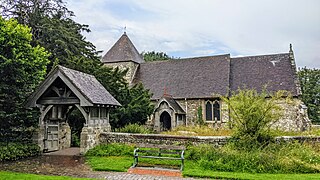
East Chiltington is a village and civil parish in the Lewes District of East Sussex, England. It is centred four miles (5.9 km) south-east of Burgess Hill and five miles (8 km) north-west of Lewes. It is a strip parish of 3.76 square miles (9.7 km2), stretching northward from the crest of the South Downs. The village church is 13th century in origin; the vicar also has charge of two churches in Plumpton. Near the church there is a pub called The Jolly Sportsman. The Sussex Greensand Way, a Roman road, runs from east to west through the centre of the parish.
The Lea Valley, the valley of the River Lea, has been used as a transport corridor, a source of sand and gravel, an industrial area, a water supply for London, and a recreational area. The London 2012 Summer Olympics were based in Stratford, in the Lower Lea Valley. It is important for London's water supply, as the source of the water transported by the New River aqueduct, but also as the location for the Lee Valley Reservoir Chain, stretching from Enfield through Tottenham and Walthamstow.

Moorlinch is a 226.0 hectare biological Site of Special Scientific Interest at Moorlinch in Somerset, notified in 1985.

Fishers Green is a settlement 1 mile (1.6 km) to the north of the town of Waltham Abbey, Essex, England, in the parish of Waltham Abbey. It lies on the flood plain of the River Lea.

Ingrebourne Marshes are a 74.8 hectare biological Site of Special Scientific Interest in Hornchurch in the London Borough of Havering. Ingrebourne Valley Local Nature Reserve includes a small part of the SSSI west of the River Ingrebourne. The site is managed by the Essex Wildlife Trust

The River Lee Country Park is located in the Lee Valley Park and is managed by the Lee Valley Regional Park Authority. Covering 1,000 acres (400 ha) on either side of the River Lee Navigation between Waltham Abbey and Broxbourne, it is an area of lakes, watercourses, open spaces and three Sites of Special Scientific Interest (SSSI) linked by footpaths and cycle tracks.

Decoy Pit, Pools and Woods is a 17.7-hectare (44-acre) biological Site of Special Scientific Interest south of Aldermaston in Berkshire. An area of 8 hectares is a nature reserve called Decoy Heath, which is managed by the Berkshire, Buckinghamshire and Oxfordshire Wildlife Trust.

Mid Colne Valley is a 132 hectare biological Site of Special Scientific Interest in Harefield in the London Borough of Hillingdon and Denham in South Buckinghamshire. Its main importance lies in its extensive diversity of birdlife in lakes in former gravel pits.

Rammey Marsh is located in the Lee Valley Park at Enfield Lock, Enfield, and covers approximately 42 hectares. The site is owned and managed by the Lee Valley Regional Park Authority.

Old River Severn, Upper Lode is a 3.72-hectare (9.2-acre) biological Site of Special Scientific Interest in Gloucestershire, notified in 1985. It is a cross county border site between Gloucestershire and Herefordshire and Worcestershire.

Turnford is a village in the Borough of Broxbourne, in Hertfordshire, England, in an area generally known as the Lee Valley. It is bounded by Wormley to the north, Cheshunt to the south and west, and its eastern boundary is formed largely by the Lee Navigation. Central London at Charing Cross is approximately 18 miles (29 km) south. At the 2001 census, together with Wormley, the village had a population of 8,146 in 3,399 households.

Amwell Quarry or Amwell Nature Reserve is a 37 hectare biological Site of Special Scientific Interest in Great Amwell in Hertfordshire. The planning authority is East Hertfordshire District Council. It is also part of the Lee Valley Ramsar Site and Special Protection Area, and is owned and managed by the Hertfordshire and Middlesex Wildlife Trust.
Monawilkin is a townland in the West Fermanagh Scarplands in the Civil Parish of Inishmacsaint, Barony of Magheraboy, Northern Ireland. The townland has an area of 85.1947 hectares and has previously been referred to as Meenwilkin (1817) and Munadh Wilkin. Monawilkin is the best example of unimproved calcareous grassland in Northern Ireland. This differs from other Sesleria-dominated grasslands in the UK in that it also includes species such as Euphrasia salisburgensis (eyebright). Monawilikin is also an important orchid site, contains the best inland site for moths and butterflies in Northern Ireland, and is the only Northern Irish site for Cupido minimus, the small blue butterfly. Consequently, this area was designated as a special area of conservation (SAC) and area of special scientific interest (ASSI). The Monawilkin SAC land cover comprises 3% water bodies, 5% bogs, marshes, and fringe water vegetation, 13% heath and scrub, 50% dry grassland, 14% humid grassland, and 15% broad-leaved woodland.

Canvey Wick is a 93.2-hectare (230-acre) Site of Special Scientific Interest at the south-west corner of Canvey Island in Essex. It is owned by The Land Trust and 18.5 hectares is managed by the Royal Society for the Protection of Birds and Buglife as a nature reserve, who are working to bring more of the area under management and to improve public access.

Glemsford Pits is a 37.5-hectare (93-acre) biological Site of Special Scientific Interest south of Glemsford in Suffolk. The River Stour, which forms the boundary between Suffolk and Essex, runs through the site, which is thus in both counties.

Bassenhally Pit is an 8.6-hectare (21-acre) biological Site of Special Scientific Interest north-east of Whittlesey in Cambridgeshire.

Upper Nene Valley Gravel Pits is a 1,382.4 hectare biological Site of Special Scientific Interest in a chain of flooded gravel pits along 35 kilometres of the valley of the River Nene between Northampton and Thorpe Waterville in Northamptonshire. It is a Ramsar wetland site of international importance, a Special Protection Area under the European Communities Birds Directive and part of the Nene Valley Nature Improvement Area. It is also part of the River Nene Regional Park. Two areas are managed by the Wildlife Trust for Bedfordshire, Cambridgeshire and Northamptonshire, Summer Leys and Titchmarsh Nature Reserve.

Wraysbury No 1 Gravel Pit is a 58.0-hectare (143-acre) biological Site of Special Scientific Interest in Wraysbury in Berkshire. It is part of South West London Waterbodies Ramsar site, and Special Protection Area. The lake has an area of 39.6 hectares. The pit was excavated in the 1920s and 1930s with gravel being removed from the site. Over the years plants and wildlife have colonised the area and it is now mature.


