Pewsey Downs is a 305.3 hectare biological Site of Special Scientific Interest on the southern edge of the Marlborough Downs north of Pewsey in Wiltshire, notified in 1951. It includes the Pewsey Downs National Nature Reserve.

Ingrebourne Marshes are a 74.8 hectare biological Site of Special Scientific Interest in Hornchurch in the London Borough of Havering. Ingrebourne Valley Local Nature Reserve includes a small part of the SSSI west of the River Ingrebourne. The site is managed by the Essex Wildlife Trust

Rye Meads is a 58.5 hectare biological Site of Special Scientific Interest (SSSI) in Rye House, Hoddesdon, Hertfordshire. It is one of series of wetlands and reservoirs situated along the River Lea, to the north-east of London. It is part of the Lea Valley Ramsar site and a Special Protection Area.
Deacon Hill SSSI is a 35.4 hectare biological Site of Special Scientific Interest in Pegsdon in Bedfordshire. It is in the Chilterns Area of Outstanding Natural Beauty, and it is part of the Pegsdon Hills and Hoo Bit nature reserve, managed by Wildlife Trust for Bedfordshire, Cambridgeshire and Northamptonshire.

Brassey is a 2.1-hectare (5.2-acre) biological Site of Special Scientific Interest in Gloucestershire, notified in 1954 and renotified in 1983. It is situated on the north side of the Windrush Valley, midway between Naunton and Upper Slaughter. The reserve comprises sloping, unimproved limestone pasture. There is a fast-flowing stream. This site is one of the few freshwater marshes in Gloucestershire. The stream joins the River Windrush.

Blaxhall Common is a nature reserve in the parish of Blaxhall in the East Suffolk District of Suffolk. The reserve is owned by Blaxhall Parish Council and managed by Suffolk Wildlife Trust. It is designated a 45.9-hectare (113-acre) biological Site of Special Scientific Interest as Blaxhall Heath. It is part of the Sandlings Special Protection Area under the European Union Directive on the Conservation of Wild Birds, and of the Suffolk Coast and Heaths Area of Outstanding Natural Beauty. A Bronze Age bowl barrow is a Scheduled Monument.

Blo' Norton and Thelnetham Fens are a 21.3-hectare (53-acre) biological Site of Special Scientific Interest (SSSI) on the Norfolk/Suffolk border. Blo' Norton Fen is in the parish of Blo' Norton in Norfolk and Thelnetham Fen is in Thelnetham parish in Suffolk. It is a Nature Conservation Review site, Grade 2, and part of the Waveney and Little Ouse Valley Fens Special Area of Conservation, Thelnetham Fen is managed by the Suffolk Wildlife Trust and Blo' Norton Fen by the Little Ouse Headwaters Project (LOHP).

Hucclecote Meadows is a 5.74-hectare (14.2-acre) biological Site of Special Scientific Interest divided into two areas on each side of the M5 road in the Severn Vale, Gloucestershire. It was notified in 1984. The western area is also a Local Nature Reserve.

Rough Bank, Miserden is a 9.2-hectare (23-acre) biological Site of Special Scientific Interest in Gloucestershire, notified in 1986. It was purchased by the wildlife charity Butterfly Conservation in 2012.

Moor Mill Quarry, West is a 0.16 hectare geological Site of Special Scientific Interest in How Wood in Hertfordshire. The local planning authority is St Albans City and District Council. It was notified in 1992 as representing the former Moor Mill Quarry SSSI, which was lost to landfill operations. It is listed by the Geological Conservation Review.

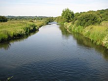
Sarratt Bottom nature Reserve in Hertfordshire is a 3.2 hectare biological Site of Special Scientific Interest. The site is a meadow beside the River Chess. It is an example of damp grassland which has been traditionally managed for grazing. There are also areas of swamp and marsh. The main plants in grassland areas include sweet vernal grass and meadow foxtail, and marsh horsetail and common spike-rush are common in damper areas. The site has hedgehogs and a wide variety of wetland birds and invertebrates.

Alpine Meadow is a 0.4 hectare nature reserve near Berkhamsted in Hertfordshire in the United Kingdom. It is a designated biological Site of Special Scientific Interest (SSSI), managed by the Hertfordshire and Middlesex Wildlife Trust and the planning authority is Dacorum Borough Council.

Roughdown Common is a 3.6 hectare biological Site of Special Scientific Interest in Hemel Hempstead in Hertfordshire. The planning authority is Dacorum Borough Council. The site is Common land, and it is owned by the Box Moor Trust having been officially brought by the trust in April 1886 from the Dean and Chapter of St Paul's. It is part of the Chilterns Area of Outstanding Natural Beauty. The Common is a steeply sloping chalk hill in south Hemel Hempstead.

Hunsdon Mead is a 34 hectare biological Site of Special Scientific Interest (SSSI) west of Harlow and east of Roydon in Essex. The site is partly in Essex and partly in Hertfordshire, and it is jointly owned and managed by the Essex Wildlife Trust and the Herts and Middlesex Wildlife Trust. The SSSI also includes part of the neighbouring Roydon Mead. The planning authorities are East Hertfordshire District Council and Epping Forest District Council. Hunsdon Mead is registered common land.

Northaw Great Wood is a 223.6-hectare (553-acre) biological Site of Special Scientific Interest (SSSI) near Cuffley in Hertfordshire, England. It covers Northaw Great Wood Country Park, which is managed by Welwyn Hatfield Borough Council, Well Wood, Justice Hill and Grimes Bottom. Part of the site is managed by Hertfordshire County Council as a schools' park. The country park is also a local nature reserve.

Sawbridgeworth Marsh is a 6.3-hectare (16-acre) biological Site of Special Scientific Interest (SSSI) near Sawbridgeworth in Hertfordshire, apart from a small area in the north which is in Essex. It is managed by the Essex Wildlife Trust. The planning authorities are East Hertfordshire District Council and Uttlesford District Council.

Mill Meadows, Billericay is a 6.7-hectare (17-acre) biological Site of Special Scientific Interest (SSSI) in Billericay in Essex, England. It is part of the 36.8 hectare Mill Meadows Local Nature Reserve (LNR), which is owned and managed by Basildon District Council.

Quarry Moor is a Site of Special Scientific Interest, or SSSI, at the south edge of Ripon, North Yorkshire, England, and adjacent to the A61 road. It contains an outcrop of Magnesian Limestone, exposed by former quarrying. 255 million years ago this limestone was the peripheral sediment of a tropical sea. The land was donated in 1945 to the people of Ripon by the town's mayor, Alderman Thomas Fowler Spence, a varnish manufacturer. The land was notified as an SSSI in 1986 because its calcareous grassland supported a large diversity of plant species. The site features a Schedule 8 protected plant, thistle broomrape. The land is protected as a nature reserve, and it is also managed as a recreational area. Therefore, its calcareous grass area is fenced off for protection and study, but it also contains a car park, information signs, a children's play area, accessible paths, benches, and dog waste bins.