
Frays Farm Meadows is a 28.2-hectare (70-acre) biological Site of Special Scientific Interest near Denham in the London Borough of Hillingdon. It was notified as an SSSI in 1981, and has been managed by the London Wildlife Trust on behalf of Hillingdon Council since 1999. It is part of the Colne Valley Regional Park.

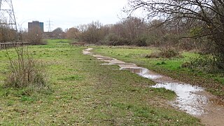
Elmbridge Open Space or Elmbridge Meadows is a Local Nature Reserve in Berrylands in the Royal Borough of Kingston upon Thames in London. It is a linear open space along the western bank of the Hogsmill River which starts at Malden Way and ends at a path between Surbiton Hill Park to Green Lane.

Oxhey Woods is a 98 hectare Local Nature Reserve in South Oxhey in Hertfordshire, England. It is owned and managed by Three Rivers District Council.
Wandle Meadow Nature Park is a 4.15 hectare local nature reserve and Site of Borough Importance for Nature Conservation, Grade 1, in Colliers Wood in the London Borough of Merton. It is owned and managed by Merton Council.

Pevensey Road is a 10.2 hectare Local Nature Reserve in Hanworth in the London Borough of Hounslow. It is also part of the Crane Corridor Site of Metropolitan Importance for Nature Conservation. It is owned and managed by Hounslow Council.

Frogmore Meadows is a 4.6-hectare (11-acre) biological Site of Special Scientific Interest in Hertfordshire and Buckinghamshire, north of the village of Chenies. It consists of two meadows in the Chilterns Area of Outstanding Natural Beauty, next to the River Chess, one of which is a Hertfordshire and Middlesex Wildlife Trust nature reserve. The planning authorities are Three Rivers District Council, Dacorum Borough Council and Chiltern District Council.

Rickmansworth Aquadrome is a 41-hectare (101-acre) public park and Local Nature Reserve in Rickmansworth in Hertfordshire. It is owned and managed by Three Rivers District Council.
Stanborough Reedmarsh is a 3.3 hectare Local Nature Reserve in Welwyn Garden City in Hertfordshire. It is owned by Welwyn Hatfield Borough Council and managed by the Herts and Middlesex Wildlife Trust.

Purwell Meadows is an 8.6-hectare (21-acre) nature reserve in Hitchin, Hertfordshire, England. It was declared a Local Nature Reserve in 1994. It is owned and managed by North Hertfordshire District Council.

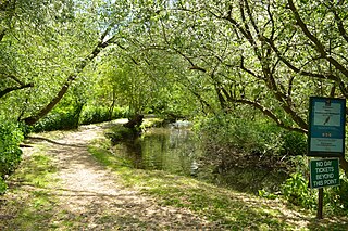
The Withey Beds is a 7.5 hectare Local Nature Reserve (LNR) in Rickmansworth in Hertfordshire. It was declared an LNR in 2004 by Three Rivers District Council, and the council owns and manages the site.

Warren Nature Reserve is a 2.3 hectares Local Nature Reserve in Wooburn in Buckinghamshire. It is owned by Wycombe District Council and managed by the council together with Wooburn and Bourne End parish council.

Hoppit Mead is a 9.2 hectare Local Nature Reserve in Braintree in Essex. It is owned and managed by Braintree District Council.

Harlow Marsh is a 13.8 hectare Local Nature Reserve in Harlow in Essex. It is owned and managed by Harlow District Council.

Hawkenbury Meadow is a 1.6 hectare Local Nature Reserve in Harlow in Essex. It is owned and managed by Harlow District Council.

Nazeing Triangle is a 0.5 hectare Local Nature Reserve in Nazeing, between Harlow and Cheshunt in Essex. It is owned by Nazeing Parish Council and managed by the council together with Epping Forest District Council.

Thornwood Common Flood Meadow is a 3-hectare (7.4-acre) Local Nature Reserve in Thornwood Common in Essex. It is owned and managed by Epping Forest District Council.

Lakeside Park is a 14.7-hectare (36-acre) Local Nature Reserve in Ash Vale west of Guildford in Surrey. It is owned and managed by Guildford Borough Council.

Target Hill Park is a 9-hectare (22-acre) Local Nature Reserve in Crawley in West Sussex. It is owned by Crawley Borough Council and managed by the council and Gatwick Greenspace Partnership.
