
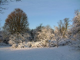
Therfield Heath is a biological Site of Special Scientific Interest and Local Nature Reserve on the chalk escarpment just north of Therfield, Hertfordshire; since it lies south-west of the town of Royston it is also known locally as Royston Heath. The Heath is a common on which sheep are still regularly grazed. The site offers views towards the north, over the valley of the Cam as far as Cambridge.
Norton Common is a 25.7-hectare park and Local Nature Reserve in the centre of Letchworth Garden City, Hertfordshire. It is owned and managed by North Hertfordshire District Council, and the declaring authority is Hertfordshire County Council.

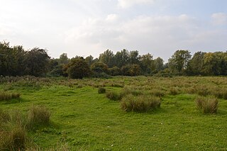
Rye Meads is a 58.5 hectare biological Site of Special Scientific Interest (SSSI) in Rye House, Hertfordshire. It is one of series of wetlands and reservoirs situated along the River Lea, to the north-east of London. It is part of the Lea Valley RAMSAR site and a Special Protection Area.

Rowley Green Common is a six hectare Local Nature Reserve and a Site of Importance Metropolitan for Nature Conservation in Arkley, north London. It is owned by the London Borough of Barnet and according to the Natural England details page it is jointly managed by the Hertfordshire and Middlesex Wildlife Trust and the London Wildlife Trust, but as of August 2015 it is not on the list of reserves of either Trust. It is also registered common land.

Northaw Great Wood is a 223.6 hectare biological Site of Special Scientific Interest (SSSI) near Cuffley in Hertfordshire, England. It covers Northaw Great Wood Country Park, which is managed by Welwyn Hatfield Borough Council, Well Wood, Justice Hill and Grimes Bottom. Part of the site is managed by Hertfordshire County Council as a schools' park. The country park is also a local nature reserve.
Waterford Heath is a 35.2 hectare Local Nature Reserve in Waterford in Hertfordshire, England. It is owned by Lafarge Tarmac and managed by the Herts and Middlesex Wildlife Trust together with East Hertfordshire District Council and Lafarge.

Batford Springs is a 3.5 hectare Local Nature Reserve in Harpenden in Hertfordshire. It is owned and managed by Harpenden Town Council, and most work on the site is undertaken by the Batford Springs Volunteers. The declaring authority is St Albans City Council.

Chorleywood Common is a 75.6 hectare Local Nature Reserve in Chorleywood in Hertfordshire. It is owned and managed by Chorleywood Parish Council, and the declaring authority is Hertfordshire County Council. The common is part of the Chilterns Area of Outstanding Natural Beauty.

Oughtonhead Common is a 17.4 hectare Local Nature Reserve in the Westmill district of Hitchin, Hertfordshire. It is owned and managed by North Hertfordshire District Council.

Rickmansworth Aquadrome is a 41 hectares public park and Local Nature Reserve in Rickmansworth in Hertfordshire. It is owned and managed by Three Rivers District Council.
Stanborough Reedmarsh is a 3.3 hectare Local Nature Reserve in Welwyn Garden City in Hertfordshire. It is owned by Welwyn Hatfield Borough Council and managed by the Herts and Middlesex Wildlife Trust.

Top Field and Cozens Grove is a 6.1 hectare Local Nature Reserve in Wormley in Hertfordshire. It is owned and managed by Broxbourne Borough Council.
Howe Grove Wood is an 8.5 hectare Local Nature Reserve (LNR) in Hemel Hempstead in Hertfordshire. It was declared an LNR in 1997 by Dacorum Borough Council.

Purwell Meadows is an 8.6 hectare nature reserve in Hitchin, Hertfordshire, England. It was declared a Local Nature Reserve in 1994. It is owned and managed by North Hertfordshire District Council.

Danesbury Park is a 24.5 hectare public park and Local Nature Reserve in Welwyn in Hertfordshire. It is owned and managed by Welwyn Hatfield Borough Council.

The Lairage Land is a 4.4 hectare Local Nature Reserve in Watford in Hertfordshire. It is owned and managed by Watford Borough Council.

Weston Hills is a 17 hectare Local Nature Reserve in Baldock in North Hertfordshire. It is owned by Hertfordshire County Council and North Hertfordshire District Council (NHDC) and managed by NHDC.

Prestwick Road Meadows is a 2.8 hectare Local Nature Reserve in South Oxhey in Hertfordshire. It is owned and managed by Three Rivers District Council.
Henlow Common and Langford Meadows is an 18.4 hectare Local Nature Reserve in Langford, and two miles north of Henlow, in Bedfordshire. It is owned and managed by Central Bedfordshire Council. Henlow Common is common land.


