
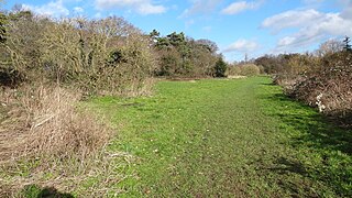
Rowhill Nature Reserve or Rowhill Copse is a 26.6-hectare (66-acre) Local Nature Reserve (LNR) which straddles the border between Aldershot in Hampshire and Farnham in Surrey. It is owned by Rushmoor Borough Council, was declared an LNR by Waverley Borough Council and is managed by Rowhill Nature Reserve Society.
Grove Farm is an 8-hectare Local Nature Reserve (LNR) in Greenford in the London Borough of Ealing. It was declared an LNR in 2002 by Ealing Council, which owns and manages the site.

Anton Crescent Wetland is a one hectare Local Nature Reserve in Sutton in the London Borough of Sutton. It is owned by Sutton Council and managed by the council together with Sutton Nature Conservation Volunteers.

Southwood Open Space is a 12.9 hectare Local Nature Reserve (LNR) in Old Malden in the Royal Borough of Kingston upon Thames in London. It is a linear park along the Hogsmill River between the Kingston Bypass opposite Elmbridge Avenue and the junction between the Hogsmill and a footpath to Manor Drive North.

Gutteridge Wood and Meadows is a Local Nature Reserve (LNR) in Yeading in the London Borough of Hillingdon, which is owned by Hillingdon Council and managed by the London Wildlife Trust (LWT). It is also part of the Yeading Brook Meadows Site of Metropolitan Importance for Nature Conservation, which includes two neighbouring reserves managed by the LWT, Ten Acre Wood and Yeading Brook Meadows LNRs.

Ten Acre Wood is a Local Nature Reserve (LNR) in Yeading in the London Borough of Hillingdon, which is owned by Hillingdon Council and managed by the London Wildlife Trust (LWT). It is also part of the Yeading Brook Meadows Site of Metropolitan Importance for Nature Conservation (SINC), which includes two neighbouring LNRs managed by the LWT, Gutteridge Wood and Meadows and Yeading Brook Meadows LNR.

Yeading Brook Meadows is a 17 hectare Local Nature Reserve (LNR) in Yeading in the London Borough of Hillingdon. It is owned by Hillingdon Council and managed by the London Wildlife Trust (LWT). In the north it adjoins Ten Acre Wood across the Golden Bridge and Charville Lane; it then stretches south along the banks of the Yeading Brook to Yeading Lane. The reserve is also part of the Yeading Brook Meadows Site of Metropolitan Importance for Nature Conservation, which includes two neighbouring LNRs managed by the London Wildlife Trust, Ten Acre Wood and Gutteridge Wood and Meadows.
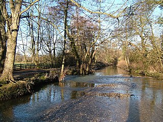
Howe Grove Wood is an 8.5 hectare Local Nature Reserve (LNR) in Hemel Hempstead in Hertfordshire. It was declared an LNR in 1997 by Dacorum Borough Council.
Fisher's Field is a 1.8 hectare Local Nature Reserve (LNR) in Bushey in Hertfordshire. It is owned and managed by Hertsmere Borough Council.

Masons Field is a 2.9 hectare Local Nature Reserve (LNR) in Kingsbury in the London Borough of Brent. It was declared an LNR in 2013, it is owned by London Underground Ltd and managed by Brent Council on a 125-year leasehold.

Batchworth Heath is 4 hectares of designated common land in Rickmansworth, Hertfordshire, around the junction of Batchworth Heath Hill, Batchworth Lane and White Hill, owned and managed by Three Rivers District Council. The habitat is heathland with an ancient pond and rich wildlife. Since July 2015 the site has been listed by Natural England as a Local Nature Reserve, but according to Three Rivers Council this is an error and they have asked Natural England to remove it from the list.

Wheathampstead Local Nature Reserve is a 5.9 hectare Local Nature Reserve (LNR) in Wheathampstead in Hertfordshire. It was declared an LNR by St Albans City Council in 2002, and is leased by Wheathampstead Parish Council from Hertfordshire County Council.

Holt Copse & Joel Park is a 5.3-hectare (13-acre) Local Nature Reserve (LNR) in Wokingham in Berkshire. It is owned by Wokingham Town Council and managed by the council and Holt Copse Conservation Volunteers.
Hogsmill LNR is a 36-hectare (89-acre) Local Nature Reserve in Ewell in Surrey. It is owned by Epsom and Ewell Borough Council and Surrey County Council and managed by Epsom and Ewell Borough Council.
River Mole LNR is a 23.3-hectare (58-acre) Local Nature Reserve in Leatherhead in Surrey. It is owned by private landowners and managed by the Environment Agency, Mole Valley District Council, Lower Mole Countryside Project, Leatherhead Trust, Surrey County Council and private landowners.

Warnham LNR is a 38.4-hectare (95-acre) Local Nature Reserve in Horsham in West Sussex. It is owned and managed by Horsham District Council.

Up Nately LNR is a 2.8-hectare (6.9-acre) local nature reserve in Up Nately in Hampshire. It is owned by Hampshire County Council and Surrey County Council and managed by the Basingstoke Canal Authority. It is part of Butter Wood, which is a Site of Special Scientific Interest.
