Norton Common is a 25.7-hectare park and Local Nature Reserve in the centre of Letchworth Garden City, Hertfordshire. It is owned and managed by North Hertfordshire District Council, and the declaring authority is Hertfordshire County Council.
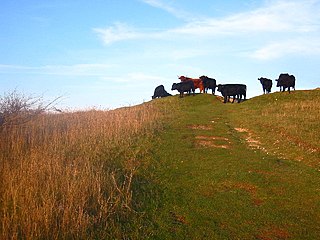
Galley and Warden Hills is a 47 hectare biological Site of Special Scientific Interest in Warden Hill, a suburb of Luton in Bedfordshire. The local planning authority is Central Bedfordshire Council, and it was notified in 1986 under Section 28 of the Wildlife and Countryside Act 1981. It is also a Local Nature Reserve.

Linder's Field is a 3.6 hectare Local Nature Reserve in Buckhurst Hill in Essex. It is owned and managed by Epping Forest District Council.

Cuddington Meadows is a 1.4 hectare Local Nature Reserve and Site of Borough Importance for Nature Conservation, Grade I, in Belmont in the London Borough of Sutton. It is owned by Sutton Council and managed by the council together with Sutton Nature Conservation Volunteers.

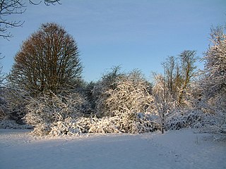
Colney Heath Local Nature Reserve is a 22.5 hectare Local Nature Reserve in Colney Heath in Hertfordshire. It is owned by St Albans City Council and managed by Colney Heath Parish Council. The site was acquired in the 1950s and 1960s, and it is a Hertfordshire Heritage Site.

Croxley Common Moor is a 39.5 hectare biological Site of Special Scientific Interest (SSSI) and Local Nature Reserve in Croxley Green, Hertfordshire. It is owned by Three Rivers District Council and managed by the council together with the Countryside Management Service and the Friends of Croxley Common Moor. Most of it is a registered common.

Batford Springs is a 3.5 hectare Local Nature Reserve in Harpenden in Hertfordshire. It is owned and managed by Harpenden Town Council, and most work on the site is undertaken by the Batford Springs Volunteers. The declaring authority is St Albans City Council.

Chorleywood Common is a 75.6 hectare Local Nature Reserve in Chorleywood in Hertfordshire. It is owned and managed by Chorleywood Parish Council, and the declaring authority is Hertfordshire County Council. The common is part of the Chilterns Area of Outstanding Natural Beauty.

Rickmansworth Aquadrome is a 41 hectares public park and Local Nature Reserve in Rickmansworth in Hertfordshire. It is owned and managed by Three Rivers District Council.

Shrubhill Common is a 9.8 hectare Local Nature Reserve in Hemel Hempstead in Hertfordshire. It is owned and managed by Dacorum Borough Council. The site is common land, and it is part of the Chilterns Area of Outstanding Natural Beauty.

Danesbury Park is a 24.5 hectare public park and Local Nature Reserve in Welwyn in Hertfordshire. It is owned and managed by Welwyn Hatfield Borough Council.

Garston Park is a park in Garston, Hertfordshire, a suburb of Watford in Hertfordshire. An area of 6.4 hectares, about half of the park, is a Local Nature Reserve. It is owned and managed by Watford Borough Council.

Wheathampstead Local Nature Reserve is a 5.9 hectare Local Nature Reserve (LNR) in Wheathampstead in Hertfordshire. It was declared an LNR by St Albans City Council in 2002, and is leased by Wheathampstead Parish Council from Hertfordshire County Council.

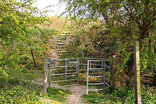
Hexton Chalk Pit is a 1.9 hectare nature reserve in Hexton in North Hertfordshire, managed by the Herts and Middlesex Wildlife Trust. It is grassland with steep slopes and many chalk-loving plants such as horseshoe vetch, yellow-wort, milkwort and rockrose. There are five species of orchid and a large colony of chalkhill blue butterflies. The site has extensive views over the countryside.

Brush Hill is a 14.7 hectares Local Nature Reserve east of Princes Risborough in Buckinghamshire. It has been managed since 2013 by the Chiltern Society, and it is part of the Chilterns Area of Outstanding Natural Beauty.

Holtspur Bank is a 6.6 hectares Local Nature Reserve in Beaconsfield in Buckinghamshire. It is owned and managed by Beaconsfield Town Council.

Pewley Down is a 9.5-hectare (23-acre) Local Nature Reserve on the southern outskirts of Guildford in Surrey. It is owned and managed by Guildford Borough Council.

Mill Hill is a 13.5-hectare (33-acre) Local Nature Reserve on the northern outskirts of Shoreham-by-Sea in West Sussex. It is owned by Adur District Council and managed by the council and the South Downs Joint Committee.
Watlington Chalk Pit is a 1.6-hectare (4.0-acre) Local Nature Reserve east of Watlington in Oxfordshire. It is owned by South Oxfordshire District Council and managed by Watlington Parish Council and Watlington Environment Group. It is part of Watlington and Pyrton Hills Site of Special Scientific Interest.
