
Streatham Common is a large open space on the southern edge of Streatham in the London Borough of Lambeth. The shallow sloping lower (western) half of the common is mostly mowed grass, and the upper (eastern) half is mostly woodland with some small areas of gorse scrub and acid grassland. The eastern half has been designated a Local Nature Reserve.
Fryent Country Park, together with Barn Hill Open Space, is a large park situated in the north of the London Borough of Brent. It covers 103 hectares of rolling fields and small woods.

Railway Fields is a Local Nature Reserve and a Site of Borough Importance for Nature Conservation, Grade I, in Harringay the London Borough of Haringey. About one hectare in area, it was a railway goods yard until 1967.

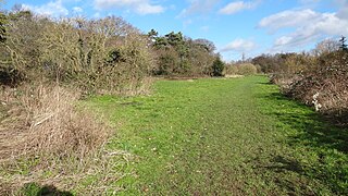
Wormley-Hoddesdonpark Wood South is a 192.5 hectares is a biological site of Special Scientific Interest near Cheshunt in Hertfordshire. It is part of Broxbourne Woods National Nature Reserve, and is listed in A Nature Conservation Review. Wormley Wood is owned and managed by the Woodland Trust. The site is also a Special Area of Conservation.

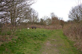
Wormley-Hoddesdonpark Wood North is a 143.9-hectare (356-acre) woodland area in Hertfordshire which has been designated as a biological site of Special Scientific Interest. The site is listed as Grade 1 in A Nature Conservation Review, and is also designated a Special Area of Conservation. It is in Hoddesdon in the borough of Broxbourne, but part of the site is in East Hertfordshire.

The Dollis Valley Greenwalk is a footpath route in the London Borough of Barnet in London, England, between Moat Mount Nature Reserve in Mill Hill and Hampstead Heath. The route is designed to act as a link between the Capital Ring and the London Loop, and between the many green spaces and wildlife corridors along the way. It is approximately 10 miles (16 km) long. It mainly follows the Dollis Brook and is one of the many parks and open spaces in Barnet.

Wormley is a village and former civil parish, lying between Hoddesdon and Cheshunt in the Broxbourne district, in the county of Hertfordshire, England. The village is part of the ward of Wormley and Turnford, which had a population of 8,146 at the 2001 census. In 1931 the parish had a population of 930. The parish was abolished in 1935 and absorbed into Hoddesdon.

Stanmore Common is a 49.2-hectare public park, Local Nature Reserve and Site of Metropolitan Importance for Nature Conservation in Stanmore in the London Borough of Harrow in England. It is owned by Harrow Council and managed by the council with a local group. It was a biological Site of Special Scientific Interest, but was de-notified in the early 1990s.

Rowley Green Common is a six hectare Local Nature Reserve and a Site of Importance Metropolitan for Nature Conservation in Arkley, north London. It is owned by the London Borough of Barnet. It is also registered common land.

Turnford is a village in the Borough of Broxbourne, in Hertfordshire, England, in an area generally known as the Lee Valley. It is bounded by Wormley to the north, Cheshunt to the south and west, and its eastern boundary is formed largely by the Lee Navigation. Central London at Charing Cross is approximately 18 miles (29 km) south. At the 2001 census, together with Wormley, the village had a population of 8,146 in 3,399 households.

Elmbridge Open Space or Elmbridge Meadows is a Local Nature Reserve in Berrylands in the Royal Borough of Kingston upon Thames in London. It is a linear open space along the western bank of the Hogsmill River which starts at Malden Way and ends at a path between Surbiton Hill Park to Green Lane.
Grove Farm is an 8-hectare Local Nature Reserve (LNR) in Greenford in the London Borough of Ealing. It was declared an LNR in 2002 by Ealing Council, which owns and manages the site.

Cuddington Meadows is a 1.4-hectare (3.5-acre) Local Nature Reserve and Site of Borough Importance for Nature Conservation, Grade I, in Belmont in the London Borough of Sutton. It is owned by Sutton Council and managed by the council together with Sutton Nature Conservation Volunteers.

Cheshunt Park is a 40 hectare public park and Local Nature Reserve in Cheshunt in Hertfordshire. It is owned and managed by Broxbourne Borough Council.
Fisher's Field is a 1.8 hectare Local Nature Reserve (LNR) in Bushey in Hertfordshire. It is owned and managed by Hertsmere Borough Council.
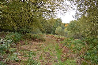
Broxbourne Woods are a 239.1 hectare National Nature Reserve west of Broxbourne in Hertfordshire. The site is Hertfordshire's only National Nature Reserve, and is also a Special Area of Conservation. It covers Hoddesdonpark Wood, Wormley Wood, Broxbourne Wood and Bencroft Wood. Bencroft and Broxbourne are owned by Hertfordshire County Council, and Hoddesdonpark and Wormley Woods by the Woodland Trust. They are all in Sites of Special Scientific Interest; Wormley Wood and Bencroft Wood form almost all of Wormley-Hoddesdonpark Wood South, and Hoddesdonpark Wood and Broxbourne Wood are part of Wormley-Hoddesdonpark Wood North.
Danemead is a 5.6-hectare nature reserve west of Hoddesdon in Hertfordshire, managed by the Herts and Middlesex Wildlife Trust. It is part of the Wormley-Hoddesdonpark Wood North Site of Special Scientific Interest.

Ockwells Park is a park, part of which is a local nature reserve, in Cox Green, Berkshire, England. The nature reserve is owned by the Royal Borough of Windsor and Maidenhead.

