
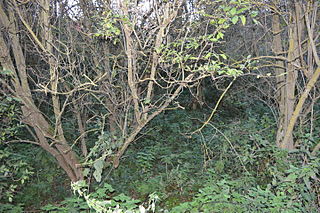
Swanscombe Skull Site or Swanscombe Heritage Park is a 3.9 hectares geological Site of Special Scientific Interest in Swanscombe in north-west Kent, England. It contains two Geological Conservation Review sites and a National Nature Reserve. The park lies in a former gravel quarry, Barnfield Pit.
Castle Lime Works Quarry is a 1.6 hectares geological Site of Special Scientific Interest near South Mimms in Hertfordshire. The site was notified in 1986 under the Wildlife and Countryside Act 1981. The site is a disused chalk quarry and according to Natural England:

Stockstone Quarry is a 3.9-hectare (9.6-acre) geological Site of Special Scientific Interest south of Farnham in Surrey. It is a Geological Conservation Review site.

Moor Mill Quarry, West is a 0.16-hectare (0.40-acre) geological Site of Special Scientific Interest in How Wood in Hertfordshire. The local planning authority is St Albans City and District Council. It was notified in 1992 as representing the former Moor Mill Quarry SSSI, which was lost to landfill operations. It is listed by the Geological Conservation Review.

Amwell Quarry or Amwell Nature Reserve is a 37 hectare biological Site of Special Scientific Interest in Great Amwell in Hertfordshire. The planning authority is East Hertfordshire District Council. It is also part of the Lee Valley Ramsar Site and Special Protection Area, and is owned and managed by the Hertfordshire and Middlesex Wildlife Trust.

Downfield Pit is a 3.6-hectare (8.9-acre) geological Site of Special Scientific Interest near Ware in Hertfordshire. It is in the Geological Conservation Review in the Thames Pleistocene section, and the local planning authority is East Hertfordshire District Council.

Hillcollins Pit or Furneux Pelham Gravel Pit is a 0.2-hectare (0.49-acre) geological Site of Special Scientific Interest near Furneux Pelham in Hertfordshire. The local planning authority is East Hertfordshire District Council. it was identified as a site of national importance in the Geological Conservation Review in 1988.

Little Heath Pit is a 0.3-hectare (0.74-acre) geological Site of Special Scientific Interest at Little Heath near Potten End in Hertfordshire. It is part of the Ashridge Estate, owned by the National Trust, and the local planning authority is Dacorum Borough Council. It is listed in the Geological Conservation Review.

Oughtonhead Lane is a 0.9-hectare (2.2-acre) geological Site of Special Scientific Interest in Hitchin in Hertfordshire. The local planning authority is North Hertfordshire District Council. The site has been identified as of national importance in the Geological Conservation Review.

Fern House Gravel Pit is a 1.3-hectare (3.2-acre) geological Site of Special Scientific Interest in Fern, near Bourne End in Buckinghamshire. It is also a Geological Conservation Review site.

Highlands Farm Pit is a 0.6-hectare (1.5-acre) geological Site of Special Scientific Interest in Henley-on-Thames in Oxfordshire. It is a Geological Conservation Review site.
Hall's Quarry is a 0.8-hectare (2.0-acre) geological Site of Special Scientific Interest north-west of Ugley Green in Essex. It is a Geological Conservation Review site.

Purfleet Chalk Pits is a 10.7-hectare (26-acre) geological Site of Special Scientific Interest in Purfleet in Essex. It is a Geological Conservation Review site.

Newney Green Pit is a 0.07-hectare (0.17-acre) geological Site of Special Scientific Interest west of Writtle in Essex. It is a Geological Conservation Review site.

Sturry Pit is a 0.7 hectares geological Site of Special Scientific Interest north-east of Canterbury in Kent. It is a Geological Conservation Review site.

Philpot's and Hook Quarries is a 2.6-hectare (6.4-acre) geological Site of Special Scientific Interest south-west of Sharpthorne in West Sussex. It is a Geological Conservation Review site.

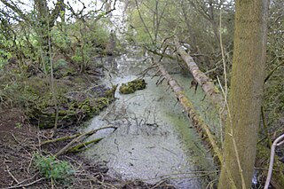
Dry Sandford Pit is a 4.2-hectare (10-acre) biological and geological Site of Special Scientific Interest north-west of Abingdon-on-Thames in Oxfordshire. It is a Geological Conservation Review site and it is managed as a nature reserve by the Berkshire, Buckinghamshire and Oxfordshire Wildlife Trust.
Sugworth is a 0.6-hectare (1.5-acre) geological Site of Special Scientific Interest north of Abingdon-on-Thames in Oxfordshire. It is a Geological Conservation Review site.
