The Lea Valley, the valley of the River Lea, has been used as a transport corridor, a source of sand and gravel, an industrial area, a water supply for London, and a recreational area. The London 2012 Summer Olympics were based in Stratford, in the Lower Lea Valley. It is important for London's water supply, as the source of the water transported by the New River aqueduct, but also as the location for the Lee Valley Reservoir Chain, stretching from Enfield through Tottenham and Walthamstow.

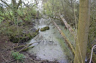
Cuffley Brook is a tributary of Turkey Brook. It runs through parts of Hertfordshire and the London Borough of Enfield, England. After the confluence of the two streams in Whitewebbs Park, the watercourse continues eastwards as Turkey Brook to join the River Lea near Enfield Lock.

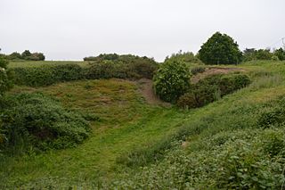
Swanscombe Skull Site or Swanscombe Heritage Park is a 3.9 hectares geological Site of Special Scientific Interest in Swanscombe in north-west Kent, England. It contains two Geological Conservation Review sites and a National Nature Reserve. The park lies in a former gravel quarry, Barnfield Pit.

Westwood Quarry is a 0.07 hectare geological site of Special Scientific Interest west of Watford in Hertfordshire. It was notified in 1987 under the Wildlife and Countryside Act 1981. The planning authority is Three Rivers District Council. It is a Geological Conservation Review site.

Downfield Pit is a 3.6-hectare (8.9-acre) geological Site of Special Scientific Interest near Ware in Hertfordshire. It is in the Geological Conservation Review in the Thames Pleistocene section, and the local planning authority is East Hertfordshire District Council.

Hillcollins Pit or Furneux Pelham Gravel Pit is a 0.2-hectare (0.49-acre) geological Site of Special Scientific Interest near Furneux Pelham in Hertfordshire. The local planning authority is East Hertfordshire District Council. it was identified as a site of national importance in the Geological Conservation Review in 1988.

Fern House Gravel Pit is a 1.3-hectare (3.2-acre) geological Site of Special Scientific Interest in Fern, near Bourne End in Buckinghamshire. It is also a Geological Conservation Review site.

Highlands Farm Pit is a 0.6-hectare (1.5-acre) geological Site of Special Scientific Interest in Henley-on-Thames in Oxfordshire. It is a Geological Conservation Review site.
Hall's Quarry is a 0.8-hectare (2.0-acre) geological Site of Special Scientific Interest north-west of Ugley Green in Essex. It is a Geological Conservation Review site.

Wivenhoe Gravel Pit is a 2.1-hectare (5.2-acre) geological Site of Special Scientific Interest north of Wivenhoe in Essex. It is a Geological Conservation Review site.

Holland-on-Sea Cliff is a 0.1-hectare (0.25-acre) geological Site of Special Scientific Interest in Holland-on-Sea, north-west of Clacton-on-Sea in Essex. It is a Geological Conservation Review site.
St Osyth Pit is a 0.1-hectare (0.25-acre) geological Site of Special Scientific Interest north of St Osyth in Essex. It is a Geological Conservation Review site.

Goldsands Road Pit is a 1.3-hectare (3.2-acre) geological Site of Special Scientific Interest in Southminster in Essex. It is a Geological Conservation Review site.

Newney Green Pit is a 0.07-hectare (0.17-acre) geological Site of Special Scientific Interest west of Writtle in Essex. It is a Geological Conservation Review site.
Flixton Quarry is a 0.7 hectares geological Site of Special Scientific Interest 3.75 miles (6.04 km) south-west of Bungay in the English county of Suffolk. It is a Geological Conservation Review site located in the parish of Homersfield.

Holton Pit is a 1.6-hectare (4.0-acre) geological Site of Special Scientific Interest east of Halesworth in Suffolk. It is a Geological Conservation Review site.
