
South Norwood is a district of south-east London, England, within the London Borough of Croydon and the historic county of Surrey. It is located 7.8 miles (12.5 km) south-east of Charing Cross, north of Woodside and Addiscombe, east of Selhurst and Thornton Heath, south of Crystal Palace/Upper Norwood and Anerley, and west of Elmers End and Penge.

The London Borough of Croydon has over 120 parks and open spaces within its boundaries, ranging from the 200 acre (80ha) Selsdon Wood Nature Reserve to many recreation grounds and sports fields scattered throughout the Borough. Croydon covers an area of 86.52 km², the 256th largest district in England. Croydon's physical features consist of many hills and rivers that are spread out across the borough and into the North Downs, Surrey and the rest of South London. Some of the open spaces in Croydon form part of the well-known London LOOP walks where the first section was opened on 3 May 1996 with a ceremony on Farthing Downs in Coulsdon. As a borough in Outer London it also contains some open countryside in the form of country parks. Croydon Council is associated with several other boroughs who are taking part in the Downlands Countryside Management Project. These boroughs are Sutton; and by Surrey County Council; the City of London Corporation; the Surrey districts of Reigate and Banstead and Tandridge; and the Countryside Agency. An additional partner is Natural Britain.

Woodside is an area in south London, in the London Borough of Croydon and the historic county of Surrey. It is between Addiscombe and South Norwood. It is south of South Norwood, west of Shirley and Monks Orchard, north of Addiscombe, and east of Selhurst.
Mitcham Common is 182 hectares (460 acres) of common land situated in south London. It is predominantly in the London borough of Merton, with parts straddling the borders of Croydon and Sutton. It is designated a Site of Metropolitan Importance for Nature Conservation.
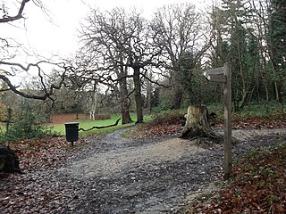
Beaulieu Heights 16 acres (6.5 ha) is an area of ancient woodland between South Norwood and Upper Norwood in the London Borough of Croydon, London. It is located between South Norwood Hill and Auckland Road with Auckland Rise to the north and Tummonds Gardens to the south. There are pedestrian entrances from South Norwood Hill and Auckland Rise, and a pond. The name is pronounced as if spelled "Beulah" like the nearby Beulah Hill, and not like the French word or the town of Beaulieu, Hampshire.

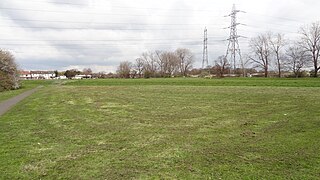
South Norwood Recreation Ground is a park located in South Norwood in the London Borough of Croydon. In 1889, Croydon Corporation acquired the land and the borough surveyor estimated that it would cost just over £1,300 to lay out. Over a quarter of the projected cost was to install land drainage, which indicates that the site was quite wet. The recreation ground includes a sports area, football pitches, tennis court, floodlit courts, bowling green with pavilion and a children's playground.
Heavers Meadow is a meadow located in South Norwood and Selhurst in the London Borough of Croydon. South Norwood Recreation Ground is on the other side of the road. The meadow covers an area of 83⁄4 acres. With meadows there are not usually many facilities. Heavers is no exception; the only facility stated on the council's website is a footpath through a flood meadow.

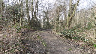
Ashburton Park is a park located in Woodside, in the London Borough of Croydon, and takes its name from nearby Ashburton.

Addington Hills is a park in Upper Shirley, London, England. It is managed by the London Borough of Croydon. It was part of the old parish of Addington before the suburb of Shirley was developed in the 1930s. The site consists largely of woodland on a gravel bed, with London's largest area of heathland at its heart. It is a Site of Metropolitan Importance. In the mid-18th century, it was a noted cricket venue used by the then-prominent Addington Cricket Club.

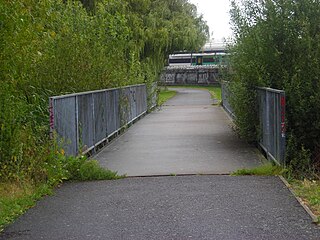
Addiscombe Railway Park, also known as the Addiscombe Linear Park, is a 3.3 acres (1.3 ha) park in Addiscombe, South London, managed by the London Borough of Croydon.

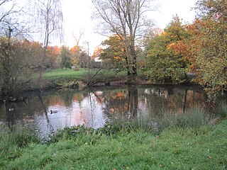
Grangewood Park is an extensive woodland area situated in South Norwood, London. It is managed by the London Borough of Croydon. It is bounded by Grange Road, Wharncliffe Road, and Ross Road. It covers an area of 27.7 acres. The park is located on the main A212 road between Thornton Heath and Upper Norwood/Crystal Palace. The nearest stations are Thornton Heath, Selhurst and Norwood Junction.

Selsdon Wood is a woodland area located in the London Borough of Croydon. The park is owned by the National Trust but managed by the London Borough of Croydon. It is a Local Nature Reserve. The wood has a Friends group - the Friends of Selsdon Wood (FSW) - who have their own website.

Scratchwood is an extensive, mainly wooded, country park in Mill Hill in the London Borough of Barnet. The 57-hectare site is a Site of Metropolitan Importance for Nature Conservation and together with the neighbouring Moat Mount Open Space. It is a Local Nature Reserve.
Totteridge Green is a five hectare Site of Borough Importance for Nature Conservation, Grade II, in Totteridge in the London Borough of Barnet. It is also registered common land.

Happy Valley Park is a public park in Coulsdon in the London Borough of Croydon. It is owned and managed by Croydon Council. Located in the Green Belt, most of it forms part of the Farthing Downs and Happy Valley Site of Special Scientific Interest.

Riddlesdown Common or Riddlesdown is a 43 hectare area of green space in Kenley, towards the northern end of the North Downs in the London Borough of Croydon. It is owned and maintained by the City of London Corporation, apart from two small areas, one of which is operated by the London Wildlife Trust and the other by Croydon Council. An area of 32 hectares is a biological Site of Special Scientific Interest. The name Riddlesdown also applies to the local district of residential housing. A trig point at the site indicates that it is 525 ft (160 m) above sea level.

Littleheath Woods is the collective name for Littleheath Wood, Foxearth Woods, part of Queenhill Shaw and part of Gee Wood in Selsdon in the London Borough of Croydon. It is a Site of Borough Importance for Nature Conservation, Grade I, with an area of 64 acres (26 ha). It is owned by Croydon Council and the Friends of Littleheath Woods assist with the management.
Bramley Bank is a 10.3 hectare local nature reserve in Upper Shirley in the London Borough of Croydon. It is owned by Croydon Council and managed by the London Wildlife Trust.
A brickfield is an open site where bricks are made. Place names are often formed from the word.

Brickfields Country Park is a park in Aldershot in Hampshire described as one of the smallest country parks in Britain. The park is owned and maintained by Rushmoor Borough Council.


