
London Trams, previously Tramlink and Croydon Tramlink, is a light rail tram system serving Croydon and surrounding areas in South London, England. It began operation in 2000, the first tram system in the London region since 1952. It is managed by London Trams, a public body part of Transport for London (TfL), and has been operated by FirstGroup since 2017. Tramlink is one of two light rail networks in Greater London, the other being the Docklands Light Railway.

Mitcham Junction is a National Rail station served by Southern and Thameslink trains, and a Tramlink stop. It is in the London Borough of Merton and is in Travelcard Zone 4.

East Croydon is a railway station and tram stop in Croydon, Greater London, England, and is located in Travelcard Zone 5. At 10 miles 28 chains from London Bridge, it is one of the busiest non-terminal stations in London, and in the United Kingdom as a whole. It is one of three railway stations in the London Borough of Croydon with Croydon in their name, the others being West Croydon and South Croydon. A Tramlink tram stop is located immediately outside the main station entrance.

Beckenham Junction is the main railway and tram station in Beckenham in the London Borough of Bromley, south London. The railway stop is on the Chatham Main Line, 8 miles 53 chains (13.9 km) down the line from London Victoria and situated between Kent House and Shortlands. The tram stop is one of the eastern termini of Tramlink.
There have been two separate generations of trams in London, from 1860 to 1952 and from 2000 to the present. There were no trams at all in London between 1952 and 2000.

West Croydon is a combined railway, bus station and tram stop in Croydon, south London. It is served by National Rail, London Overground, Tramlink and London Buses services and is in Travelcard Zone 5.

The Woodside and South Croydon Joint Railway (W&SC) was a short, relatively short-lived and unsuccessful railway in the London Borough of Croydon in London, England. Its site is now largely occupied by Tramlink.

Lebanon Road tram stop is a light rail stop in the London Borough of Croydon in the southern suburbs of London. It serves the residential area along Addiscombe Road to the east of the centre of the town of Croydon. The stop is named after Lebanon Road, a cross-street in the vicinity of the stop.

Addiscombe tram stop is a light rail stop in the London Borough of Croydon in the southern suburbs of London.

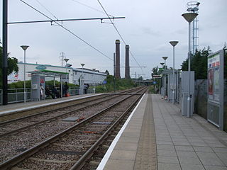
Therapia Lane tram stop is a stop on the Tramlink service in Croydon, close to the Purley Way commercial area. The stop is in the London Borough of Sutton close to the boundary with Croydon. It is one of two Tramlink stops within Sutton borough, the other being Beddington Lane.

Ampere Way is a tram stop in the London Borough of Croydon, serving the Purley Way commercial area. Tramlink trams serve the stop, which is located opposite IKEA Croydon.
Waddon Marsh tram stop is a stop on the Tramlink service serving the area between Waddon and Croydon in the London Borough of Croydon. It is close to the commercial areas of the Purley Way. The stop is overshadowed by the giant gasometer of Croydon Gas Works. There was previously a railway station about 100 metres north of this site called Waddon Marsh, though all that remains of the previous station is an access path still lined with streetlamps painted BR red.

Fieldway tram stop is a light rail stop serving the Fieldway residential area of New Addington, in the London Borough of Croydon in the southern suburbs of London. It is adjacent to a northbound bus stop on the A2022 Lodge Lane.

Centrale tram stop is a stop on the Tramlink service in Croydon town centre, serving the Centrale shopping centre. The tram stop was provided and paid for as part of the development of the shopping centre.

Addington Village Interchange is a light rail stop and associated bus station serving Addington in the London Borough of Croydon in the southern suburbs of London. It opened on 10 May 2000 along with the line to New Addington.

New Addington is a terminal tram stop serving the centre of New Addington, in the London Borough of Croydon, in the southern suburbs of London. The tram stop is served by London Trams, which connects New Addington with central Croydon. The next stop on the line towards central Croydon is King Henry's Drive.

Lloyd Park tram stop is on the edge of Lloyd Park in the London Borough of Croydon in the southern suburbs of London, beside Coombe Road and opposite Croham Park Avenue and Castlemaine Avenue. It is 200 metres east of the site of the Coombe Road railway station, on the former Woodside and South Croydon Railway.

Beckenham Road tram stop is a light rail stop in the London Borough of Bromley in the southern suburbs of London. The stop is located on an embankment above Beckenham Road (A234) which connects Beckenham with Crystal Palace and Penge on the site of the short-lived (1858–1860) West End of London & Crystal Palace Railway Penge station.

Gravel Hill tram stop is a light rail stop serving Addington, in the London Borough of Croydon in the southern suburbs of London. It is the main destination for tourists visiting the historic site of Addington Palace. It is also used by students who attend John Ruskin College and is the nearest stop for Forestdale.

King Henry's Drive tram stop is a light rail stop serving the Betchworth Way residential area of New Addington, in the London Borough of Croydon in the southern suburbs of London. It is located in the wide central reservation of a dual carriageway.
