The London Borough of Croydon is a borough in south London, part of Outer London. It covers an area of 87 km2 (33.6 sq mi). It is the southernmost borough of London. At its centre is the town of Croydon from which the borough takes its name; while other urban centres include Coulsdon, Purley, South Norwood, Norbury, New Addington, Selsdon and Thornton Heath. Croydon is mentioned in Domesday Book, and from a small market town has expanded into one of the most populous areas on the fringe of London. The borough is now one of London's leading business, financial and cultural centres. Its influence in entertainment and the arts contribute to its status as a major metropolitan centre. Its population is 390,719, making it the most populous London borough and sixteenth largest English district.

Addiscombe is an area of south London, England, within the London Borough of Croydon. It is located 9.1 miles (15 km) south of Charing Cross, and is situated north of Coombe and Selsdon, east of Croydon town centre, south of Woodside, and west of Shirley.

Carshalton is a town, with a historic village centre, in south London, England, within the London Borough of Sutton. It is situated 9.5 miles (15.3 km) south-southwest of Charing Cross, in the valley of the River Wandle, one of the sources of which is Carshalton Ponds in the middle of the village. Prior to the creation of Greater London in 1965, Carshalton was in the administrative county of Surrey.

Mottingham is a district of south-east London, England, which straddles the border of the London Borough of Bromley the London Borough of Lewisham and the Royal Borough of Greenwich. It is located south west of Eltham, 1.5 miles. It was historically within the county of Kent.

Selsdon is a village in South London, England, located in the London Borough of Croydon, in the ceremonial county of Greater London. Prior to 1965 it was in the historic county of Surrey. It now has the character of a suburb and sits at a high elevation, bordering downland.

Sydenham is a district of south-east London, England, which is shared between the London boroughs of Lewisham, Bromley and Southwark. Prior to the creation of the County of London in 1889, Sydenham was located in Kent, bordering Surrey. Historically, the area was very affluent, with the Crystal Palace being relocated to Sydenham Hill in 1854. Today, Sydenham is a diverse area, with a population of 28,378 and borders Forest Hill, Dulwich, Crystal Palace, Penge, Beckenham, Catford and Bellingham.

East Sheen, also known as Sheen, is a suburb in south-west London in the London Borough of Richmond upon Thames.

Croydon is a large town in South London, England, 9 miles (14 km) south of Charing Cross. Part of the London Borough of Croydon, a local government district of Greater London; it is one of the largest commercial districts in Greater London, with an extensive shopping area. The entire town had a population of 192,064 as of 2011, whilst the wider borough had a population of 384,837.

West Wickham is an area of South East London, England, in the London Borough of Bromley. It lies south of Park Langley, Eden Park, Beckenham and Bromley town centre, west of Hayes and north of Coney Hall, east of Spring Park and Shirley. It is 10.3 miles (17 km) south-east of Charing Cross on the line of a Roman road, the London to Lewes Way. Before the creation of Greater London in 1965, West Wickham was in Kent.

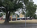
Shirley is an area of south London, England, within the London Borough of Croydon. It lies north of Spring Park and Addington, east of Addiscombe, south of Monks Orchard and west of West Wickham, and 10 miles south-southeast of Charing Cross. Prior to the creation of Greater London in 1965, Shirley was in the administrative county of Surrey.

Monks Orchard is a suburb on the edge of the London Borough of Croydon, in the ceremonial county of Greater London, England, prior to 1965 it was located in the historical county of Surrey. It is situated about 10 miles (16.1 km) south south-east of Charing Cross, south of Elmers End and Eden Park, west of West Wickham, and north and east of Shirley and Shirley Oaks.

South Norwood is a district of South London, England, within the London Borough of Croydon, Greater London and formerly in the historic county of Surrey. It is located 7.8 miles (12.5 km) south-east of Charing Cross, north of Woodside and Addiscombe, east of Selhurst and Thornton Heath, south of Crystal Palace/Upper Norwood and Anerley, and south-west of Penge.

South Croydon in south London is the area surrounding the valley south of central Croydon and running as far south as the former Red Deer public house on the Brighton Road. It is bounded by Waddon to the West and Selsdon and Sanderstead to the East. It is part of the South Croydon (CR2) post town and in the London Borough of Croydon.

Hamsey Green is an area of Sanderstead in the Tandridge District of Surrey and partly in the London Borough of Croydon of Greater London, England. To the north is Sanderstead and Warlingham is to the south.

Eden Park is a suburban area in Greater London, England, within the London Borough of Bromley, Greater London and prior to 1965, in the historic county of Kent. It lies south of Beckenham, west of Park Langley and Shortlands, north of West Wickham and Monks Orchard and east of Elmers End.

Woodside is an area in south London, in the London Borough of Croydon. It is between Addiscombe and South Norwood. It is south of South Norwood, west of Shirley and Monks Orchard, north of Addiscombe, and east of Selhurst.

Roundshaw is a housing estate and park in south Wallington and Beddington on the eastern edge of the London Borough of Sutton. Grid Ref TQ302633.

Gipsy Hill in south London is a hilly and leafy neighbourhood spanning the southern parts of the London Boroughs of Lambeth and Southwark characterised for its stunning views of the City of London and Dulwich.

Orchard Park High School is an 11–18 mixed, secondary school and sixth form with academy status in Shirley, Croydon, Greater London, England. It was formerly a foundation school and became an academy in September 2015. It adopted its present name in September 2017 and is part of the Greenshaw Learning Trust.
Joshua Buatsi is a British professional boxer. He has held the World Boxing Organization (WBO) interim light-heavyweight title since September 2024. At regional level, he has held the British and Commonwealth light-heavyweight titles since February 2024, and previously held the British title in 2019. As an amateur, he won light-heavyweight bronze medals at the 2015 European Championships and the 2016 Olympics.