
Biggin Hill is a settlement on the south-eastern outskirts of Greater London, England, within the London Borough of Bromley. Within the boundaries of the historic county of Kent, prior to 1965 it was also in the administrative county of Kent. It is situated beyond London's urban sprawl, 15.2 miles (24.5 km) south-southeast of Charing Cross, with Keston to the north, New Addington to the north-west and Tatsfield, in the neighbouring county of Surrey, to the south. At the 2011 Census, Biggin Hill had a population of 9,951.

Cudham is a village in Greater London, England, located within the London Borough of Bromley and beyond London's urban sprawl. It is located on the Greater London border with Kent, bordering the Sevenoaks District. Cudham lies south of Orpington and north west of Sevenoaks. It is located 15.9 miles (25.6 km) south-southeast of Charing Cross.

Keston is a village in Greater London, England, located within the London Borough of Bromley and the historic county of Kent. It is part suburban, part rural in nature and lies on the edge of Hayes Common, just beyond the London conurbation to the south of Bromley Common. It includes the small hamlet of Nash to the southwest. The northern, more suburban part of Keston is sometimes referred to as Keston Mark.
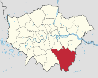
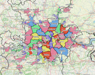
The London Borough of Bromley is the southeasternmost of the London boroughs that make up Greater London, bordering the ceremonial county of Kent, which most of Bromley was part of before 1965. The borough's population is an estimated 332,336. It is named after Bromley, its principal town; other major towns are Penge, Hayes, West Wickham, Chislehurst, Beckenham and Orpington. The local authority is Bromley London Borough Council.
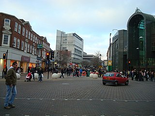
Bromley is a large town in Greater London, England, within the London Borough of Bromley. It is 9.4 miles (15.1 km) south-east of Charing Cross, and had an estimated population of 87,889 as of 2011.

London Biggin Hill Airport is an operational general aviation airport at Biggin Hill in the London Borough of Bromley, located 12 NM south-southeast of Central London. The airport was formerly a Royal Air Force station RAF Biggin Hill, and a small enclave on the airport still retains that designation.

Downe, formerly Down, is a village in Greater London, England, located within the London Borough of Bromley but beyond the London urban sprawl. Downe is 3.4 miles (5.5 km) south west of Orpington and 14.2 miles (22.9 km) south east of Charing Cross. Downe lies on a hill, and much of the centre of the village is unchanged; the former village school now acts as the village hall. The word Downe originates from the Anglosaxon word dūn, latterly down, hence the South and North Downs. In April 1965, it, which was abolished, were transferred from the historic county of Kent and placed within the newly created London Borough of Bromley.
Westerham is a town and civil parish in the Sevenoaks District of Kent, England. It is located 3.4 miles east of Oxted and 6 miles west of Sevenoaks, adjacent to the Kent border with both Greater London and Surrey. It is recorded as early as the 9th century, and was mentioned in the Domesday Book in a Norman form, Oistreham. Hām is Old English for a village or homestead, and so Westerham means a westerly homestead. The River Darent flows through the town, and formerly powered three watermills.
New Addington is a town in South London, England, within the London Borough of Croydon and the historic county of Surrey. It is located 5 miles south east of Croydon, south of Addington Village and north of Biggin Hill.

Orpington is a constituency created in 1945 and represented in the House of Commons of the UK Parliament since 2019 by Gareth Bacon, a Conservative. It is the largest constituency in Greater London by area, covering the east and south of the London Borough of Bromley.

Tatsfield is a village and civil parish in the Tandridge District of Surrey, England. It is located 3.3 miles north west of Westerham and 3.9 miles north east of Oxted, and is adjacent to the Surrey border with both Greater London and Kent.
The Greater London Built-up Area, or Greater London Urban Area, is a conurbation in south-east England that constitutes the continuous urban sprawl of London, and includes surrounding adjacent urban towns as defined by the Office for National Statistics. It is the largest urban area in the United Kingdom with a population of 9,787,426 in 2011.
Ravensbourne was a borough constituency in the London Borough of Bromley in south London. It returned one Member of Parliament (MP) to the House of Commons of the Parliament of the United Kingdom by the first-past-the-post system. It existed from the February 1974 general election until it was abolished for the 1997 general election.
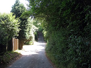
Berry's Green a small hamlet in the London Borough of Bromley in Greater London, UK. It is a fairly wooded rural area with a scattering of farmland. Housing consists mainly of detached properties, mostly bungalows, with a row of local authority cottages and a static mobile home site. It is part of the largest ward in Greater London, Darwin (ward), which covers a very rural area, including Downe, Cudham, Leaves Green, Single Street, Luxted, and Westerham Hill.

Crofton is a suburb of Orpington in southeast London, England, located in the London Borough of Bromley and the historic county of Kent. It is about 13.6 miles (21.9 km) southeast of Charing Cross. It lies south of Petts Wood, west of Orpington and Broom Hill, north of Green Street Green and Farnborough, north-east of Locksbottom and east of Bromley Common.
Elections to Bromley Council were held on 22 May 2014.

Luxted is a hamlet in the London Borough of Bromley, located to the south of Downe. The area is rural, noted for its abundance of woods and grasslands. It is a part of the largest ward in Greater London, the Darwin (ward), which also includes Downe, Cudham, Leaves Green, Single Street, Berry's Green, and Westerham Hill.

Single Street is a hamlet in the London Borough of Bromley in Greater London, located between Luxted and Berry's Green, and centred around a street of the same name. The first record of a settlement under the name 'Single Street' is from an Ordnance Survey map in 1871, but its name is derived from sengel, an Old English word meaning 'burnt clearing'. It is part of the largest ward in Greater London, Darwin (ward), covering a rural area including Downe, Cudham, Leaves Green, Berry's Green, and Westerham Hill.
Darwin is a ward of the London Borough of Bromley, named after Charles Darwin, who lived and worked in the ward for 40 years.

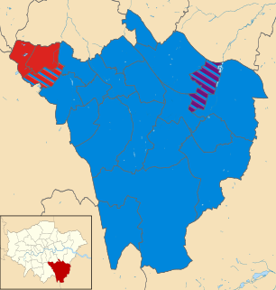
The 2022 Bromley London Borough Council election took place on 5 May 2022. All 58 members of Bromley London Borough Council were elected. The elections took place alongside local elections in the other London boroughs and elections to local authorities across the United Kingdom.


