
Beckenham is a town in Greater London, England, within the London Borough of Bromley. Until 1965 it was part of the historic county of Kent. It is located 8.4 miles (13.5 km) south-east of Charing Cross, situated north of Elmers End and Eden Park, east of Penge, south of Lower Sydenham and Bellingham, and west of Bromley and Shortlands. Its population at the 2011 census counted 46,844 inhabitants.

Mottingham is a district of south-east London, England, which straddles the border of both the London Borough of Bromley and the Royal Borough of Greenwich. It is located south west of Eltham, 1.5 miles. It was historically within the county of Kent.

Orpington is an area in south east London, England, within the London Borough of Bromley. It is 13.4 miles south east of Charing Cross.
Pratt's Bottom is a village in Greater London, England, within the London Borough of Bromley and, prior to 1965, within the historic county of Kent. It is south of its parent parish of Orpington, lies about 100 metres above sea level and beyond London's urban sprawl.
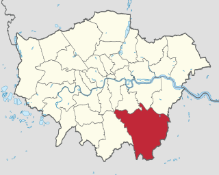
The London Borough of Bromley is the largest and southeasternmost of the London boroughs that make up Greater London, bordering the county of Kent, which most of Bromley was part of before 1965. The borough's population is an estimated 332,336. It is named after Bromley, its principal town; other major towns are Penge, Hayes, West Wickham, Chislehurst, Beckenham and Orpington. The local authority is Bromley London Borough Council.

Bickley is a district and a local government electoral ward in South East London, within the London Borough of Bromley. It is located 10.4 miles (16.7 km) south east of Charing Cross, bordering Elmstead to the north, Chislehurst to the north-east and east, Petts Wood to the south-east, Southborough to the south, Bromley to the south-west and west and Widmore to the north-west. Until 1965 it was in the historic county of Kent.
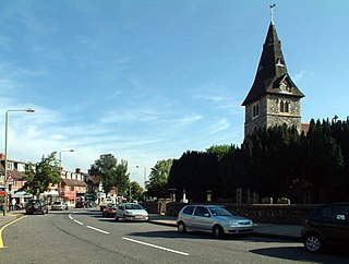
Hayes is a neighbourhood of Bromley in the South East of Greater London, England and part of the London Borough of Bromley. It is located 11 miles (18 km) south-east of Charing Cross, to the north of Keston and Coney Hall, west of Bromley Common, south of Bromley town centre, and east of West Wickham. An ancient parish in the county of Kent, Hayes was within the Orpington Urban District that became part of Greater London in 1965.
New Eltham is a suburban area of South East London, England, primarily in the Royal Borough of Greenwich with some parts in the London Borough of Bexley. It is located south east of Eltham and north west of Sidcup.

West Wickham is an area of South East London, England, mainly within the London Borough of Bromley with some parts lying in the London Borough of Croydon. It lies south of Park Langley and Eden Park, west of Hayes and Coney Hall, north of Spring Park and east of Shirley it’s also half a mile away from Addington, Forestdale and is located north from those following areas. 10.3 miles (16.6 km) south-east of Charing Cross on the line of a Roman road, the London to Lewes Way. Before the creation of Greater London in 1965, West Wickham was in Kent.

Orpington is a constituency created in 1945 and represented in the House of Commons of the UK Parliament since 2019 by Gareth Bacon, a Conservative. It is the largest constituency in Greater London by area, covering the east and south of the London Borough of Bromley.

St Mary Cray is an area of South East London, England, within the London Borough of Bromley. Historically it was a market town in the county of Kent. It is located north of Orpington, and 13 miles (21 km) south-east of Charing Cross.

Southborough is an area of South East London, within the London Borough of Bromley, Greater London. Prior to 1965 it was within the historic county of Kent. It is located south of Bickley and Bromley, east of Bromley Common, north of Locksbottom, and west of Petts Wood.
Chinbrook is an area of south east London, England, located 14 km (8.7 mi) southeast of Charing Cross in the London Borough of Lewisham. Chinbrook lies between Grove Park and Mottingham, approximately half a mile east of Grove Park centre and is generally considered part of Grove Park.
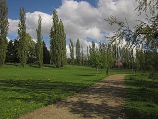
Chinbrook Meadows is a park in southeast London, England, one of Lewisham's public open spaces. It is located between Chinbrook and Grove Park in the London Borough of Lewisham adjacent to the boundary with the London Borough of Bromley. The park is within the SE12 postcode district, next to the border of the BR1 postcode district.
Ruxley is a rural settlement of South East London, England that straddles the boundary of the London Boroughs of Bromley and Bexley. It is located 13 miles southeast of Charing Cross, the traditional centre of London, in the Metropolitan Green Belt between Sidcup and Swanley and is also adjacent to the Greater London border with the county of Kent.

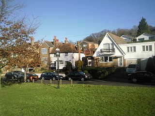
Green Street Green is an area in south-east London, located in the London Borough of Bromley and, prior to 1965, in the historic county of Kent. It is located south of Orpington, west of Chelsfield, north-west of Pratt's Bottom, north of Hazelwood, and south east of Farnborough.

Chelsfield is an area in south-east London, England, within the London Borough of Bromley and, prior to 1965, in the historic county of Kent. It lies south of Goddington, west of Well Hill, north of Pratt's Bottom and east of Green Street Green. The area is split into two distinct areas – the historic 'village' section, and the newer development by the train station.

Westcombe Park RFC is a rugby football club based in Orpington in south-east London. The name of the club comes from the Westcombe Park area of what is today part of the Royal Borough of Greenwich, where the club was founded. The club played on fields in Lee, Shooter's Hill and Sidcup before the move to Orpington. Westcombe Park play in National League 2 East, a level four league in the English rugby union system following their promotion from Regional 1 South East at the end of the 2022–23 season.
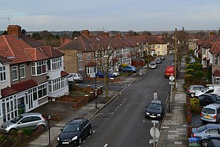
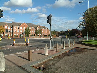
Park Langley is a suburb of South-East London, located in the London Borough of Bromley, Greater London and prior to 1965, in the historic county of Kent. It borders Shortlands and Beckenham to the north, Bromley to the east, Hayes and West Wickham to the south, and Eden Park to the west.

Ramsden is an area in south-east London, generally considered a suburb of Orpington, located in the London Borough of Bromley and, prior to 1965, within the historic county of Kent. It is situated south of Derry Downs and St Mary Cray, east of Orpington town centre and north of Goddington. It was built as a council estate in the 1950-60s and is directly adjacent to the London Green Belt.


