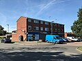
| Broom Hill | |
|---|---|
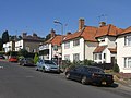
 Cottages, Broom Hill | |
 Broom Hill Location within Greater London | |
| London borough | |
| Ceremonial county | Greater London |
| Region | |
| Country | England |
| Sovereign state | United Kingdom |
| Post town | ORPINGTON |
| Postcode district | BR6 |
| Police | Metropolitan |
| Fire | London |
| Ambulance | London |
| London Assembly | |
Broom Hill, sometimes spelt Broomhill, [1] is a suburb of Orpington in southeast London, England, located in the London Borough of Bromley in Greater London. Prior to 1965 it was within the historic county of Kent. It lies south of Poverest, west of Orpington High Street, north-east of Crofton, and south-east of Petts Wood.