Penge is a suburb of South East London, England, now in the London Borough of Bromley, 3.5 miles (5.6 km) west of Bromley, 3.7 miles (6.0 km) north east of Croydon and 7.1 miles (11.4 km) south east of Charing Cross.

Bickley is a district and a local government electoral ward in South East London, within the London Borough of Bromley. It is located 10.4 miles (16.7 km) south east of Charing Cross, bordering Elmstead to the north, Chislehurst to the north-east and east, Petts Wood to the south-east, Southborough to the south, Bromley to the south-west and west and Widmore to the north-west. Until 1965, it was in the historic county of Kent.
Bromley is a large town in Greater London, England, within the London Borough of Bromley. It is 9+1⁄2 miles southeast of Charing Cross, and had an estimated population of 88,000 as of 2023.

Lee, also known as Lee Green, is an area of South East London, England, straddling the border of the London Borough of Lewisham and the Royal Borough of Greenwich. It is located northwest of Eltham and southeast of Lewisham. It was in Kent before becoming part of the County of London in 1889, and then Greater London in 1965.

West Wickham is an area of South East London, England, in the London Borough of Bromley. It lies south of Park Langley, Eden Park, Beckenham and Bromley town centre, west of Hayes and north of Coney Hall, east of Spring Park and Shirley. It is 10.3 miles (17 km) south-east of Charing Cross on the line of a Roman road, the London to Lewes Way. Before the creation of Greater London in 1965, West Wickham was in Kent.

Shirley is an area of south London, England, within the London Borough of Croydon. It lies north of Spring Park and Addington, east of Addiscombe, south of Monks Orchard and west of West Wickham, and 10 miles south-southeast of Charing Cross. Prior to the creation of Greater London in 1965, Shirley was in the administrative county of Surrey.
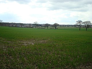
Bromley Common is an unincorporated village in Greater London, within the London Borough of Bromley. Prior to 1965 it was within the historic county of Kent. It is south of Bromley town centre and Bickley, west of Southborough and Petts Wood, north of Locksbottom and Keston, and east of Hayes.
Coney Hall is an area of Greater London, within the London Borough of Bromley, Greater London and formerly in the historic county of Kent. It is located south of Hayes, west of Keston, north of Nash, and east of West Wickham of which it is usually considered a part. The Prime Meridian passes through Coney Hall.

Southborough is an area of South East London, within the London Borough of Bromley, Greater London. Prior to 1965 it was within the historic county of Kent. It is located south of Bickley and Bromley, east of Bromley Common, north of Locksbottom, and west of Petts Wood.
Shortlands is a suburb of South East London, England, within the London Borough of Bromley. It has been part of Greater London since 1965, and was previously part of the historic county of Kent. It is located between west of Bromley and east of Beckenham.

Locksbottom is a suburb of south-east London within the London Borough of Bromley, Greater London. Prior to 1965 it was within the historic county of Kent. It is located south of Bromley Common, west of Crofton, north-west of Farnborough, and east of Keston.
Chinbrook is an area of south east London, England, located 14 km (8.7 mi) southeast of Charing Cross in the London Borough of Lewisham. Chinbrook lies between Grove Park and Mottingham, approximately half a mile east of Grove Park centre and is generally considered part of Grove Park.

Green Street Green is an area in south-east London, located in the London Borough of Bromley and, prior to 1965, in the historic county of Kent. It is located south of Orpington, west of Chelsfield, north-west of Pratt's Bottom, north of Hazelwood, and south east of Farnborough.
The suburban district of Sketty is about 2 miles (3.2 km) west of the Swansea city centre on Gower Road. It falls within the Sketty council ward of Swansea. It is also a community.

Sundridge Park, also known simply as Sundridge, is an area of Greater London within the London Borough of Bromley and prior to 1965 it was in the historic county of Kent. It is situated north of Bromley, north-west of Widmore and Bickley, south of Grove Park and south-east of Downham. In the twentieth century Sundridge names began to overlap somewhat with neighbouring Plaistow, for example, the main Sundridge shopping parade by the station sits directly east of Plaistow Green, with business and facilities in the area using the two names interchangeably, and Plaistow Cemetery is actually on the Sundridge side of the border. However, during the early twenty first century there have been deliberate attempts to re-establish the separate identities of both villages, Sundridge has its own village sign, and representation has been made to the local council for a village sign for Plaistow. Plaistow refers especially to the area north of Sundridge Park station along Burnt Ash Lane, part of the A2212 road which runs north to south between Grove Park and Bromley.
Ernest Newton was an English architect, President of Royal Institute of British Architects and founding member of the Art Workers' Guild.
Plaistow is an area of south-east London located in the London Borough of Bromley and, until 1965, in the historic county of Kent. It is located south of Downham and Grove Park and north of Sundridge Park and Bromley. Nowadays Plaistow overlaps somewhat with Sundridge, for example the main Sundridge Park shopping parade by the station sits directly east of Plaistow Green, with business and facilities in the area using the two names interchangeably. Plaistow now refers especially to the area north of Sundridge Park station along Burnt Ash Lane, part of the A2212 road which runs north to south between Grove Park and Bromley.

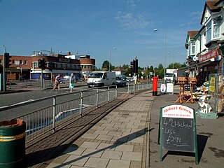
Elmers End is an area of south-east London, England, within the London Borough of Bromley, Greater London and formerly part of the historic county of Kent. It is located south of Beckenham, west of Eden Park, north of Monks Orchard and east of Anerley.

Southend is a small residential locality in the London Borough of Lewisham in southeast London, England. It was historically a rural village at the south of the parish of Lewisham, Kent that remained undeveloped until after the First World War. It is now a residential suburb, with some large retail stores, within the built-up area of London.