Green Street Green

Last updated

Green Street Green
Green Street Green Roundabout - geograph.org.uk - 1605918.jpg
Greater London UK location map 2.svg
Red pog.svg
Green Street Green
Location within Greater London
London borough
Ceremonial county Greater London
Region
Country England
Sovereign state United Kingdom
Post town ORPINGTON
Postcode district BR6
Dialling code 01689
Police Metropolitan
Fire London
Ambulance London
UK Parliament
London Assembly
List of places
UK
England
London
51°21′03″N0°05′19″E / 51.350933°N 0.088706°E / 51.350933; 0.088706

Green Street Green is an area in south-east London, located in the London Borough of Bromley and, prior to 1965, in the historic county of Kent. It is located south of Orpington, west of Chelsfield, north-west of Pratt's Bottom, north of Hazelwood, and south east of Farnborough.

Contents

Etymology

The name originates from La Grenestrete c.1290, meaning the green or grassy hamlet. [1] It is recorded as Greenstreet Green in 1819, the addition of the suffix Green, referring to a village green. [2] The village did not historically form a parish of its own, instead forming part of the parishes of Farnborough and Chelsfield. [3]

History

Historical information plaque by the village sign Green Street Green historical plaque.jpg
Historical information plaque by the village sign

Green Street Green was historically a hamlet, forming part of the coaching routes from London to Sussex. [1] Development only really started with the opening of Oak Brewery by Fox & Sons in 1836, the growth of which led to a modest expansion of the area. [1] Village life centred round the brewery until 1909 when it closed down, causing much unemployment. [1] The area managed to recover, with a row of shops being built along the High Street in 1912. [1] From the 1920s till the 1960s Green Street Green was such a popular meeting point for cyclists that several tea rooms opened in the village, attracting trade from the hordes of weekend cyclists who rode into the Kent countryside from London's suburbs. [1] The former Mrs Valentine Moon's teashop is still a landmark on the east side of Sevenoaks Road, standing opposite The Green.

The first modern housing development was at Chelsfield Park in the 1920s. There were plans to extensively remodel the area as a 'model village' in the 1940s; however, due to post-war financial constraints, this never happened. [1] In 1947, the Town and Country Planning Act set the London Green Belt boundary at the edge of Green Street Green by the A20 and A21 roads. Intensive building, council and private, took place in the 1950s between the village High Street and new Chelsfield. [1] It was during this period that the attractive old people's dwellings were built at Brittenden Close, around three sides of a square lawn with rose gardens and terrace. [4] The old brewery became the Telcon Plastics factory site before the Second World War, and made way for a new housing estate in 1992. [1]

Parks

Recreation grounds are at Cudham Lane North and at Glentrammon Road. [5]

A Coal Post at Brittenden Close. Coal Post at Brittenden Close, Green Street Green.jpg
A Coal Post at Brittenden Close.

Buildings

The Anglican parish church is St Mary's Green Street Green. It falls under the parish of Green Street Green and Pratt's Bottom in the diocese of Rochester.[ citation needed ] It was built in the early 20th century and in the first decade of the 21st century underwent some work on both inside and out to make it more accessible.[ citation needed ] The church plays an important role in the village, with many of the local schools' governors regularly attending it. The church's creative art group recently created a willow structure, placed on the top of the church, in the shape of a man reaching to the heavens, which has been a large attraction to the church. The vicar is Reverend Karl Carpani.[ citation needed ]

Green Street Green's Baptist church, know to members as "The Green" is a pivotal part of the local community. It holds youth events such as the popular worship event "Encounter" and does work within the community with the young people from St Mary's Church in an initiative called "Liberation".[ citation needed ]

Pubs, restaurants and coffee houses

Green Street Green has a number of pubs, restaurants and coffee houses. The Bombay (Curry House) is an Indian restaurant.[ citation needed ] Belmondo, situated in the premises formerly occupied by Spoons, is a coffee house offering coffee and sandwiches.

Sports teams

Green Street Green Football Club

Green Street Green Football Club is an Amateur Football Club that plays its home games at Norman Park, Bromley. The club was formed in 2009 by Manager and player Darren Butland, after he decided to start a competitive 11 a side football team with friends.[ citation needed ] Green Street Green Football Club competes in the Metropolitan Sunday Football League Division Two.[ citation needed ] The team's original football kit colours were yellow and black (yellow shirts, black shorts and yellow socks) whilst its away kit was Red and White (white shirts, red shorts and red socks), however the team later changed their home colours to all green.[ citation needed ] On the 11 October 2020, Green Street Green defeated Bromley South FC 2-1 at Beckenham Town Football Club to win the Ted Holder Trophy for the 2019-20 season.

Green Street Green 2019-20 first team.jpg

Green Street Green Rovers F.C.

GSGR F.C. is an amateur adult football team, formed in 2017, that plays in the Sevenoaks and District League on Saturdays.[ citation needed ]

Transport

Rail

The nearest National Rail stations to Green Street Green are Chelsfield, located 1.3 miles away, and Orpington, located 1.6 miles away.

Buses

Green Street Green is served by London Buses routes 358, R1, R5, R8, R10 & R11 and Go Coach route 3. These connect it with areas including Beckenham, Bromley, Biggin Hill, Orpington, Penge, Sevenoaks & Sidcup.

Notable residents

See also

Related Research Articles

<span class="mw-page-title-main">Beckenham</span> Human settlement in England

Beckenham is a town in Greater London, England, within the London Borough of Bromley. Until 1965 it was part of the historic county of Kent. It is located 8.4 miles (13.5 km) south-east of Charing Cross, situated north of Elmers End and Eden Park, east of Penge, south of Lower Sydenham and Bellingham, and west of Bromley and Shortlands. Its population at the 2011 census counted 46,844 inhabitants.

<span class="mw-page-title-main">Chislehurst</span> Settlement in South East England

Chislehurst is a suburban district of south-east London, England, in the London Borough of Bromley. It lies east of Bromley, south-west of Sidcup and north-west of Orpington, 10 miles (16 km) south-east of Charing Cross. Before the creation of Greater London in 1965, it was in Kent.

<span class="mw-page-title-main">Cudham</span> Human settlement in England

Cudham is a village in Greater London, England, located within the London Borough of Bromley and beyond London's urban sprawl. It is located on the Greater London border with Kent, bordering the Sevenoaks District. Cudham lies south of Orpington and north west of Sevenoaks. It is located 15.9 miles (25.6 km) south-southeast of Charing Cross.
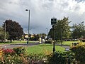
<span class="mw-page-title-main">Orpington</span> Town in South East London, England

Orpington is a town and area in south east London, England, within the London Borough of Bromley. It is 13.4 miles south east of Charing Cross.

<span class="mw-page-title-main">Penge</span> Suburb of south-east London

Penge is a suburb of South East London, England, now in the London Borough of Bromley, 3.5 miles (5.6 km) west of Bromley, 3.7 miles (6.0 km) north east of Croydon and 7.1 miles (11.4 km) south east of Charing Cross.

<span class="mw-page-title-main">Pratt's Bottom</span> Human settlement in England

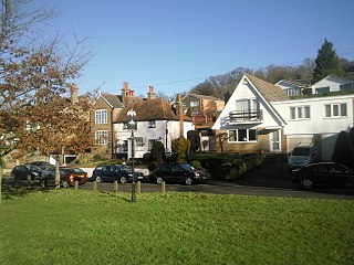
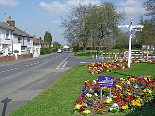
Pratt's Bottom is a village in Greater London, England, within the London Borough of Bromley and, prior to 1965, within the historic county of Kent. It is south of its parent parish of Orpington, lies about 100 metres above sea level and beyond London's urban sprawl.

<span class="mw-page-title-main">London Borough of Bromley</span> Borough in United Kingdom

The London Borough of Bromley is the southeasternmost of the London boroughs that make up Greater London, bordering the ceremonial county of Kent, which most of Bromley was part of before 1965. The borough's population is an estimated 332,336. It is named after Bromley, its principal town; other major towns are Penge, Hayes, West Wickham, Chislehurst, Beckenham and Orpington. The local authority is Bromley London Borough Council.
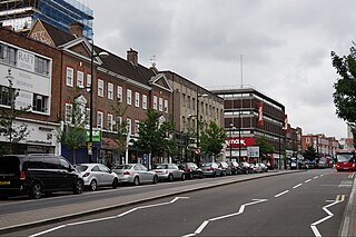
<span class="mw-page-title-main">Hayes, Bromley</span> Human settlement in England

Hayes is a suburban area of southeast London, England and part of the London Borough of Bromley. It is located 11 miles (18 km) south-east of Charing Cross, to the north of Keston and Coney Hall, west of Bromley Common, south of Bromley town centre, and east of West Wickham. An ancient parish in the county of Kent, Hayes was within the Orpington Urban District that became part of Greater London in 1965.

<span class="mw-page-title-main">Westerham</span> Town and civil parish in Kent, England

Westerham is a town and civil parish in the Sevenoaks District of Kent, England. It is located 3.4 miles east of Oxted and 6 miles west of Sevenoaks, adjacent to the Kent border with both Greater London and Surrey. It is recorded as early as the 9th century, and was mentioned in the Domesday Book in a Norman form, Oistreham. Hām is Old English for a village or homestead, and so Westerham means a westerly homestead. The River Darent flows through the town, and formerly powered three watermills.

<span class="mw-page-title-main">Farnborough, London</span> Human settlement in England

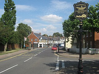
Farnborough is a village in south-eastern Greater London, England, and prior to 1965, in the historic county of Kent. Situated south of Locksbottom, west of Green Street Green, north of Downe and Hazelwood, and east of Keston, it is centred 13.4 miles (21.6 km) southeast of Charing Cross.

<span class="mw-page-title-main">Eden Park, London</span> Human settlement in England

Eden Park is a suburban area in Greater London, England, within the London Borough of Bromley, Greater London and prior to 1965, in the historic county of Kent. It lies south of Beckenham, west of Park Langley and Shortlands, north of West Wickham and Monks Orchard and east of Elmers End.

<span class="mw-page-title-main">Chelsfield railway station</span> National Rail station in London, England

Chelsfield railway station is on the South Eastern Main Line, serving the Chelsfield and Green Street Green areas south of Orpington, in the London Borough of Bromley, south-east London. It is 15 miles 25 chains (24.6 km) down the line from London Charing Cross and is situated between Orpington and Knockholt stations. It is in Travelcard Zone 6.

<span class="mw-page-title-main">Knockholt railway station</span> National Rail station in London, England

Knockholt railway station is on the South Eastern Main Line, located in the London Borough of Bromley, Greater London. It is 16 miles 44 chains (26.6 km) down the line from London Charing Cross and is situated between Chelsfield and Dunton Green stations. It is in Travelcard Zone 6 and is located next to the Greater London boundary with the Kent district of Sevenoaks. The boundary is the farm bridge at the southern end of the platforms.

<span class="mw-page-title-main">Orpington (UK Parliament constituency)</span> Parliamentary constituency in the United Kingdom

Orpington is a constituency created in 1945 and represented in the House of Commons of the UK Parliament since 2019 by Gareth Bacon, a Conservative. It is the largest constituency in Greater London by area, covering the east and south of the London Borough of Bromley.

Knockholt is a village and civil parish in the Sevenoaks District of Kent, England. It is located 5 mi (8 km) north west of Sevenoaks & 5.7 mi (9.2 km) south of Orpington, adjacent to the Kent border with Greater London.

<span class="mw-page-title-main">St Mary Cray</span> Human settlement in England

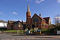
St Mary Cray is an area of South East London, England, within the London Borough of Bromley. Historically it was a market town in the county of Kent. It is located north of Orpington, and 13 miles (21 km) south-east of Charing Cross.

<span class="mw-page-title-main">Chelsfield</span> Human settlement in England

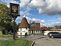
Chelsfield is an area in south-east London, England, within the London Borough of Bromley and, prior to 1965, in the historic county of Kent. It lies south of Goddington, west of Well Hill, north of Pratt's Bottom and east of Green Street Green. The area is split into two distinct areas – the historic 'village' section, and the newer development by the train station.

<span class="mw-page-title-main">Elmers End</span> Human settlement in England

Elmers End is an area of south-east London, England, within the London Borough of Bromley, Greater London and formerly part of the historic county of Kent. It is located south of Beckenham, west of Eden Park, north of Monks Orchard and east of Anerley.

References

  1. 1 2 3 4 5 6 7 8 9 10 Willey, Russ (2006). The London Gazetteer. Chambers Harrap Publishers Ltd. pp. 202–03.
  2. Mills, A., Dictionary of London Place Names, (2001)
  3. Bartholomew, J., Gazetteer of the British Isles, (1887)
  4. London Borough of Bromley Official Guide. Published by authority of the Council of the London Borough of Bromley (1971/74)
  5. The Book of Orpington. Dorothy Cox, Barracuda Books (1983). ISBN   978-0860234241
  6. "Thomas Frank Durrant VC". VC Online. Retrieved 30 September 2020.
  7. "ELEANOR MARX, BELFORT BAX AND "THE WOMAN QUESTION"". Socialist Party. Retrieved 30 September 2020.
  8. "St Mary's Church". The Parish of Green Street Green and Pratts Bottom. Retrieved 2 October 2020.
  9. "Who Are We". Green Street Green Baptist Church. Retrieved 2 October 2020.
  10. Vision of Britain http://www.visionofbritain.org.uk/place/23341