Crofton | |
---|---|
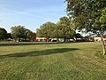
![]() 208 bus route at Crofton junction | |
Location within Greater London | |
Population | 14,632 (2011 Census) |
OS grid reference | TQ445658 |
• Charing Cross | 13.6 mi (21.9 km) NW |
London borough | |
Ceremonial county | Greater London |
Region | |
Country | England |
Sovereign state | United Kingdom |
Post town | ORPINGTON |
Postcode district | BR5, BR6 |
Police | Metropolitan |
Fire | London |
Ambulance | London |
UK Parliament | |
London Assembly | |
Crofton is a suburb of Orpington in southeast London, England, located in the London Borough of Bromley in Greater London. Prior to 1965 it was within the historic county of Kent. It is about 13.6 miles (21.9 km) southeast of Charing Cross. It lies south of Petts Wood, west of Orpington and Broom Hill, north of Green Street Green and Farnborough, north-east of Locksbottom and east of Bromley Common.
A Roman settlement existed here from circa 140 ADs-400, with the ruins of a Roman villa forming a small museum just next to Orpington train station. [1]
The name Crofton comes from Old English and means 'farm on a rounded hill'. [1] Little is known of its subsequent history, though it remained a rural locality until well into the 19th century. [1] Some small-scale development occurred from 1868 following the opening of Orpington train station, and St Paul's Church, Crofton Road was built in 1887 (later rebuilt in 1958). [1] The inter-war years saw extensive development and the area is now effectively a suburban extension of Orpington. [1]
The area contains two small shopping parades on Crofton Lane and Kelvin Parade. To the north-west lies Crofton Wood, which is designated a Site of Special Scientific Interest. [1] [2]
Crofton falls within the London Borough of Bromley and is in the Orpington Parliament constituency. [3] For local council elections it forms a part of the Farnborough and Crofton ward along with Farnborough. [4]
Demographic data is produced by the Office for National Statistics for the Farnborough and Crofton ward. In the 2011 census, the population for the Farnborough and Crofton ward was 14,632. [5] The most common ethnic group was White British in the Farnborough and Crofton ward, measured at 90.5%, followed by Asian or British Asian (5.5%) and mixed-race (1.9%). The remaining percentage was made up of Black or Black British and other unspecified ethnic groups. [6]
Crofton has no railway station of its own, but east of Crofton is Orpington railway station which runs on the South Eastern Main Line.
There is good bus infrastructure in Crofton, having six daytime routes, one nighttime route and one school bus route. Buses in Crofton include bus routes 61, 208, 353, N199, R2, R3, R7 and school route 654 with connections to many towns, villages and suburbs such as Biggin Hill, Bromley town centre, Catford, Lewisham town centre, Petts Wood, St Mary Cray and several other areas. [7]
Chislehurst is a suburban district of south-east London, England, in the London Borough of Bromley. It lies east of Bromley, south-west of Sidcup and north-west of Orpington, 10 miles (16 km) south-east of Charing Cross. Before the creation of Greater London in 1965, it was in Kent.
Orpington is a town and area in south east London, England, within the London Borough of Bromley. It is 13.4 miles south east of Charing Cross.
Petts Wood is a town in south-east London, England, previously located in the historic county of Kent. It lies south of Chislehurst, west of St Paul's Cray and Poverest, north of Orpington and Crofton, and east of Southborough and Bromley Common. The area forms part of the London Borough of Bromley local authority district in the ceremonial county of Greater London.
The London Borough of Bromley is the southeasternmost of the London boroughs that make up Greater London, bordering the ceremonial county of Kent, which most of Bromley was part of before 1965. The borough's population is an estimated 332,336. It is named after Bromley, its principal town; other major towns are Penge, Hayes, West Wickham, Chislehurst, Beckenham and Orpington. The local authority is Bromley London Borough Council.
Bickley is a district and a local government electoral ward in South East London, within the London Borough of Bromley and the historic county of Kent. It is located 10.4 miles (16.7 km) south east of Charing Cross, bordering Elmstead to the north, Chislehurst to the north-east and east, Petts Wood to the south-east, Southborough to the south, Bromley to the south-west and west and Widmore to the north-west.
Bromley is a large town in Greater London, England, within the London Borough of Bromley. It is 9.4 miles (15.1 km) south-east of Charing Cross, and had an estimated population of 87,889 as of 2011.
Orpington railway station is on the South Eastern Main Line, serving the town of Orpington in the London Borough of Bromley, south-east London. It is 13 miles 65 chains (22.2 km) down the line from London Charing Cross and is situated between Petts Wood and Chelsfield stations. It is in Travelcard Zone 6.
Farnborough is a village in south-eastern Greater London, England, located in the historic county of Kent. Situated south of Locksbottom, west of Green Street Green, north of Downe and Hazelwood, and east of Keston, it is centred 13.4 miles (21.6 km) southeast of Charing Cross.
Bickley railway station is on the Chatham Main Line in England, serving the town of Bickley in the London Borough of Bromley, south-east London. It is 11 miles 76 chains (19.2 km) down the line from London Victoria and is situated between Bromley South and St Mary Cray on the main line. Southeastern trains branch from the main line south of Bickley and run to Orpington via Petts Wood. Thameslink services run either via Petts Wood or St Mary Cray on the main line.
Orpington is a constituency created in 1945 and represented in the House of Commons of the UK Parliament since 2019 by Gareth Bacon, a Conservative. It is the largest constituency in Greater London by area, covering the east and south of the London Borough of Bromley.
St Mary Cray is an area of South East London, England, within the London Borough of Bromley. Historically it was a market town in the county of Kent. It is located north of Orpington, and 13 miles (21 km) south-east of Charing Cross.
St Paul's Cray is an area of South East London, England, within the London Borough of Bromley in Greater London. Prior to 1965 it was within the historic county of Kent. It is located south of Sidcup and north of Orpington.
Shortlands is a suburb of South East London, England, within the London Borough of Bromley, Greater London and prior to 1965, in the historic county of Kent. It is located between Beckenham and Bromley, to the north of Park Langley.
Locksbottom is a suburb of south-east London within the London Borough of Bromley, Greater London. Prior to 1965 it was within the historic county of Kent. It is located south of Bromley Common, west of Crofton, north-west of Farnborough, and east of Keston.
Chelsfield is an area in south-east London, England, within the London Borough of Bromley and the historic county of Kent. It lies south of Goddington, west of Well Hill, north of Pratt's Bottom and east of Green Street Green. The area is split into two distinct areas – the historic 'village' section, and the newer development by the train station.
Broom Hill, sometimes spelt Broomhill, is a suburb of Orpington in southeast London, England, located in the London Borough of Bromley in Greater London. Prior to 1965 it was within the historic county of Kent. It lies south of Poverest, west of Orpington High Street, north-east of Crofton, and south-east of Petts Wood.
Poverest is an area in south-east London, England, within the London Borough of Bromley in Greater London. Prior to 1965 it was within the historic county of Kent. It lies south of St Paul's Cray, west of St Mary Cray, north of Orpington and Broom Hill, and east of Petts Wood.
The 2018 Bromley London Borough Council election took place on 3 May 2018 to elect members of Bromley London Borough Council in England. This was the same day as other local elections.