East Anglia is an area in the East of England. It comprises the counties of Norfolk and Suffolk, with Cambridgeshire and Essex also included in some definitions. The name derives from the Anglo-Saxon kingdom of the East Angles, a people whose name originated in Anglia, in what is now Northern Germany.

The historic counties of England are areas that were established for administration by the Normans, in many cases based on earlier kingdoms and shires created by the Angles, Saxons, Jutes, Celts and others. They are alternatively known as ancient counties, traditional counties, former counties or simply as counties. In the centuries that followed their establishment, as well as their administrative function, the counties also helped define local culture and identity. This role continued even after the counties ceased to be used for administration after the creation of administrative counties in 1889, which were themselves amended by further local government reforms in the years following.

The home counties are the counties of England that surround London. The counties are not precisely defined but Berkshire, Buckinghamshire, Essex, Hertfordshire, Kent and Surrey are usually included in definitions as they border London. Other counties slightly further from London – such as Bedfordshire, Cambridgeshire, Hampshire, Oxfordshire, East Sussex and West Sussex – are not always regarded as home counties, although on occasion may be thought of as such due to their proximity to London and their connection to the London regional economy.

Biddenden is a large, mostly agricultural and wooded village and civil parish in the borough of Ashford in Kent, England. The village lies on the Weald of Kent, some 5 miles (8 km) north of Tenterden. It was a centre for the Wealden iron industry and also of clothmaking.

Boxley is a village and civil parish in the Maidstone District of Kent, England.

Lenham is a market village and civil parish in Kent situated on the southern edge of the North Downs, 9 miles (14 km) east of Maidstone. The picturesque square in the village has two public houses, a couple of restaurants, and a tea-room. Lenham has a population of 3,370 according to the 2011 Census.

Brancaster is a village and civil parish on the north coast of the English county of Norfolk. The civil parish of Brancaster comprises Brancaster itself, together with Brancaster Staithe and Burnham Deepdale. The three villages form a more or less continuous settlement along the A149 at the edge of the Brancaster Manor marshland and the Scolt Head Island National Nature Reserve. The villages are located about 3 miles (4.8 km) west of Burnham Market, 22 miles (35 km) north of the town of King's Lynn and 31 miles (50 km) north-west of the city of Norwich. The civil parish has an area of 8.27 square miles (21.4 km2) and in the 2011 census had a population of 797 in 406 households. For the purposes of local government, the parish falls within the district of King's Lynn and West Norfolk. In 2016, Janet Lake, the clerk to Brancaster Parish Council, reached 50 years of service in the post.
Belton with Browston is a civil parish in the Borough of Great Yarnmouth in Norfolk, England. Historically part of Suffolk, the parish consists of the villages of Belton and Browston Green, and is situated some 5 miles (8 km) south-west of the town of Great Yarmouth and 61⁄4 miles (10 km) north-west of the Suffolk town of Lowestoft.
Broome is a village and civil parish in the English county of Norfolk. It is situated on the north bank of the River Waveney, which forms the border with Suffolk, some 2 km north of the town of Bungay and 20 km south-east of the city of Norwich.

The National Register of Historic Places is a United States federal official list of places and sites considered worthy of preservation. In the state of Massachusetts, there are over 4,300 listings, representing about 5% of all NRHP listings nationwide and the second-most of any U.S. state, behind only New York. Listings appear in all 14 Massachusetts counties.

Long Stratton is a town and civil parish in Norfolk, England. It historically consisted of two villages; the larger, Stratton St. Mary, is to the south, and the other, Stratton St. Michael, is to the north. It had a population of 4,424 in the 2011 Census. South Norfolk Council are based in the town.

Briston is a village, civil parish and electoral ward in the English county of Norfolk that contains the hamlet of Briston Common. The village is 11 miles (18 km) east north east of the town of Fakenham, 13.3 miles (21.4 km) west south west of Cromer, 20.3 miles (32.7 km) north north west of the city of Norwich, and 125 miles (201 km) north north east of London. The village is situated on the route of the B1354 that runs between the A148 at Thursford and the B1149 at Saxthorpe.

Earsham is a village and civil parish in the English county of Norfolk. Earsham is located 1.7 kilometres (1.1 mi) west of its postal town of Bungay and 21 kilometres (13 mi) south-east of Norwich. The village is located close to the border between Norfolk and Suffolk, and the River Waveney.
A large number of places in the U.S were named after places in England largely as a result of English settlers and explorers of the Thirteen Colonies.

Sandling is a hamlet to the north of the town of Maidstone, Kent, England, at the foot of the North Downs. It falls within the parish of Boxley.

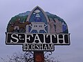
Horsham St Faith and Newton St Faith is a civil parish in the English county of Norfolk, consisting of the former parishes of Horsham St Faith and Newton St Faith. Collectively they are known as St Faiths. It covers an area of 7.33 km2 (2.83 sq mi) and had a population of 1,624 in 770 households at the 2001 census, increasing to a population of 1,724 in 797 households at the 2011 Census. For the purposes of local government, it falls within the district of Broadland.
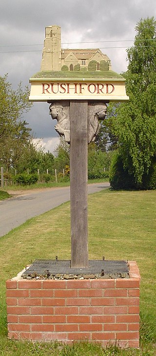
Rushford is a small village in the civil parish of Brettenham, in the Breckland district, in the county of Norfolk, England. It is situated on the north bank of the River Little Ouse, 3+1⁄2 miles (5.6 km) east of the town of Thetford and south of the main A1066 road. The river forms the boundary between Norfolk and Suffolk and, until 1894, Rushford was in both counties. Rushford Hall is south of the river and thus in Suffolk. In 1931 the parish had a population of 94. On 1 April 1935 the parish was abolished and merged with Brettenham.

Leslie H. Kemp and Frederick E. Tasker were English architects who practiced in the 1930s as Kemp & Tasker.