Hounslow West

Last updated

Hounslow West
Hounslow West from the air - geograph.org.uk - 4544595.jpg
Hounslow West from the air, including the tube station (centre left) and former barracks (upper right)
Greater London UK location map 2.svg
Red pog.svg
Hounslow West
Location within Greater London
Population12,658 
OS grid reference TQ120756
London borough
Ceremonial county Greater London
Region
Country England
Sovereign state United Kingdom
Post town HOUNSLOW
Postcode district TW4, TW3
Dialling code 020
Police Metropolitan
Fire London
Ambulance London
UK Parliament
London Assembly
List of places
UK
England
London
51°28′06″N0°23′20″W / 51.468445402963646°N 0.3888526266408676°W / 51.468445402963646; -0.3888526266408676

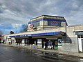
Hounslow West is an area of the London Borough of Hounslow, United Kingdom. It is part of the western residential area of Hounslow but is its separate area. The area came about with the arrival of the District Railway and then the Piccadilly Line with the opening of what is now Hounslow West tube station and the remodeling of Hounslow Barracks

The River Crane bounds the area to the west, Cranford and the A30 road to the north and north-west, Hounslow to the east and south-east and Hounslow Heath to the south.

Features of the area include Beaversfield Park, Hounslows Heath, Beavers Primary School, St Paul's Church and Hounslow Bowls Club.

Nearest stations


Related Research Articles

<span class="mw-page-title-main">Hounslow</span> Town in the west of London, England

Hounslow is a large suburban district of West London, England, 10+34 miles west-southwest of Charing Cross. It is the administrative centre of the London Borough of Hounslow, and is identified in the London Plan as one of the 14 metropolitan centres in Greater London.

<span class="mw-page-title-main">London Borough of Hounslow</span> London borough in United Kingdom

The London Borough of Hounslow is a London borough in west London, England, forming part of Outer London. It was created in 1965 when three smaller borough councils amalgamated under the London Government Act 1963. It is governed by Hounslow London Borough Council.

<span class="mw-page-title-main">Feltham</span> Suburb of West London

Feltham is a town in West London, England, 13 miles (21 km) from Charing Cross. Historically part of Middlesex, it became part of the London Borough of Hounslow in 1965. The parliamentary constituency of Feltham and Heston has been held by Labour Party MPs since 1992. In 2011, the population of the combined census area of Feltham, Bedfont and Hanworth was 63,368.

<span class="mw-page-title-main">Gunnersbury</span> Human settlement in England

Gunnersbury is an area of West London, England.

<span class="mw-page-title-main">Hanworth</span> Human settlement in England

Hanworth is a district of West London, England. Historically in Middlesex, it has been part of the London Borough of Hounslow since 1965. Hanworth adjoins Feltham to the northwest, Twickenham to the northeast and Hampton to the southeast, with Sunbury-on-Thames to the southwest.

<span class="mw-page-title-main">London Borough of Ealing</span> London borough in United Kingdom

The London Borough of Ealing is a London borough in London, England. It comprises the districts of Acton, Ealing, Greenford, Hanwell, Northolt, Perivale and Southall. With a population of 367,100 inhabitants, it is the third most populous London borough.

<span class="mw-page-title-main">Heston</span> Human settlement in England

Heston is a suburban area and part of the Hounslow district in the London Borough of Hounslow. The residential settlement covers a slightly smaller area than its predecessor farming village, 10.8 miles (17.4 km) west south-west of Charing Cross and adjoins the M4 motorway but has no junction with it; Heston also adjoins the Great West Road, a dual carriageway, mostly west of the "Golden Mile" headquarters section of it. Heston was, historically, in Middlesex.

<span class="mw-page-title-main">Isleworth</span> Suburb of West London

Isleworth is a suburban town located within the London Borough of Hounslow in West London, England. It lies immediately east of the town of Hounslow and west of the River Thames and its tributary the River Crane. Isleworth's original area of settlement, alongside the Thames, is known as 'Old Isleworth'. The north-west corner of the town, bordering on Osterley to the north and Lampton to the west, is known as 'Spring Grove'.

<span class="mw-page-title-main">Osterley</span> Human settlement in England

Osterley is an affluent district of the historic parish of Isleworth in west London approximately 8.7 miles (14.0 km) from Charing Cross and is part of the London Borough of Hounslow. Most of its land use is mixed agricultural and aesthetic parkland at Osterley House, charity-run, much of which is open to paying visitor access.

<span class="mw-page-title-main">Burgess Hill</span> Human settlement in England

Burgess Hill is a town and civil parish in West Sussex, England, close to the border with East Sussex, on the edge of the South Downs National Park, 39 mi (63 km) south of London, 10 mi (16 km) north of Brighton and Hove, and 29 mi (47 km) northeast of the county town, Chichester. It had an area of 3.7 sq mi (9.6 km2) and a population of 30,635 at the 2011 Census, making it the fourth most populous parish in the county and the most populous in the Mid Sussex District. Other nearby towns include Haywards Heath to the northeast and Lewes, the county town of East Sussex, to the southeast.

<span class="mw-page-title-main">St Margarets, London</span> Human settlement in England

St Margarets is an affluent suburb and neighbourhood in the London Borough of Richmond upon Thames, about 9 miles (14 km) west-southwest of central London. It is bounded by the Thames Tideway to the north-east, and the River Crane to the north-west and north where the land tapers between these rivers. Land and buildings closer to Richmond Bridge than the eponymous railway station are, traditionally distinctly, known as East Twickenham. Both places go by their post town and traditional parish, Twickenham quite often; in the 19th century the south of St Margarets was marked on maps as Twickenham Park.

<span class="mw-page-title-main">Hounslow West tube station</span> London Underground station

Hounslow West is a London Underground station in locality of Hounslow West in Hounslow within the London Borough of Hounslow, West London. The station is on the Heathrow Terminals 2 & 3 branch of the Piccadilly line, between Hatton Cross and Hounslow Central stations and is in Travelcard Zone 5. The station is located on Bath Road, close to the Great West Road (A4). The station has an island platform, with step-free access via a stairlift for manual wheelchair users only.

<span class="mw-page-title-main">District Railway</span> Former underground railway in London (1868–1933)

The Metropolitan District Railway, also known as the District Railway, was a passenger railway that served London, England, from 1868 to 1933. Established in 1864 to complete an "inner circle" of lines connecting railway termini in London, the first part of the line opened using gas-lit wooden carriages hauled by steam locomotives. The Metropolitan Railway operated all services until the District Railway introduced its own trains in 1871. The railway was soon extended westwards through Earl's Court to Fulham, Richmond, Ealing and Hounslow. After completing the inner circle and reaching Whitechapel in 1884, it was extended to Upminster in Essex in 1902.

<span class="mw-page-title-main">Whitton, London</span> Human settlement in England

Whitton is an area of the London Borough of Richmond upon Thames, England. Historically, it was the north-western part of Twickenham manor, bounded by the River Crane and the Duke of Northumberland's River.

<span class="mw-page-title-main">Feltham and Heston (UK Parliament constituency)</span> Parliamentary constituency in the United Kingdom, 1974 onwards

Feltham and Heston is a constituency in Greater London created in 1974 and represented in the House of Commons of the UK Parliament. Its Member of Parliament (MP) since 2011 has been Seema Malhotra of the Labour and Co-operative Party, in political union with the Labour Party.

<span class="mw-page-title-main">Hatton, London</span> Human settlement in England

Hatton including Hatton Cross is a small settlement and locality in the London boroughs of Hillingdon and Hounslow, on the south-eastern edge of London Heathrow Airport and straddling the A30 road. Prior to 1965 it was in the county of Middlesex.

<span class="mw-page-title-main">Bedfont</span> Human settlement in England

Bedfont is a suburb in the London Borough of Hounslow, approximately 15 miles (24 km) west of Charing Cross. Originally a distinct village, Bedfont has a large central conservation area around Bedfont Green. The majority of the housing was built at a time of an emerging economy of aviation and distribution-related businesses. The area was formerly part of the Staines Rural District and was one of the formerly agricultural areas chosen for significant low-rise social housing, planned and built in the mid 20th century.

<span class="mw-page-title-main">Hounslow Heath</span> Nature reserve located in the London Borough of Hounslow

Hounslow Heath is a local nature reserve in the London Borough of Hounslow and at a point borders Richmond upon Thames. The public open space, which covers 200 acres (80 ha), is all that remains of the historic Hounslow Heath which covered more than 4,000 acres (1,600 ha). The present day area is bounded by A315 Staines Road, A3063 Wellington Road South, A314 Hanworth Road, and the River Crane.

<span class="mw-page-title-main">Grove Park, Chiswick</span> Human settlement in England

Grove Park is an area in the south of Chiswick, now in the borough of Hounslow, West London. It lies in the meander of the Thames occupied by Duke's Meadows park. Historically, the area belonged to one of the four historic villages in modern Chiswick, Little Sutton. It was long protected from building by the regular flooding of the low-lying land by the River Thames, remaining as orchards, open fields, and riverside marshland until the 1880s. Development was stimulated by the arrival of the railway in 1849; Grove Park Hotel followed in 1867, soon followed by housing.

<span class="mw-page-title-main">Cranford Park</span>

Cranford Countryside Park is a 144-acre public park in Cranford, in the London Borough of Hillingdon, England. Situated in close proximity to Heathrow Airport, it is bordered by the M4 Motorway to the north, the A312 trunk road to the east, and by the towns of Harlington and Cranford to the southwest and southeast respectively. Although Cranford is mostly within the London Borough of Hounslow, the park itself is in the London Borough of Hillingdon, as it straddles the southernmost point of this borough. Although the park is in an urban location, it is vehicle-accessible only by a small road before a motorway entrance slip, and as such it has been described as a 'hidden gem'.