
Bexleyheath is a town in south-east London, England, located in the historic county of Kent. It had a population of 31,929 as at 2011.
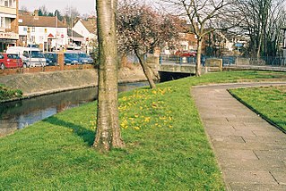
Crayford is a town and electoral ward in South East London, England, within the London Borough of Bexley. It lies east of Bexleyheath and north west of Dartford. Crayford is in the historic county of Kent. The settlement developed by the river Cray, around a ford that is no longer used.

Erith is an area in south-east London, England, 13.3 miles (21.4 km) east of Charing Cross. Within the historic county of Kent, it has formed part of the London Borough of Bexley since 1965. It lies north-east of Bexleyheath and north-west of Dartford, on the south bank of the River Thames. The population is 45,345. The town centre has been modernised with further dwellings added since 1961. The curved riverside high street has three listed buildings, including the Church of England church and the Carnegie Building. Erith otherwise consists mainly of suburban housing. It is linked to central London and Kent by rail and to Thamesmead by a dual carriageway. It has the longest pier in London, and retains a coastal environment with salt marshes alongside industrial land.
Welling is an area of South East London, England, within the London Borough of Bexley and the boundaries of the historic county of Kent. It is 1.5 miles (2.4 km) west of Bexleyheath, 4 miles (6.4 km) south east of Woolwich and 10.5 miles (16.9 km) east-southeast of Charing Cross, the traditional centre of London.

The London Borough of Bexley is a London borough in south-east London, forming part of Outer London. It has a population of 248,287. The main settlements are Sidcup, Erith, Bexleyheath, Crayford, Welling and Old Bexley. The London Borough of Bexley is within the Thames Gateway, an area designated as a national priority for urban regeneration. The local authority is Bexley London Borough Council.

Bexley is an area of south-eastern Greater London, England and part of the London Borough of Bexley. It is sometimes known as Bexley Village or Old Bexley to differentiate the area from the wider borough. It is located 13 miles (21 km) east-southeast of Charing Cross and south of Bexleyheath.

Old Bexley and Sidcup is a constituency created in 1983 and represented in the House of Commons of the UK Parliament represented since 2021 by Louie French of the Conservative Party.

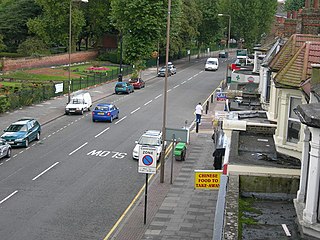
Barnehurst is a town and electoral ward in South East London within the London Borough of Bexley. It lies north east of Bexleyheath, and 13.0 miles (20 km) east south-east of Charing Cross. It is separated from North Bexleyheath by the A220, Erith Road.

Danson House is a Palladian mansion and a Grade I listed building at the centre of Danson Park, in Welling in the London Borough of Bexley, south-east London.
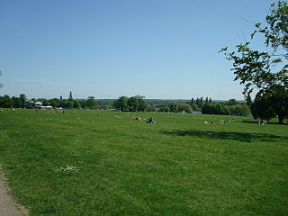
Danson Park is a public park in the London Borough of Bexley, South East London, located between Welling and Bexleyheath. At 75 hectares, it is the second largest public park in the borough, and the most used by the community. Opened in 1925, it is often considered the finest green open space in the borough, and is Grade II listed on the Register of Historic Parks and Gardens. The park also gives its name to the electoral ward that covers the park and the surrounding area. The park is located at grid reference TQ472752. The southern boundary of both the park and the ward is delineated by Rochester Way, the A2 road.
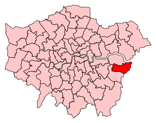
Bexleyheath and Crayford is a constituency represented in the House of Commons of the UK Parliament since 2005 by David Evennett, a Conservative.

Blackfen is an area of south-east London, England, north of Sidcup in the London Borough of Bexley and not the historic county of Kent.

Slade Green is an area of South East London, England, within the London Borough of Bexley and the historic county of Kent. It lies northeast of Bexleyheath, northwest of Dartford and south of Erith, and 14 miles (23 km) east-southeast of Charing Cross.
Bexley was a local government district in north west Kent from 1879 to 1965 around the town of Old Bexley.
The London Borough of Bexley owns and maintains over 100 parks and open spaces within its boundaries, with a total of 638 hectares. They include small gardens, river and woodland areas, and large parks with many sporting and other facilities.
Ruxley is a small settlement in southeast London, England, with no present formal boundaries. It is located 21 km (13 mi) southeast by east of Charing Cross, in the northeast corner of the London Borough of Bromley on the borough boundary with the southeast corner of the London Borough of Bexley, and is also adjacent to the Greater London border with Kent, overlapping into the Sevenoaks District and Borough of Dartford in Kent. Ruxley lies east of Sidcup and west of Swanley, on green belt land, where two main roads pass through east-west connecting London to the coast. Ruxley was a parish prior to 1557 and had its own thirteenth century church, St Botolph's. Ruxley's central location on the main road made it an important meeting place for the Hundred of Ruxley, which was named after it. Today still a major transport route, Ruxley's location on green belt land is on the edge of London's urban sprawl, industrial and residential areas are found on the west side, but to the east this quickly turns into more rural woodland and farmland. Ruxley Gravel Pits is a biological Site of Special Scientific Interest located on the west side of Ruxley. Today the area is known for Ruxley Manor, a large site with a garden centre and other retailers and services.
Well Hall is a place to the north of Eltham in the Royal Borough of Greenwich in southeast London, England, with no present formal boundaries and located 13.5 km (8.4 mi) east-southeast of Charing Cross. In the past Well Hall was the grounds of a manor house, and then a hamlet. Today it is a largely residential suburb and housing estate absorbed by the development of Eltham and London. It is centred on the main road between Eltham and Woolwich, on which many shops and businesses are located. Several major A roads including the South Circular Road and A2 road pass through the area, as does a railway line, serving Eltham station which is located in Well Hall. The Postcode that covers Well Hall and most of the Eltham area is SE9, and the 020 dialing covers the entire Royal Borough of Greenwich. Well Hall is split across two electoral wards, Eltham West on the west side of Well Hall Road, and Eltham North on the east side of Well Hall Road. In 2015 the population of these two wards combined was recorded as 24,621, although the wards cover a larger area than just Well Hall.

Little and Lesnes was a hundred, a historical land division, in the county of Kent, England. It occupied the northern part of the Lathe of Sutton-at-Hone, within in the west division of Kent. Little and Lesnes was the northernmost hundred in the whole county of Kent. The hundred existed since ancient times, before the Domesday Book of 1086, until it was made obsolete with the creation of new districts at the end of the nineteenth century.

St Botolph's Church is a church building in Ruxley, in the London Borough of Bromley, southest London, England. It was constructed in the thirteenth century and dedicted to Botwulf of Thorney. St Botolph's was used as a church for around 300 years but was deconsecrated in 1557. The church was then used a farm building for over 400 years and the remains of an oast house are still adjacent to it. In the 1960s archaeological work was carried out on the site and found evidence of an older wooden building, suggesting there may have been an older Saxon church in the same location. Today the church is a Grade II listed building and a scheduled ancient monument on the grounds of Ruxley Manor Garden Centre, although many features are still intact, the church is in disrepair and English Heritage have agreed to pay a grant to help preserve the building.


