
Bexleyheath is a town in south-east London, England, in the London Borough of Bexley. It had a population of 15,600 in 2021 and is 12 miles (19.3 km) south-east of Charing Cross. It is identified in the London Plan as one of 35 major centres in London. Its post town takes in other surrounding neighbourhoods, including Barnehurst, West Heath and Upton.

Erith is an area in south-east London, England, 13.3 miles (21.4 km) east of Charing Cross. Before the creation of Greater London in 1965, it was in the historical county of Kent. Since 1965 it has formed part of the London Borough of Bexley. It lies north-east of Bexleyheath and north-west of Dartford, on the south bank of the River Thames.
Welling is a town in South East London, England, in the London Borough of Bexley, 1.5 miles (2.4 km) west of Bexleyheath, 4 miles (6.4 km) southeast of Woolwich and 10.5 miles (16.9 km) of Charing Cross. It was part of Kent prior to the creation of Greater London in 1965.

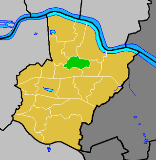
The London Borough of Bexley is a London borough in south-east London, forming part of Outer London. It has a population of 248,287. The main settlements are Sidcup, Erith, Bexleyheath, Crayford, Welling and Old Bexley. The London Borough of Bexley is within the Thames Gateway, an area designated as a national priority for urban regeneration. The local authority is Bexley London Borough Council.
Falconwood is an area of south east London within both the London Boroughs of Bexley and Greenwich. It is north east of Eltham and south west of Welling. According to the 2021 census, Falconwood, has a population of roughly 16,600.

Eltham railway station is in the Well Hall area of Eltham, South East London, within the Royal Borough of Greenwich. It is 10 miles 68 chains (17.5 km) measured from London Victoria. It is in Travelcard Zone 4.

Kidbrooke railway station serves Kidbrooke in the Royal Borough of Greenwich, south-east London. It is 9 miles 51 chains (15.5 km) measured from London Victoria.

The Bexleyheath line runs for 8 miles (13 km) from Lewisham to Dartford in Kent. It separates from the North Kent Line just to the east of Blackheath Station, and rejoins the same line just south of Slade Green near Dartford.

The North Kent Line is a railway line which branches off the South East Main Line at St Johns junction west of Lewisham station in Greater London and runs to Rochester Bridge Junction near Strood, Medway where it links to the Chatham Main Line.

The Dartford Loop Line is one of three lines linking London with Dartford in Kent, England. It lies to the south of the other two: the North Kent Line and the Bexleyheath Line.

Barnehurst is a town and electoral ward in South East London within the London Borough of Bexley. It lies north east of Bexleyheath, and 13.0 miles (20 km) east south-east of Charing Cross. It is separated from North Bexleyheath by the A220, Erith Road.

Slade Green railway station is in the London Borough of Bexley, southeast London, on the North Kent Line. It is 15 miles 30 chains (24.7 km) measured from London Charing Cross.

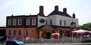
Bexleyheath railway station is in the London Borough of Bexley in southeast London, and is in Travelcard Zone 5. The station, and all trains serving it, are operated by Southeastern. There are ticket barriers at both entrances.
Wilmington is a village and civil parish in the Borough of Dartford in Kent, England. It is located 2.7 miles south of Dartford, 3.5 miles north of Swanley and 4.3 miles south east of Bexleyheath, adjacent to the Kent border with Greater London.
Northumberland Heath is an area of South East London, England within the London Borough of Bexley. It is located south of Erith and north of Bexleyheath.
The London Borough of Bexley owns and maintains over 100 parks and open spaces within its boundaries, with a total of 638 hectares. They include small gardens, river and woodland areas, and large parks with many sporting and other facilities.
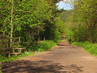
Joyden's Wood is an area of ancient woodland that straddles the border between the London Borough of Bexley in South East London and the Borough of Dartford in Kent, England. It is located 2.7 miles (4.3 km) north west of Swanley, 3.3 miles (5.3 km) south east of Bexleyheath and 3.6 miles (5.8 km) south west of Dartford. It is one of over 1,000 woodlands in the United Kingdom looked after by the Woodland Trust. The first records of a wood on this site go back to the year 1600. It is also the name of a housing estate to the east of the woodland itself.
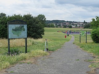
East Wickham is a district in south-east London, England, within the London Borough of Bexley. It is situated north of Welling, east of Shooter's Hill, south of Plumstead, south-west of Abbey Wood and west of West Heath, and 10.5 miles (16.9 km) east-southeast of Charing Cross. Prior to the creation of Greater London in 1965, East Wickham was in the administrative county of Kent.

North Cray is an area in South East London, England, within the London Borough of Bexley. It is located east of Sidcup and south of Bexleyheath and is 12.6 miles (20.3 km) south-east of Charing Cross, the traditional centre of London in the Metropolitan Green Belt.

Leyton Cross is a small semi-rural area in Kent, England, that largely falls within the parish of Wilmington in the borough of Dartford, although north of Oakfield Lane the area is administered directly by Dartford Borough Council. The boundaries of Leyton Cross are ill-defined but the residential area is generally said to include the neighbourhood around Leyton Cross Road, Clayton Croft Road, Tredegar Road, Manor Close and Wilmington Court Road, the western tip of Common Lane, plus the section of Oakfield Lane between Heath Lane (Upper) and Old Bexley Lane. Leyton Cross also includes areas of heathland to the immediate north and west of this district, which are parts of Dartford Heath. Leyton Cross may also sometimes be referred to as Heath Side.


