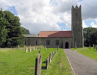
Strumpshaw is a village and civil parish in the English county of Norfolk. It is located on the northern bank of the River Yare around 6 miles (9.7 km) south-east of Norwich. The parish covers an area of 11.69 km2 (4.51 sq mi) and had a population of 602 in 245 households at the 2001 census, increasing to a population of 634 in 261 households at the 2011 Census. For the purposes of local government, it falls within the district of Broadland.
Attleborough is a market town and civil parish located on the A11 between Norwich and Thetford in Norfolk, England. The parish is in the district of Breckland and has an area of 21.9 square kilometres (8.5 sq mi).

Breckland is a local government district in Norfolk, England. Its council is based in Dereham, although the largest town is Thetford. The district also includes the towns of Attleborough, Swaffham and Watton, along with numerous villages and surrounding rural areas.

Gateley is a village and civil parish in the Breckland district of Norfolk, England.
Quidenham is a small rural village and civil parish in the English county of Norfolk. It covers an area of 22.51 km2 (8.69 sq mi) and had a population of 576 in 183 households at the 2001 census, falling to a population of 560 living in 189 households at the 2011 Census. For the purposes of local government, it falls within the district of Breckland.

New Buckenham is a village and civil parish in the English county of Norfolk.
Saham Toney is a village and a civil parish in the English county of Norfolk. The village is 14.5 miles (23.3 km) north of Thetford, 27.3 miles (43.9 km) west of Norwich and 101 miles (163 km) north-east of London. The village lies 13.1 miles (21.1 km) west of the town of Attleborough. The nearest railway station is at Attleborough for the Breckland Line which runs between Cambridge and Norwich. The nearest airport is Norwich International Airport. The civil parish has an area of 16.51 km2 (6.37 sq mi) and in 2001 had a population of 1,565 in 680 households, reducing to 1,507 in 679 households at the 2011 Census. For the purposes of local government, the parish falls within the district of Breckland.
Yaxham is a village and civil parish in centre of the English county of Norfolk. The parish includes the village of Yaxham, together with the neighbouring community of Clint Green and the hamlet of Brakefield Green. Together, they lie some 2 miles (3.2 km) south of Dereham and 20 miles (32 km) west of Norwich.

Flordon is a village and civil parish in the English county of Norfolk. The village is located 5.4 miles (8.7 km) south-east of Wymondham and 7.6 miles (12.2 km) south-west of Norwich.

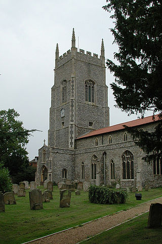
Hevingham is a village and civil parish in the Broadland district of the English county of Norfolk. Situated between the A140 road Norwich to Cromer road and the B1149 road Norwich to Holt road. It is 7 miles (11 km) north from the city of Norwich and 4 miles (6.4 km) south from the market town of Aylsham.

Thurlton is a small village in South Norfolk, located 14 miles (22 km) south-east of the city of Norwich, and 9 miles (15 km) west of the Suffolk coastal town of Lowestoft.

Mileham is a village approximately midway between East Dereham and Fakenham in Mid Norfolk with a population of 563 people in 2011. The village sits astride the B1145 Kings Lynn to Mundesley road that dissects Mid Norfolk west to east. It is the old coaching road from Kings Lynn to Norwich and then on to Great Yarmouth.

Sidestrand is a village and a civil parish on the coast of the English county of Norfolk. The village is 23.7 mi (38.1 km) north of Norwich, 3.3 mi (5.3 km) south east of Cromer and 138 mi (222 km) north-east of London. The nearest railway station is at North Walsham for the Bittern Line which runs between Cromer and Norwich. The nearest airport is Norwich International Airport. From the Census 2011 the population was included in the civil parish of Trimingham.

Shropham is a civil parish in the English county of Norfolk. It covers an area of 11.12 km2 (4.29 sq mi) and had a population of 351 in 155 households at the 2001 census. For the purposes of local government, it falls within the district of Breckland.
Great Dunham is a village situated in the Breckland District of Norfolk and covers an area of 818 hectares with an estimated population of 325, including Kempstone and increasing to a measured population of 344 at the 2011 Census. The village lies 1.5 miles (2.4 km) north of its sister village Little Dunham and 7 miles (11 km) by road north east from Swaffham.
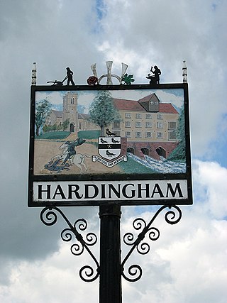
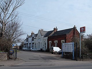
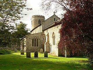
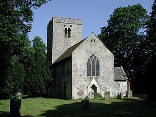
Hardingham is a civil parish in the English county of Norfolk. It covers an area of 4 square miles with a population of 274 in 110 households at the 2001 census, decreasing to a population of 267 in 107 households at the 2011 Census. For the purposes of local government, it falls within the district of Breckland. The parish includes the hamlet of Danemoor Green about one mile north-east of the main village. An interesting fact about Hardingham is that a philanthropist opened a school nearby which gave local children a higher standard of education than was usual in a rural farming area. (date?) The village is most notable for Hardingham railway station, a stop on the Mid-Norfolk Railway. It is a few miles away from the town of Wymondham, and roughly fifteen miles from Norwich.
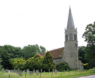
Banham is an English village and civil parish in the county of Norfolk, about 7 miles (11 km) north of Diss, 12 miles (19 km) east of Thetford and 20 miles (32 km) south-west of Norwich. It is home to Banham Zoo, a private collection open to the public for more than 40 years, which houses over 2000 animals. The Church of England parish church, dedicated to St Mary the Virgin, is a Grade I listed building. The name of the village derives from "Bean homestead/village", or perhaps "hemmed-in land where beans grow".
Norwich Road Mill or Fendick's Mill is a Grade II listed tower mill at East Dereham, Norfolk, England which was most recently restored and reopened to visitors in 2013.

Great Ellingham Windmill is a Grade II listed tower mill in Great Ellingham, Norfolk, England which has been converted to residential accommodation.

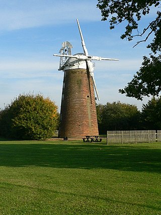
Old Buckenham Windmill is a tower flour mill which stands in the village of Old Buckenham, Norfolk, England. It is a Grade II* listed building, notable for being the largest diameter windmill in the country.


