Vale of Mowbray

Last updated

A view from the Hambleton Hills over the Vale of Mowbray, towards the Yorkshire Dales Hambleton Hills Views - geograph.org.uk - 165481.jpg
A view from the Hambleton Hills over the Vale of Mowbray, towards the Yorkshire Dales

The Vale of Mowbray is a plain in North Yorkshire, England. It is bounded by the Tees lowlands to the north, the North York Moors and the Hambleton Hills to the east, the Vale of York to the south, and the Yorkshire Dales to the west. [1] Northallerton, Catterick Garrison, and Thirsk are the largest settlements within the area. The Vale of Mowbray is distinguishable from the Vale of York by its meandering rivers and more undulating landscape. [2] [3]

Contents

The vale is the floodplain of the River Swale and its tributaries, including the Whiske and Cod Beck. The river enters the vale from Swaledale, in the north-west, then flows in a south-easterly direction before entering the Vale of York. The underlying geology of the landscape is sandstone and mudstone, with clays and silts in the south-west. [3]

The region is agricultural, with a mix of arable and grassland, though isolated pockets of woodland remain. The fields are medium-sized and typically bounded by hawthorn hedges. The villages are often linear, following the major through road, and the houses are generally brick built with pantile roofs. The vale is a major north-south transport corridor, containing the A1 road and the East Coast Main Line, which are respectively the main road and rail links between London and Edinburgh. [3]

Description

The vale takes its name from the family who were granted the rights to the land after the Norman Conquest of 1066. Robert de Mowbray, whose family had a stronghold at Thirsk Castle, was given the land by William the Conqueror in 1086. [4]

The Natural England definition of the boundaries of the Vale of Mowbray are the edge of the North York Moors in the east up to the A19/A172 junction; directly across to the junction at Scotch Corner on the A1(M), then straight down the A1(M) for a western boundary and the rough line from the A168 at Dishforth to Thirsk in the east. [5]

Vale of Mowbray small.jpg
Looking south across the Vale of Mowbray in North Yorkshire. North York Moors are in the distance and the A1(M) is on the right.

Geological surveys list the Vale of Mowbray being bounded to the west by the River Ure, and in the east by the foot of the Hambleton Hills. [6]

Features

Settlements

Major roads

Railways

Rivers

Related Research Articles

<span class="mw-page-title-main">North Yorkshire</span> County of England

North Yorkshire is a ceremonial county in the Yorkshire and the Humber and North East regions of England. It borders County Durham to the north, the North Sea to the east, the East Riding of Yorkshire to the south-east, South Yorkshire to the south, West Yorkshire to the south-west, and Cumbria and Lancashire to the west. Northallerton is the county town.

<span class="mw-page-title-main">Northallerton</span> Town in North Yorkshire, England

Northallerton is a market town and civil parish in North Yorkshire, England. The town is located near the River Wiske in the Vale of Mowbray. It had a population of 16,832 in the 2011 census, an increase from 15,741 in 2001. Northallerton is the county town of North Yorkshire and the administrative centre of North Yorkshire Council; until 1974 it was part of the North Riding of Yorkshire, of which it was also the county town.

<span class="mw-page-title-main">Hambleton District</span> Former local government district in England

Hambleton was a local government district in North Yorkshire, England. The administrative centre was Northallerton, and the district included the outlying towns and villages of Bedale, Thirsk, Great Ayton, Stokesley, and Easingwold.

<span class="mw-page-title-main">Thirsk</span> Market town and civil parish in North Yorkshire, England

Thirsk is a market town and civil parish in North Yorkshire, England; it is known for its racecourse, quirky yarn bombing displays and depiction as local author James Herriot's fictional Darrowby.

<span class="mw-page-title-main">A19 road</span> Road in Northern England

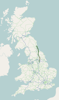
The A19 is a major road in England running approximately parallel to and east of the A1 road. Although the two roads meet at the northern end of the A19, the two roads originally met at the southern end of the A19 in Doncaster, but the old route of the A1 was changed to the A638. From Sunderland northwards, the route was formerly the A108. In the past the route was known as the East of Snaith-York-Thirsk-Stockton-on-Tees-Sunderland Trunk Road. Most traffic joins the A19, heading for Teesside, from the A168 at Dishforth Interchange.

Thornton-le-Moor is a village and civil parish in the Hambleton District of North Yorkshire, England, situated equidistantly from the towns of Thirsk and Northallerton.

<span class="mw-page-title-main">Borrowby, west North Yorkshire</span> Village and civil parish in North Yorkshire, England

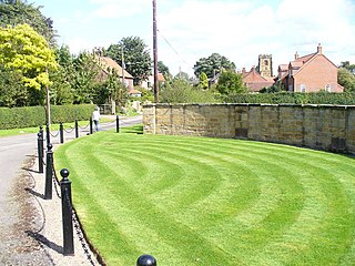
Borrowby is a village and civil parish in North Yorkshire, England. It is situated halfway between Thirsk and Northallerton, about 25 miles (40 km) north of York, in the Vale of Mowbray, a low-lying agricultural landscape shaped by the last glaciation, that lies between two national parks, the North York Moors to the east and the Yorkshire Dales to the west.
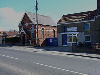
<span class="mw-page-title-main">South Kilvington</span> Village and civil parish in North Yorkshire, England

South Kilvington is a village and civil parish in the Hambleton district of North Yorkshire, England. It is situated just off the A19, about one mile north of Thirsk.

<span class="mw-page-title-main">Kirby Wiske</span> Village in North Yorkshire, England

Kirby Wiske is an English village and civil parish in the Hambleton District of North Yorkshire. It lies beside the River Wiske, about 4 miles (6.4 km) north-west of Thirsk.

<span class="mw-page-title-main">Newby Wiske</span> Village and civil parish in North Yorkshire, England

Newby Wiske is a village and civil parish in the Hambleton district of North Yorkshire, England. It is situated on the River Wiske, about five miles north-west of Thirsk.

<span class="mw-page-title-main">Morton-on-Swale</span> Village and civil parish in North Yorkshire, England

Morton-on-Swale is a large village and civil parish in the Hambleton district of North Yorkshire, England. It lies on the A684 road about 4 miles west of the County Town of Northallerton. It is less than 1 mile (1.6 km) to the village of Ainderby Steeple. As the name suggests it lies on the River Swale.

Streetlam is a hamlet in the Hambleton District of North Yorkshire, England, located 6 miles (9.7 km) north-west of Northallerton. The population fluctuates around 25. Streetlam is situated in a largely flat area of farmland in the Vale of York, which is a low-lying area of ground that extends about 40 miles from north to south in between two hilly national parks to the west and the east. Streetlam is 174 miles (280 km) south of Edinburgh and is 240 miles (387 km) north of London.

<span class="mw-page-title-main">River Wiske</span> River in North Yorkshire, England

The River Wiske is a tributary of the River Swale in Yorkshire, England. The Wiske gives its name to several villages it passes through. The name Wiske is derived from an Old English word wisca meaning a water meadow. It was once known as the Foulbroke, a name for which some writers commented that it was well deserved.

<span class="mw-page-title-main">Leeming Bar</span> Village in North Yorkshire, England

Leeming Bar is a village in the civil parish of Aiskew and Leeming Bar, in North Yorkshire, England. The village lay on the original Great North Road before being bypassed. It is now home to a large industrial estate and the main operating site of the Wensleydale Railway. It is in the historic North Riding of Yorkshire.

<span class="mw-page-title-main">Kirby Sigston</span> Village and civil parish in North Yorkshire, England

Kirby Sigston is a village and civil parish in the Hambleton district of North Yorkshire, England, approximately 4 miles (6.4 km) east of Northallerton. The village is situated on the Cod Beck river, and the wider parish contains the hamlet of Jeater Houses due east of the village on the trunk A19 road.

<span class="mw-page-title-main">A168 road</span> Road in North Yorkshire, England

The A168 is a major road in North Yorkshire, England. It runs from Northallerton to Wetherby, acting as a local access road for the A1(M).

<span class="mw-page-title-main">South Otterington</span> Village and civil parish in North Yorkshire, England

South Otterington is a village and civil parish in the Hambleton district of North Yorkshire, England. It is located on the A167 road 5 miles (8 km) south of Northallerton and on the east bank of the River Wiske.

<span class="mw-page-title-main">A684 road</span> A road in Northern England

The A684 is an A road that runs through Cumbria and North Yorkshire, starting at Kendal, Cumbria and ending at Ellerbeck and the A19 road in North Yorkshire. It crosses the full width of the Yorkshire Dales, passing through Garsdale and the full length of Wensleydale.

References

  1. Adams, Bob (25 January 2021). "A walk along Yorkshire's 'fastest flowing river'". York Press. Retrieved 31 October 2021.
  2. Innes, J. B.; Rutherford, M. M.; O’Brien, C. E.; Bridgland, D. R.; Mitchell, W. A.; Long, A. J. (January 2009). "Late Devensian environments in the Vale of Mowbray, North Yorkshire, UK: evidence from palynology". Proceedings of the Geologists' Association. 120 (4): 199–208. doi:10.1016/j.pgeola.2009.08.007.
  3. 1 2 3 4 5 Lake 2020, p. 10.
  4. Grainge 1859, pp. 1–10.
  5. "NCA Profile: 24 Vale of Mowbray - NE442" (PDF). Natural England - Access to Evidence. 23 May 2013. p. 3. Retrieved 20 March 2018.
  6. Mitchell, T. Carter (1889). "On the Drift-deposits of the Vale of Mowbray". Proceedings of the Yorkshire Geological and Polytechnic Society. 11 (2): 177–182. doi:10.1144/pygs.11.2.177.
  7. 1 2 3 4 5 Grainger, John (22 July 2021). "The Vale of Mowbray - three homes in a stunning part of Yorkshire". The Harrogate Advertiser. Retrieved 31 October 2021.
  8. 1 2 3 4 5 6 7 8 9 10 Lake 2020, p. 3.
  9. 1 2 Lake 2020, p. 9.
  10. Lake 2020, p. 7.
  11. Holst, Malin; Speed, Greg (2019). "Death, Burial and Identity: 3000 Years of Death in the Vale of Mowbray". A1 Leeming to Barton Motorway Upgrade Scheme, North Yorkshire (A1 Scheme). doi:10.5284/1050910.

Sources

54°20′31″N1°26′06″W / 54.342°N 1.435°W / 54.342; -1.435