Ovenden

Last updated

Ovenden
Ovenden-railway-building-by-Betty-Longbottom.jpg
Ovenden railway building
Calderdale UK location map.svg
Red pog.svg
Ovenden
West Yorkshire UK location map.svg
Red pog.svg
Ovenden
Location within West Yorkshire
Population12,351 (Ward. 2011)
OS grid reference SE081274
Metropolitan borough
Metropolitan county
Region
Country England
Sovereign state United Kingdom
Post town HALIFAX
Postcode district HX3,HX2
Police West Yorkshire
Fire West Yorkshire
Ambulance Yorkshire
List of places
UK
England
Yorkshire
53°44′36″N1°52′40″W / 53.743241°N 1.877863°W / 53.743241; -1.877863

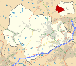
Ovenden is a village in West Yorkshire, England, next to Boothtown and Illingworth about a mile from Halifax town centre. It is also a Calderdale Ward whose population at the 2011 Census was 12,351. [1]

Contents

The area was scattered with pockets of Victorian streets and shops and nearby mills for the residents, after the second World War much of the rural area in-between the Victorian settlements was redeveloped with council housing, prefabricated buildings, shopping complexes,A secondary modern school,two primary schools one state run the other a Catholic one. A new Catholic Church was constructed to cater for the large Irish community that relocated to the area from West Central Halifax. The area is mainly working class although there is some affluent Victorian properties and steets mixed in with the social modern housing. [ citation needed ]

Ovenden railway station on the Halifax and Ovenden Junction Railway Line closed in 1955 to passengers but the line remained open until 1960 to allow freight train to access St Paul's station on the west side of Halifax. [2] It is now used as a garage with buildings constructed on the old rail line covering the front entrance of a tunnel that the trains used to run through. Parts of the television series Happy Valley were filmed in the Grove area of the village.[ citation needed ]

Ovenden rugby league club competed in the National Conference League up until 2015 before having to withdraw due to a lack of players and finance. [3] Similarly, Ovenden West Riding football team folded in August 2016 for the same reason of not having enough players to field a team. [4]

The Ridings School in Ovenden gained national notoriety as one of the worst schools in the UK. It closed in 2009 and parts of it have been converted into a doctors surgery and sports centre with rest of the school leased to a not-for-profit organisation, Threeways, who plan to open a community hub with fitness, sport and entertainment facilities. [5]

Champion Jack Dupree

In the 1970s and 1980s, Ovenden was the home of New Orleans blues and boogie woogie pianist Champion Jack Dupree. [6] A bronze plaque has been erected in his memory. [7]

See also

Related Research Articles

<span class="mw-page-title-main">Brighouse</span> Town in West Yorkshire, England

Brighouse is a town within the metropolitan borough of Calderdale, in West Yorkshire, England. Historically within the West Riding of Yorkshire, it is situated on the River Calder, 4 miles (6.4 km) east of Halifax. It is served by Junction 25 of the M62 motorway and Brighouse railway station on the Caldervale Line and Huddersfield Line. In the town centre is a mooring basin on the Calder and Hebble Navigation. The United Kingdom Census 2001 gave the Brighouse / Rastrick subdivision of the West Yorkshire Urban Area a population of 32,360. The Brighouse ward of Calderdale Council gave a population of 11,195 at the 2011 Census. Brighouse has a HD6 postcode.

<span class="mw-page-title-main">Greetland</span> Village in West Yorkshire, England.

Greetland is a village situated within the metropolitan borough of Calderdale, West Yorkshire, England. It falls within the Calderdale Ward of Greetland and Stainland. According to the 2011 Census, this ward had a population of 11,389. Geographically, Greetland is approximately 1 mile west of Elland and 2.5 miles south of Halifax.

<span class="mw-page-title-main">Mytholmroyd</span> Village in Calderdale, West Yorkshire, England

Mytholmroyd is a large village and former civil parish, now in the parish of Hebden Royd, in the Calderdale district, in West Yorkshire, England, 2 miles (3 km) east of Hebden Bridge. It lies in the Upper Calder Valley, 10 miles (16 km) east of Burnley and 7 miles (11 km) west of Halifax. The village, which has a population of approximately 4,000, is in the Luddendenfoot Ward of Calderdale Council.

<span class="mw-page-title-main">Ripponden</span> Village and civil parish in West Yorkshire, England

Ripponden is a village and civil parish on the River Ryburn near Halifax in West Yorkshire, England. Historically it was part of the West Riding of Yorkshire. Its population was 6,412 at the time of the 2001 Census, and 7,421 in 2011.

<span class="mw-page-title-main">Sowerby Bridge</span> Market town in West Yorkshire, England

Sowerby Bridge is a market town in the Upper Calder Valley in Calderdale in West Yorkshire, England. The Calderdale Council ward population at the 2011 census was 11,703.

<span class="mw-page-title-main">Huddersfield</span> Town in West Yorkshire, England

Huddersfield is a market town in the Metropolitan Borough of Kirklees in West Yorkshire, England. It is the administrative centre and largest settlement in the Kirklees district. The town is in the foothills of the Pennines. The River Holme's confluence into the similar-sized Colne is to the south of the town centre which then flows into the Calder in the north eastern outskirts of the town.

<span class="mw-page-title-main">Calderdale</span> Metropolitan borough in West Yorkshire, England

Calderdale is a metropolitan borough of West Yorkshire, England, which had a population of 211,439. It takes its name from the River Calder, and dale, a word for valley. The name Calderdale usually refers to the borough through which the upper river flows, while the actual landform is known as the Calder Valley. Several small valleys contain tributaries of the River Calder. The main towns of the borough are Brighouse, Elland, Halifax, Hebden Bridge, Sowerby Bridge and Todmorden.

<span class="mw-page-title-main">Featherstone</span> Town and civil parish in West Yorkshire, England

Featherstone is a town and civil parish in the City of Wakefield, West Yorkshire, England, two miles south-west of Pontefract. Historically part of the West Riding of Yorkshire, in 2011 it had a population of 15,244. Featherstone railway station is on the Pontefract Line.

<span class="mw-page-title-main">Queensbury, West Yorkshire</span> Village in West Yorkshire, England

Queensbury is a village in the metropolitan borough and city of Bradford, West Yorkshire, England. Perched on a high vantage point above Halifax, Clayton and Thornton and overlooking Bradford, Queensbury is one of the highest parishes in England, with views beyond the West Yorkshire conurbation to the hills of Brontë Country and the Yorkshire Dales to the north and north west. Its population of 8,718 in 2001 increased to 16,273 in the 2011 Census.

<span class="mw-page-title-main">Warley Town</span> Human settlement in England

Warley Town is a settlement near Halifax, in the Calderdale district, in the county of West Yorkshire, England. Warley is a ward of Calderdale. The population of this ward as taken at the 2011 Census was 12,215.

<span class="mw-page-title-main">Halifax railway station (England)</span> Railway station in West Yorkshire, England

Halifax railway station serves the town of Halifax in West Yorkshire, England. It lies on the Calder Valley line and is 17 miles (27 km) west from Leeds.

<span class="mw-page-title-main">Hebden Royd</span> Town and Civil Parish in West Yorkshire, England

Hebden Royd is a civil parish in the Metropolitan Borough of Calderdale in West Yorkshire, England. According to the 2001 census it had a population of 9,092, rising to 9,558 at the 2011 census. It includes market town of Hebden Bridge and the villages of Mytholmroyd and Cragg Vale. The parish was an urban district before 1974, created in 1937 by the merger of Hebden Bridge and Mytholmroyd urban districts.

<span class="mw-page-title-main">Luddendenfoot</span> Human settlement in England

Luddendenfoot or Luddenden Foot is a village and former civil parish, lying north-west of Sowerby Bridge and west of Halifax, in Calderdale, West Yorkshire, England. The population of Luddendenfoot is 2,547, with the wider Calderdale Ward at the 2011 Census as 10,653. It lies along the Upper Calder Valley below the village of Luddenden, between Sowerby Bridge and Mytholmroyd.

<span class="mw-page-title-main">Newsome</span> Village in West Yorkshire, England

Newsome is a village situated approximately 1 mile south of Huddersfield, West Yorkshire, England. It is in the Metropolitan Borough of Kirklees. The village lies at the centre of Newsome Ward to which it gives its name.

<span class="mw-page-title-main">Hipperholme</span> Village in West Yorkshire, England

Hipperholme is a village in West Yorkshire, England, located between the towns of Halifax and Brighouse in the Hipperholme and Lightcliffe ward of the Metropolitan Borough of Calderdale. The population of this ward at the 2011 Census was 11,308.

<span class="mw-page-title-main">Halifax, West Yorkshire</span> Town in West Yorkshire, England

Halifax is a town in Calderdale, West Yorkshire, England. It is near the east Pennine foothills.

<span class="mw-page-title-main">Stainland</span> Village in West Yorkshire, England

Stainland is a village in the civil parish of Stainland and District, in Calderdale, West Yorkshire, England. The village is part of the Greetland and Stainland ward of Calderdale Council and is approximately 2 miles (3 km) west of Elland, 3.5 miles (6 km) south of Halifax and 4.3 miles (7 km) north-west of Huddersfield.

<span class="mw-page-title-main">Holywell Green</span> Village in West Yorkshire, England

Holywell Green is a village in the civil parish of Stainland and District, in the Calderdale, district, in the county of West Yorkshire, England. The village is situated approximately 1.4 miles (2 km) south-west of Elland, 3.3 miles (5 km) south of Halifax and 3.9 miles (6 km) north-west of Huddersfield. Holywell Green is part of the Greetland and Stainland Ward of Calderdale Council.

<span class="mw-page-title-main">Holdsworth, West Yorkshire</span> Village in West Yorkshire, England

Holdsworth is an area of Halifax in West Yorkshire, England, 2.5 miles (4 km) north of the town centre. It was historically a village in the township of Ovenden, in the ancient parish of Halifax in the West Riding of Yorkshire. Since 1974 it has been part of the Metropolitan Borough of Calderdale.

<span class="mw-page-title-main">Fountainhead Village</span> Hamlet in West Yorkshire, England

Fountainhead is a hamlet in Calderdale, West Yorkshire, England, built on the old site of the Webster's Brewery at the turn of the 21st century. It is situated approximately 2 miles (3 km) north-west from Halifax town centre. The hamlet is in the Warley ward of Calderdale.

References

  1. "Calderdale Ward population 2011". Neighbourhood Statistics. Office for National Statistics. Retrieved 23 February 2016.
  2. Armour, Chris. "Ovenden". Disused Stations. Retrieved 5 October 2016.
  3. "Rugby League: Ovenden pull out of National Conference League". Halifax Courier. 21 January 2015. Retrieved 5 October 2016.
  4. "Prolific winners Ovenden WR fold". Halifax Courier. 4 August 2016. Retrieved 5 October 2016.
  5. "Halifax Ridings School site in community takeover". BBC News. BBC. 15 July 2009. Retrieved 1 June 2013.
  6. "Story of a boxing Champion". Halifax Courier. 15 November 2012. Retrieved 9 April 2014.
  7. "Small Town Saturday Night". HebWeb News. 15 October 2012. Retrieved 17 April 2014.

Commons-logo.svg Media related to Ovenden at Wikimedia Commons