
Bredbury and Romiley was an urban district in the administrative county of Cheshire, England from 1894 to 1974, which covered the civil parishes of Bredbury, Compstall and Romiley.
Cheadle and Gatley was, from 1894 to 1974, an urban district of Cheshire, England.
Crompton Urban District was, from 1894 to 1974, a local government district in the administrative county of Lancashire, England. The area was coterminate with Shaw and Crompton.
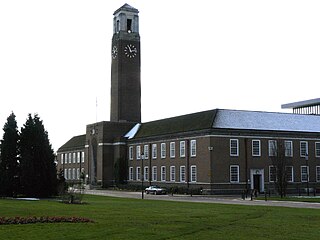
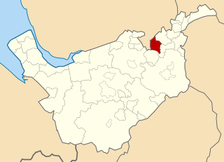
Swinton and Pendlebury was a local government district of the administrative county of Lancashire, England. It was created in 1894 as an urban district and enlarged in 1934, gaining the status of a municipal borough.
Bucklow Rural District was, from 1894 to 1974, a local government district in the north of the administrative county of Cheshire, England. Following the Local Government Act 1972, this rural district was split between the new Greater Manchester boroughs of Trafford and Manchester, and Macclesfield, which was retained in Cheshire.
Weardale was a rural district in County Durham, England from 1894 to 1974. It was formed under the Local Government Act 1894 as a successor to the Weardale rural sanitary district.
Bowland was a rural district in the West Riding of Yorkshire from 1894 to 1974. It was named after the Forest of Bowland, which it included.
Ormskirk was an urban district in the county of Lancashire from 1894 to 1974. It was named after the town of Ormskirk, which constituted its main settlement.
Lees was from 1894 to 1974, a local government district in the administrative county of Lancashire, England.

Oldham was, from 1849 to 1974, a local government district in the northwest of England coterminous with the town of Oldham.
Goole was a rural district in the West Riding of Yorkshire, England from 1894 to 1974.
The County Borough of Wigan was, from 1889 to 1974, a local government district centred on Wigan in the northwest of England. It was alternatively known as Wigan County Borough.

Longendale Urban District was, from 1936 to 1974, a local government district in the administrative county of Cheshire, England. It encompassed parts of Broadbottom, Hattersley, Hollingworth, Matley and Mottram in Longdendale, all of which form part of the non-statutory Longdendale Valley.
Urmston Urban District was, from 1894 to 1974, a local government district in the administrative county of Lancashire, England which covered the modern-day district of Urmston.

Milnrow Urban District was, from 1894 to 1974, a local government district of the administrative county of Lancashire, in northwest England. It covered an area to the east and southeast of the County Borough of Rochdale, and included the town of Milnrow, the village of New Hey, and the Piethorne Valley; Crompton Urban District lay to the south.
Orrell Urban District was, from 1894 to 1974, a local government district in the administrative county of Lancashire, England. Its boundaries were centred on Orrell, but also included parts of Upholland.
Holywell was a rural district in the administrative county of Flintshire, Wales, from 1894 to 1974.
Fenny Stratford Urban District was from 1895 to 1911 the name of a local government authority in the administrative county of Buckinghamshire, England. In 1911 the urban district was renamed Bletchley Urban District.
Driffield was a rural district in the East Riding of Yorkshire in England from 1894 to 1974. It surrounded the municipal borough of Driffield.

Buxton was an Urban District from 1894 to 1917 and a Municipal Borough from 1917 to 1974 in Derbyshire, England.

