River Hyndburn

Last updated

Hyndburn
River Hyndburn at Church Bridge - geograph.org.uk - 1181759.jpg
River Hyndburn at Church Bridge.
Location
CountryEngland
Physical characteristics
Source 
  locationGoodshaw Hill, Rossendale (as Woodnook Water)
Mouth  
  location
Hyndburn Brook, south of Dunkenhalgh.

The River Hyndburn is a minor river in Lancashire, England. Beginning as Woodnook Water on the slopes of Goodshaw Hill, it passes through Stone Fold, Rising Bridge and Baxenden where it is augmented by streams from Thirteen Stone Hill and continues to the Woodnook area of Accrington. [1] Near St James Church, it collects Broad Oak Water (recorded in 1800 as the River Grange), becoming the River Hyndburn. [2] [3] It heads northward through the town centre, collecting Pleck Brook and turning west, flowing under the East Lancashire railway line viaduct and continuing to Church.

Contents

Here it turns northward again, meeting Hyndburn Brook just before it passes under the M65 motorway bridge to the south of Dunkenhalgh, [4] [5] which continues past Clayton-le-Moors and Great Harwood, ultimately joining the River Calder. Today, much of the course of the river and parts of its tributaries run underground through culverts. [1] The Hyndburn borough of Lancashire is named after the river.

Meaning of the river name

The name is from Old English burna "stream" (not Old Norse brunnr 'spring', as with some place names over the boundary in North Yorkshire). The origins of Hynd are uncertain. It could be derived from the Old English hyldre "an elder-tree", or hynd "hind", or the Old Norse/Old English personal name Helþor/Helthor. An early mention of the name can be found in the "Chetham miscellanie", which contains an entry from 1360; "Bounds of Magna (Great) Harwood. Begin at the foot of Northdeyne water at the falling thereof into Hindeburne/Hyndburne water." [6]

The name of the river may have changed over time. On William Yates map of 1786, it is seen as the Winburn. [7] This is thought to be because the source of the river can be found in the Win Fields, still known as Winfields today. By 1828, it is written as Henburn, [8] perhaps referring to the fact it ran along the edge of HenField to the North of Accrington. Two streams that go on to become the River Hyndburn lie within the old township of Henheads. The township is thought to be so named because the Hyndburn was more often called the Henburn in the past.[ citation needed ] On the 1848 Six-inch Ordnance Survey map, it is written as Hyndburn brook. [9]

Tributaries

Wildlife

An ongoing river improvement scheme aimed to allow migrating salmon, trout and eels access to the River Hyndburn, saw the construction in 2017 of a fish bypass at the 4-metre (13 ft 1 in) high, 19th-century Oakenshaw Print Works weir on Hyndburn Brook. [11] [12] In June 2019, work started on a similar project, upstream at the weir of Dunkenhalgh near Rishton. [13]

On 11 July 2018, Woodnook Vale and Peel Park were officially designated as local nature reserves, becoming the two largest in Lancashire. Woodnook Vale covers approximately 2.2 miles (3.5 km) of Woodnook Water, south of Accrington and includes Rothwell Heights on the western side of the valley. The Peel Park site, east of the town, covers the mill ponds above the old Plantation Mill print works site, [14] which supply Pleck Brook. [10]

Related Research Articles

<span class="mw-page-title-main">Accrington</span> Town in England

Accrington is a town in the Hyndburn borough of Lancashire, England. It lies about 4 miles (6 km) east of Blackburn, 6 miles (10 km) west of Burnley, 13 miles (21 km) east of Preston, 20 miles (32 km) north of Manchester and is situated on the culverted River Hyndburn. Commonly abbreviated by locals to "Accy", the town has a population of 35,456 according to the 2011 census.

<span class="mw-page-title-main">Porter Brook</span> River in Sheffield, South Yorkshire, England

The Porter Brook is a river which flows through the City of Sheffield, England, descending over 1,000 feet (300 m) from its source on Burbage Moor to the west of the city to its mouth where it joins the River Sheaf in a culvert beneath Sheffield railway station. Like the other rivers in Sheffield, its steep gradient made it ideal for powering water mills and works associated with the metalworking and cutlery industries, and around 20 dams were constructed over the centuries to facilitate this. At its lower end, it is extensively culverted, but parts of it are gradually being restored to open channels, as part of a daylighting scheme for the city.

<span class="mw-page-title-main">River Tame, Greater Manchester</span> River in Greater Manchester, England

The River Tame flows through Greater Manchester, England. It rises on Denshaw Moor and flows to Stockport where it joins the River Goyt to form the River Mersey.

<span class="mw-page-title-main">Clayton-le-Moors</span> Human settlement in England

Clayton-le-Moors is an industrial town in the borough of Hyndburn in the county of Lancashire, England. located two miles north of Accrington. The town has a population of 8,522 according to the 2011 census.

<span class="mw-page-title-main">Oswaldtwistle</span> Human settlement in England

Oswaldtwistle is a town in the Hyndburn borough of Lancashire, England, 3 miles (5 km) southeast of Blackburn, contiguous with Accrington and Church. The town has a rich industrial heritage, being home to James Hargreaves, inventor of the spinning jenny and Sir Robert Peel of calico printing fame. The Leeds and Liverpool Canal passes through the town and was responsible for the export of much of the area's cotton produce.

<span class="mw-page-title-main">River Darwen</span> River in Lancashire, England

The River Darwen runs through Darwen and Blackburn in Lancashire, England, eventually joining the River Ribble at Walton le Dale south of Preston on its way to the Ribble Estuary.

<span class="mw-page-title-main">Church, Lancashire</span> Human settlement in England

Church is a large village in Hyndburn, Lancashire, England, situated a mile west of Accrington. The village has a population of 5,186 at the 2011 Census, an increase from 3,990 according to the 2001 census.

<span class="mw-page-title-main">Blackburn Brook</span> Stream in Sheffield, South Yorkshire, England

The Blackburn Brook is a stream in Sheffield, South Yorkshire, England which flows through the Blackburn Valley along the M1 and Ecclesfield Road and joins the River Don near the Meadowhall shopping centre. Downstream from the A61 road at Chapeltown the Blackburn Brook is defined as a main river by the Environment Agency, which requires new building development to be at least 26 feet (8 m) from the bank side as a flood defence measure and to allow access to the watercourse for maintenance.

<span class="mw-page-title-main">River Calder, Lancashire</span> River in Lancashire, England

The River Calder is a major tributary of the River Ribble in Lancashire, England and is around 20 miles (32 km) in length.

<span class="mw-page-title-main">River Croco</span> River in Cheshire, England

The River Croco is a small river in Cheshire in England. It starts as lowland field drainage west of Congleton, flows along the south edge of Holmes Chapel, and joins the River Dane at Middlewich. It is about 8 miles (13 km) long.

<span class="mw-page-title-main">River Brun</span> River in eastern Lancashire, England

The River Brun is a river in eastern Lancashire. It is approximately 4.5 miles (7.2 km) long and has a catchment area of 9.32 square miles (24.134 km2).

<span class="mw-page-title-main">Hyndburn Brook</span> River in England

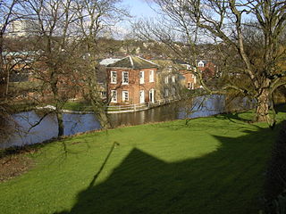
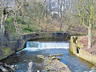
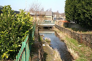
Hyndburn Brook is a minor river in eastern Lancashire. It is approximately 4.5 miles (7.3 km) long, and has the catchment area of 13.61 square miles (35.243 km2).

<span class="mw-page-title-main">Huncoat</span> Human settlement in England

Huncoat is a village in Lancashire, England; situated in the North West. It is located to the east of Accrington. It is a ward of Hyndburn where the population taken at the 2011 census was 4,418.

<span class="mw-page-title-main">Piethorne Brook</span> Stream in Greater Manchester, England

Piethorne Brook is a watercourse in Greater Manchester. It is a tributary of the River Beal.

<span class="mw-page-title-main">Hapton, Lancashire</span> Human settlement in England

Hapton is a village and civil parish in the Borough of Burnley in Lancashire, England, 3 miles (4.8 km) west of Burnley, with a railway station on the East Lancashire Line. At the United Kingdom Census 2011, it had a population of 1,979.

<span class="mw-page-title-main">Hameldon Hill</span>

Hameldon Hill is a Carboniferous sandstone hill with a summit elevation of 409 metres (1,342 ft), situated between the towns of Burnley and Accrington in Lancashire, England. It is listed as a "HuMP" or "Hundred Metre Prominence", its parent being Freeholds Top, a Marilyn near Bacup.

<span class="mw-page-title-main">Moston Brook</span> Stream in Greater Manchester, England

Moston Brook is a stream in Greater Manchester in north-west England and a tributary of the River Irk. The brook is formed at the confluence of Bower Brook and Hole Bottom Brook. This occurs near the Rochdale Canal in Failsworth in the Metropolitan Borough of Oldham. It flows southwest, forming the border between Moston, Manchester and Failsworth before being culverted almost all of the remaining route to its meeting the River Irk. It has a total length of about 3.7 miles.

<span class="mw-page-title-main">Green Brook, Lancashire</span> River in Lancashire, England

Green Brook is a minor river in Lancashire, England. It is 2.32 miles (3.73 km) long, and including tributaries, has the catchment area of 7.02 square miles (1,818.28 ha).

<span class="mw-page-title-main">Walverden Water</span> River in Lancashire, England

Walverden Water is a minor river in Lancashire, England. It is approximately 2.6 miles (4.2 km) long and has a catchment area of 5.04 square miles (1,304.23 ha).

<span class="mw-page-title-main">Burnley Coalfield</span> Coal mining region in England

The Burnley Coalfield is the most northerly portion of the Lancashire Coalfield. Surrounding Burnley, Nelson, Blackburn and Accrington, it is separated from the larger southern part by an area of Millstone Grit that forms the Rossendale anticline. Occupying a syncline, it stretches from Blackburn past Colne to the Yorkshire border where its eastern flank is the Pennine anticline.

References

  1. 1 2 "OL21" (Map). South Pennines. 1:25,000. Explorer. Ordnance Survey. 2015. ISBN   9780319242605.
  2. Lancashire and Furness (Map). 1 : 2,500. County Series. Ordnance Survey. 1892.
  3. Crossley, Richard Shaw (2013), Accrington Through The 19th Century, lulu.com, p. 8, ISBN   978-1300775966
  4. Lancashire (Map). 1 : 2,500. Ordnance Survey. 1911. Sheet LXIII.10.
  5. "Hyndburn". Catchment Data Explorer. Environment Agency. Retrieved 5 July 2019.
  6. "Chetham miscellanie" . Retrieved 30 November 2022.
  7. "View map: Centre south east sheet - The county Palatine of Lancaster - Counties of Scotland, 1580-1928". maps.nls.uk. Retrieved 26 October 2022.
  8. "View map: A map of the County Palatine of Lancaster ... from an accurate survey in the yea... - Counties of Scotland, 1580-1928". maps.nls.uk. Retrieved 26 October 2022.
  9. "View map: Lancashire LXIII (includes: Accrington; Altham; Church; Clayton Le Moors; Rishto... - Ordnance Survey Six-inch England and Wales, 1842-1952". maps.nls.uk. Retrieved 26 October 2022.
  10. 1 2 Crossley p.293
  11. Nic Marko (21 February 2018). "New £128k fish bypass opens to bring salmon back to River Hyndburn". Lancashire Telegraph. Retrieved 26 July 2019.
  12. "Brown trout have been tracked since new fish pass was put in place". Natural Course. 22 May 2019. Retrieved 26 July 2019.
  13. RLTWebadmin (20 June 2019). "Work commences on Dunkenhalgh Weir". Ribble Life Together. Retrieved 26 July 2019.
  14. "Woodnook Vale and Peel Park Local Nature Reserve leaflet". Hyndburn Borough Council. 2019. Retrieved 27 July 2019.

Coordinates: 53°44′10″N2°19′26″W / 53.736°N 2.324°W / 53.736; -2.324