River Tawd

Last updated

River Tawd in Lathom. River Tawd.JPG
River Tawd in Lathom.

The River Tawd flows through Skelmersdale and Lathom in West Lancashire.

Contents

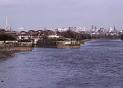
Tawd Bridge carried Ormskirk Road, the main arterial road from Wigan to Ormskirk and Southport. This is well known to Upholland locals as the place where highwayman George Lyons held up his victims during the 18th century. Today, the river flows through the middle of Skelmersdale in large culverts. It emerges near the town's shopping centre, the Concourse, and flows into a country park and Tawd Vale Adventure Centre, a Scout campsite owned and operated by Merseyside Scouts, on the site of the 19th and early 20th century colliery. Parts of the river are a county biological heritage site.

It is a tributary of the River Douglas which it joins in Lathom.

Water quality

The Environment Agency measure the water quality of the river systems in England. Each is given an overall ecological status, which may be one of five levels: high, good, moderate, poor and bad. There are several components that are used to determine this, including biological status, which looks at the quantity and varieties of invertebrates, angiosperms and fish. Chemical status, which compares the concentrations of various chemicals against known safe concentrations, is rated good or fail. [1]

The water quality of the River Tawd was as follows in 2016. Reasons for the quality being less than good include physical modification of the channel and some sewage discharge.

SectionEcological StatusChemical StatusOverall StatusLengthCatchmentChannel
Tawd [2] Moderate Good Moderate 7.8 miles (12.6 km)11.88 square miles (30.8 km2)heavily modified

Tributaries

Related Research Articles

River Douglas, Lancashire River in north-west England

The River Douglas, also known as the River Asland or Astland, flows through parts of Lancashire and Greater Manchester in North West England. It is a tributary of the River Ribble and has several tributaries, the major ones being the River Tawd and the River Yarrow.

<span class="mw-page-title-main">River Test</span> River in Hampshire, England

The River Test is a chalk stream in Hampshire in the south of England. It rises at Ashe near Basingstoke and flows southwards for 40 miles (64 km) to Southampton Water. Settlements on the Test include the towns of Stockbridge and Romsey. Below the village of Longparish, the river is broadly followed by the Test Way, a long-distance footpath.

River Leam River in Northamptonshire and Warwickshire, England

The River Leam, anciently Leame, etc, is a river in England which rises at Hellidon Hill in Northamptonshire then flows through Warwickshire, including the town of Leamington Spa, named after it. It then flows into the River Avon near Warwick, and thence into the River Severn. The name is first recorded in 956 as Limenan, and derives from British Lemanā, meaning "elm-tree river".

River Churn River in Gloucestershire and Wiltshire, England

The River Churn is a tributary of the River Thames in central England. It rises at Seven Springs in Gloucestershire and flows south for approximately 37.3 km (23.2 mi) to meet the Thames at Cricklade in Wiltshire. Its length from its source to the confluence with the Thames is greater than that of the Thames from Thames Head, though the Churn is regarded as a tributary rather than the main river.

<span class="mw-page-title-main">River Meon</span> River in Hampshire, England

The River Meon is a chalk stream in Hampshire in the south of England. It rises at East Meon then flows 34 km (21 mi) in a generally southerly direction to empty into the Solent at Hill Head near Stubbington. Above Wickham, the river runs through the South Downs National Park.

River Allen, Dorset River in Dorset, England

The River Allen is a river in the county of Dorset in South West England. It flows for 14 miles (23 km) and has its confluence with the River Stour in Wimborne Minster. It has two main tributaries, the Gussage Stream and the Crichel Stream.

River Salwarpe River in Worcestershire, England

The River Salwarpe is a 20.4 miles (32.8 km) long river in Worcestershire, England. It is a left bank tributary of the River Severn, which it joins near Hawford.

River Yarrow (Lancashire) River in Lancashire, England

The River Yarrow is in Lancashire, with its source at an area called Will Narr at Hordern Stoops, along Spitlers Edge - the Chorley/Blackburn boundary - on the West Pennine Moors. The river feeds the Yarrow Reservoir, which in turn feeds the Anglezarke and Upper and Lower Rivington Reservoirs. Upon leaving the reservoirs via a pumping station, the river passes through an area that was formerly known as Abyssinia. Currently, this area is within the boundaries of Heath Charnock and Limbrick, but the original name was given because it was a route frequented by coal miners, and the workers were said to look like natives of Abyssinia : until the mid 20th century it was usual for miners to return from work covered in coal dust.

The Rye (brook) Stream in Surrey, England

The Rye is a stream rising east of Ashtead and flowing into the River Mole near Leatherhead, Surrey.

River Blackwater (River Test) River in Hampshire and Wiltshire, England

This River Blackwater drains small parts of the English counties of Hampshire and Wiltshire. It is a tributary of the River Test.

<span class="mw-page-title-main">Meers Brook</span>

The Meers Brook is a stream in Sheffield, England and one of the main tributaries of the River Sheaf. The Meers Brook originates in Gleadless and flows downhill through Gleadless Valley and Meersbrook then, culverted, continues underneath Heeley to pour into the River Sheaf near Saxon Road and Clyde Road in Lowfield.

Emm Brook River in Berkshire, England

The Emm Brook, sometimes known as the Embrook or Emmbrook, is a small river in the English county of Berkshire. It is a tributary of the River Loddon which it meets at the village of Hurst.

The River Nadder is a tributary of the River Avon, flowing in south Wiltshire, England.

River Lostock River in Lancashire, England

The River Lostock is a river in Lancashire, England.

River Asker River in Dorset, England

The River Asker is a small river in Dorset, England. It rises on the chalk slopes of Eggardon Hill, approximately five miles (8 km) east of Bridport. It flows west-northwest through the villages of Askerswell to which it gives its name, Uploders, where many cottages have gardens backing onto the river, and Loders. Here it heads west towards Bradpole, where it is joined by the small Mangerton Brook flowing in from the north. It then flows southwest into Bridport, passing underneath the A3066 and B3162 roads in the town. In this section there are weirs and fish ladders. South of the B3162, between Bridport and Bothenhampton, the river also forms the western boundary of the Askers Meadow Nature Reserve, which was designated a Local Nature Reserve in 2004. The river then flows under the B3157 road and joins the River Brit beside Palmers Brewery in the south of the town.

<span class="mw-page-title-main">River Till, Wiltshire</span> River in Wiltshire, England

The River Till rises near Tilshead on Salisbury Plain in the English county of Wiltshire. It flows for about 14 km south and south-east, through Orcheston, Maddington, Shrewton, Winterbourne Stoke, Berwick St James and Stapleford, to join the River Wylye.

Clayhill Brook Stream in Berkshire, England

Clayhill Brook is a small stream in southern England, in the county of Berkshire.

Cranleigh Waters River in Surrey, England

The Cranleigh Waters or Bramley Wey is a tributary of the River Wey in Surrey.

<span class="mw-page-title-main">Pillhill Brook</span> River in Hampshire, England

Pilhill Brook is a 9.9-kilometre-long (6.2 mi) tributary of the River Anton in Hampshire, England. It is a chalk stream, known for its trout fishing.

The River Sem is a natural waterway that flows through the ceremonial county of Wiltshire in England. It flows approximately 4+14 miles (7 km) from its source near East Knoyle to join the River Nadder near Wardour.

References

  1. "Glossary (see Biological quality element; Chemical status; and Ecological status)". Catchment Data Explorer. Environment Agency. Retrieved 1 August 2018.
  2. "Tawd". Catchment Data Explorer. Environment Agency. Retrieved 1 August 2018.

Coordinates: 53°36′23″N2°47′34″W / 53.6065°N 2.7927°W / 53.6065; -2.7927