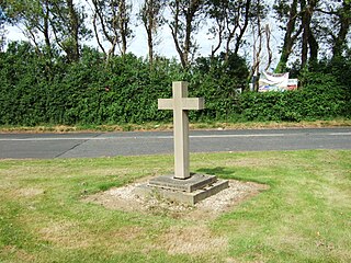
Downholland Cross is a small village in the civil parish of Downholland in the county of Lancashire on the West Lancashire Coastal Plain in England. It is to the north of Lydiate on the A5147 and the Leeds and Liverpool Canal.

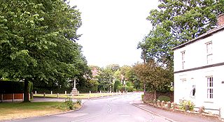
Haskayne is a small village in the county of Lancashire, England, and on the West Lancashire Coastal Plain. It is to the north of Downholland Cross on the A5147 and the Leeds and Liverpool Canal.

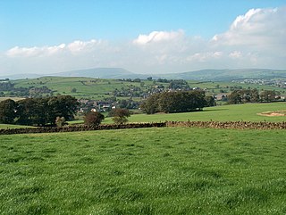
Yealand Redmayne is a village and civil parish in the English county of Lancashire.
Aughton is a village and civil parish in the Borough of West Lancashire of Lancashire, England, between Ormskirk and Maghull. It is a residential area with tree lined roads being found in all parts of the parish and an area of 1,658 hectares. The northern part is known as Aughton village, the south-west as Holt Green and the south-east as Town Green.

Barley-with-Wheatley Booth is a civil parish in the Pendle district of Lancashire, England. It has a population of 298, and contains the village of Barley and the hamlet of White Hough or Whitehough. To the west of Barley is Pendle Hill; its summit, at 557 metres (1,827 ft), is within the parish.

Simonswood is a civil parish in the West Lancashire district of Lancashire, England. At the 2001 census, the population was 130, increasing to 151 by the 2011 census.

Yate and Pickup Bank is a civil parish in the borough of Blackburn with Darwen, Lancashire, England. The population of the civil parish taken at the census of 2011 was 366. The parish contains two hamlets, Bank Fold and Pickup Bank and part of the village of Belthorn which is on the boundary with Hyndburn. It has boundaries with the parishes of Eccleshill to the west and North Turton to the south.
Trawden Forest is a civil parish in the Pendle district of Lancashire, England. It has a population of 2,765, and contains the village of Trawden and the hamlets of Cottontree, Winewall and Wycoller. Boulsworth Hill is a well known local landmark situated within the parish. It takes its name from a medieval royal forest or "chase" which was in the same area.

Ribbleton is a suburb and ward of the city of Preston, Lancashire, England. It is located to the east of the city centre, between the A59 New Hall Lane and the B6243 Longridge Road. The M6 motorway also runs through the area. The ward had a population of 7,351 recorded in the 2001 census increasing to 8,548 at the 2011 Census.

Goldshaw Booth is a civil parish in the Pendle district of Lancashire, England. It has a population of 248, and contains the village of Newchurch in Pendle and the hamlets of Spen Brook and Sabden Fold. Pendle Hill lies to the north.

Sawley is a village and civil parish in the Borough of Ribble Valley in Lancashire, England. The population of the civil parish was 305 at the 2001 Census, rising to 345 at the 2011 census. It is situated north-east of Clitheroe, on the River Ribble. It was historically part of the West Riding of Yorkshire.

Hothersall is a civil parish in the Ribble Valley district, in Lancashire, England. The parish, which is on the north bank of the River Ribble, is rural and contains no major villages, and in the 2001 census had a population of 136, increasing to 145 at the 2011 Census. It is approximately 8 miles (13 km) north-east of Preston, and has boundaries with Longridge to the north and west, and Ribchester to the east.

Gawthorpe is an electoral ward in the non-metropolitan district of Burnley in Lancashire, England. The population of the Burnley Ward at the 2011 census was 6,148. The ward covers the majority of the town of Padiham, meaning it is a largely urban area. It is part of the Padiham and Burnley West electoral division of Lancashire County Council, the Burnley UK Parliament constituency. Prior to Brexit in 2020 it was part of the North West England European Parliament constituency.

Horton, historically known as Horton-in-Craven, is a village and a civil parish in the Ribble Valley district of the English county of Lancashire. Population details are now included in the civil parish of Newsholme. It is near the town of Barnoldswick. Horton has a place of worship, anciently called a chapelry or chapel of ease. For transport, there is the A59 nearby.

The City of Preston is a city and non-metropolitan district in Lancashire, England. On the north bank of the River Ribble, it was granted city status in 2002, becoming England's 50th city in the 50th year of Queen Elizabeth II's reign. The City of Preston district has a population of 143,135 (mid-2019 est.), and lies at the centre of the Central Lancashire sub-region, with a population of 335,000.

Kelbrook and Sough is a civil parish in the Pendle district of Lancashire, England. It has a population of 1,008, and contains the village of Kelbrook and neighbouring hamlet of Sough.
Barton is a small village in the county of Lancashire, England. It is approximately 4 miles (6 km) west from Ormskirk, and less than 1 mile (2 km) west from the A5147 road. Barton sits on the West Lancashire Coastal Plain, and is 5 miles (8 km) from the Irish Sea coast. The village lies within the civil parish of Downholland.

Old Laund Booth is a civil parish in the Pendle district of Lancashire, England. It has a population of 1,459, and contains the villages of Fence and Wheatley Lane.
Downholland is a civil parish in the West Lancashire district of Lancashire, England. It contains eight listed buildings that are recorded in the National Heritage List for England. All the listed buildings are designated at Grade II, the lowest of the three grades, which is applied to "buildings of national importance and special interest". The parish contains the villages of Barton, Haskayne and Downholland Cross, and is otherwise rural. The Leeds and Liverpool Canal passes through the parish. Two milestones by the towpath of the canal are listed, and the other listed buildings are houses and associated structures.
Hilldale is civil parish in the West Lancashire district of Lancashire, England, containing the village of Hill Dale and the neighbouring hamlet of Andertons Mill. Formerly part of Wrightington, Hilldale became a separate civil parish in 1999. As of 2011, Hilldale has a population of 581.

