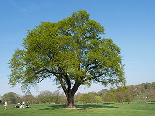
Ashton Park is situated in Ashton-on-Ribble to the west of Preston, Lancashire, England. It has one bowling green, two play areas, with swings, roundabouts and climbing frames, several football pitches within a large, main field, and contains within it a magnificent country house. It is the headquarters of the Armed Forces Group, Dig in North West and Let's Grow Preston. These are all situated within the walled garden that also contains the Peace garden the fruit garden and Ashton Community Garden. It also has a beautiful woodland area, ornamental gardens and many flower beds. Ashton House, the large country house within the park, has recently undergone extensive repair and restoration and is particularly well used as a children's nursery school. Extensive parking facilities are provided in the park which is located immediately to the south of Blackpool Road, which proceeds westwards to Cottam. Nearby on the southern side are the docks, and Riversway complex, containing many offices and shops including Morrisons, McDonald's, and Pets at Home. To the west are the Larches and Savick estates and Lea.
Ashton Park has a colourful history started by the Pedders family, who had made their fortune by founding the Old Preston Bank (located on Church St), built the Ashton Estate and Mansion in 1810 and lived there until 1861. Nearby Pedders Street and Pedders Lane are testimony to the importance of the family.
When Edward Pedder died in 1861, it became apparent that there were not sufficient funds to pay all the demands on the bank and so the estate and its contents had to be sold.
The park was then purchase by Edmund Robert Harris, who became Preston's greatest public benefactor and left the mansion to the governors of Queen Anne's Bounty for the benefit of poor clergy, which evolved into the Church Commissioners.
After the death of Harris in 1877 the estate was sold again. After many changes of ownership, the Calverts, mill owners, sold the mansion to English Electric at the end of World War I, who used it as a social club and for sporting activities. The best known from this period was Dick, Kerr's Ladies football team.
In 1937, Preston Town Council finally bought Ashton Park for the sum of £27.00 and the mansion, Ashton House was sold to Lancashire County Council who turned it into a care home for the elderly. In the 1990s the house was sold to its present owners of the pre-school.
Ashton Park Ranger
Ashton Park has its own dedicated Park Ranger who carries out daily patrols and inspections, to makes sure with the grounds maintenance staff, the park is tidy and safe. In addition the Ranger organises Environmental, Historical and Creative events for schools, community groups and general public.
Friends of Ashton Park
Established in 2002, the Friends of Ashton Park work in partnership with the Park Ranger and the Councils Parks Development Team. The Friends play a major role in the organisation of community events and contribute to management decisions, they also help raise funding for improvements and new facilities.
Preston is a city on the north bank of the River Ribble in Lancashire, England. The city is the administrative centre of the county of Lancashire and the wider City of Preston local government district. Preston and its surrounding district obtained city status in 2002, becoming England's 50th city in the 50th year of Queen Elizabeth II's reign. Preston has a population of 114,300, the City of Preston district 132,000 and the Preston Built-up Area 313,322. The Preston Travel To Work Area, in 2011, had a population of 420,661, compared with 354,000 in the previous census.
Ashton-in-Makerfield is a market town in the Metropolitan Borough of Wigan, Greater Manchester, England, 4 miles (6.4 km) south of Wigan. As of the 2021 census, there was a population of 26,380.
Holland Park is an area of Kensington, on the western edge of Central London, that lies within the Royal Borough of Kensington and Chelsea and largely surrounds its namesake park, Holland Park.
Ashton Court is a mansion house and estate to the west of Bristol in England. Although the estate lies mainly in North Somerset, it is owned by the City of Bristol. The mansion and stables are a Grade I listed building. Other structures on the estate are also listed.
Roundhay is a large suburb in north-east Leeds, West Yorkshire, England. Roundhay had a population of 22,546 in 2011.
Preston Park is a 100-acre (0.40 km2) public park in Preston-on-Tees, England. It hosts multiple events each year and is located next to the River Tees.
Lostock Hall is a suburban village within the South Ribble borough of Lancashire, England. It is located on the south side of the River Ribble, some 3 miles (4.8 km) south of Preston and 3 miles (5 km) north of Leyland. It is bordered on its southeastern side by the interchange for the M6, M61 and M65 motorways.
Buckshaw Village is a 21st-century residential and industrial area between the towns of Chorley and Leyland in Lancashire, England, developed on the site of the former Royal Ordnance Factory (ROF) Chorley. It had a population of 4,000. It is divided between the civil parishes of Euxton (south) and Whittle-le-Woods in Chorley, with the north western part being in Leyland unparished area in South Ribble district.
The English city of Bristol has a number of parks and public open spaces.
Banks is a large coastal village in Lancashire, England, south of the Ribble estuary four miles (6 km) north-east of Southport. The village is administered by West Lancashire Borough and North Meols Parish Council. It is in the South Ribble parliamentary constituency. At the 2001 census the population of the North Meols civil parish was 3,792, rising to 4,146 by the 2011 census.
The City Council elections for the City of Preston, Lancashire were held on 4 May 2006 on the same day as other 2006 United Kingdom local elections. Nineteen electoral wards were fought. The only change was that Labour gained one seat from the Liberal Democrats, continuing to be the largest party, but the Council remained under no overall control
Preston is a suburb about a mile north of North Shields, North Tyneside. Its population was recorded at 8419 in the 2011 census. Historically a separate entity, it has slowly been absorbed into the town to the south and expanded as to form a continuous urban area north to Monkseaton.
Elections to the Preston City Council took place on 3 May 2007.
Grangewood Park is an extensive woodland area situated in South Norwood, London. It is managed by the London Borough of Croydon. It is bounded by Grange Road, Wharncliffe Road, and Ross Road. It covers an area of 27.7 acres. The park is located on the main A212 road between Thornton Heath and Upper Norwood/Crystal Palace. The nearest stations are Thornton Heath, Selhurst and Norwood Junction.
Ashton-on-Ribble is a suburb in the West of Preston, Lancashire, England. The population at the 2021 Census was 8,700. Ashton-on-Ribble was recorded in the Domesday Book.
Ribbleton is a suburb and ward of the city of Preston, Lancashire, England. It is located to the east of the city centre, between the A59 New Hall Lane and the B6243 Longridge Road. The M6 motorway also runs through the area. The ward had a population of 7,351 recorded in the 2001 census increasing to 8,548 at the 2011 Census.
Lucknam Park is a luxury hotel, spa and restaurant in west Wiltshire, England, about 3 miles (5 km) north-west of Corsham and 7 miles (11 km) north-east of Bath. The core of its building is a Grade II listed country house built in the late 17th or early 18th century. The hotel's restaurant has held one star in the Michelin Guide since 2006.
Beckenham Place Park is a large park located near Beckenham in the London Borough of Lewisham. It lies close to the border with the London Borough of Bromley, and was formerly divided between the two boroughs. The Palladian-style mansion that gave the park its name now serves as a community centre and café.
Avery Hill is an area of South East London mainly within Royal Borough of Greenwich, and with some parts in the London Borough of Bexley. It is located east of Eltham and north west of Sidcup. It is believed that the area is named after an aviary formerly located in the area.
Manor House Gardens is a 3.34-hectare public park and gardens situated in Lee, in south east London. The park features a walled flower garden, ornamental pond, fountain, ice-house, cafeteria, children's playground, community garden, dog-walking area and tennis courts/multi-purpose sports pitches. There is also a Park Ranger's Office and information point adjacent to the cafe, and the River Quaggy flows from east to west across the southern part of the park.
This page is based on this Wikipedia article Text is available under the CC BY-SA 4.0 license; additional terms may apply. Images, videos and audio are available under their respective licenses.