Whitechapel, Lancashire

Last updated

Whitechapel
Whitechapel Church 230-30.jpg
St James' Church
Location map United Kingdom City of Preston.svg
Red pog.svg
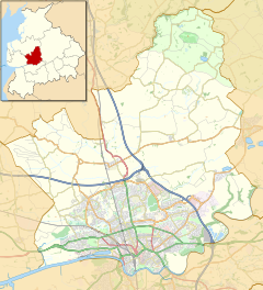
Whitechapel
Location in the City of Preston district
Location map United Kingdom Forest of Bowland.svg
Red pog.svg
Whitechapel
Location in the Forest of Bowland
Lancashire UK location map.svg
Red pog.svg
Whitechapel
Location within Lancashire
OS grid reference SD557413
Civil parish
District
Shire county
Region
Country England
Sovereign state United Kingdom
Post town PRESTON
Postcode district PR3
Dialling code 01995
Police Lancashire
Fire Lancashire
Ambulance North West
UK Parliament
List of places
UK
England
Lancashire
53°51′58″N2°40′23″W / 53.866°N 2.673°W / 53.866; -2.673

Whitechapel is a tiny hamlet in the civil parish of Goosnargh in Lancashire, England. It lies on the border of the Forest of Bowland near the foot of Beacon Fell, and close to the neighbouring village of Inglewhite. Its name is marked as White Chapel on some maps.

Contents

The area was known as "Threlfall" in the Domesday Book. [1] A tiny 27×13-foot private chapel was built for the Threlfall family in Elizabethan times, and was rebuilt as St James' Church about 1738. [2] The churchyard contains a sundial dated 1745 which is a Grade II listed building. [3]

The name "Whitechapel" came into use in the early nineteenth century, named after the church. It was originally a part of Goosnargh ecclesiastical parish, but acquired independent parish status in 1846. [2]

The village primary school originated in 1705, within the church, acquiring its own building in 1810. [4]

On Pancake Day the children of Whitechapel, Inglewhite and the surrounding area keep alive an age-old tradition that was once more widespread in the Goosnargh, Garstang and Fylde areas of Lancashire. [5] They visit local households and ask "please a pancake", to be rewarded with oranges or sweets. It is thought the tradition arose when farm workers visited the wealthier farm and manor owners to ask for pancakes or pancake fillings. [6] [7] In 1888, Richard Cookson wrote, "The children go from house to house and are treated with ginger-bread, toffies and other sweet meats." [8]

WICE (Whitechapel and Inglewhite Community Enterprises) is a community organisation to enable a sustainable and resilient community.

See also

Related Research Articles

<span class="mw-page-title-main">Longridge</span> Town in Lancashire, England

Longridge is a market town and civil parish in the borough of Ribble Valley in Lancashire, England. It is situated 8 miles (13 km) north-east of the city of Preston, at the western end of Longridge Fell, a long ridge above the River Ribble. The nearest villages are Grimsargh, 2 miles (3 km) to the southeast, and Ribchester 4 miles (6 km) to the southeast. The parish of Longridge had a population of 7,546 recorded in the 2001 census, increasing to 7,724 at the 2011 Census.

<span class="mw-page-title-main">Goosnargh</span> Village and parish in Lancashire, England

Goosnargh is a village and civil parish in the City of Preston district of Lancashire, England.

<span class="mw-page-title-main">Grimsargh</span> Human settlement in England

Grimsargh is a village and civil parish in the City of Preston, Lancashire, England. It's located approximately 6 miles (10 km) east of Preston.

<span class="mw-page-title-main">Freeby</span> Human settlement in England

Freeby is a village and civil parish in the Melton district of Leicestershire, England, about 3 miles (5 km) east of Melton Mowbray. As well as the village of Freeby the civil parish includes the villages of Brentingby, Saxby, Stapleford and Wyfordby. The 2011 Census recorded the parish population as 244.

<span class="mw-page-title-main">Barton, Preston</span> Linear village and civil parish in the City of Preston, Lancashire, England

Barton is a linear village and civil parish in the City of Preston, Lancashire, England. The parish had a population of 1,150, of whom 552 were male and 598 were female, according to the 2011 census.

<span class="mw-page-title-main">Rivington</span> Village in Lancashire, England

Rivington is a village and civil parish of the Borough of Chorley, Lancashire, England, occupying 2,538 acres. It is about 6 miles (9.7 km) southeast of Chorley and about 8+12 miles (13.7 km) northwest of Bolton. Rivington is a rural area consisting primarily of agricultural grazing land, moorland, with hill summits including Rivington Pike and Winter Hill within the West Pennine Moors. The area has a thriving tourist industry centred around reservoirs created to serve Liverpool in the Victorian era and Lever Park created as a public park by William Lever at the turn of the 20th century, with two converted barns, a replica of Liverpool Castle and open countryside. Rivington and Blackrod High School is located here. Rivington and its village had a population of 109 at the 2011 Census.

<span class="mw-page-title-main">Plumpton, Cumbria</span> Human settlement in England

Plumpton or Plumpton Wall is a small village and former civil parish, in the parish of Hesket, in the Westmorland and Furness district, in the traditional and historic county of Cumberland but now in the ceremonial county of Cumbria, England. It is about 4 miles (6 km) north of Penrith. In 1931 the parish had a population of 320.

<span class="mw-page-title-main">East Hagbourne</span> Village in England

East Hagbourne is a village and civil parish about 1 mile (1.6 km) south of Didcot and 11 miles (18 km) south of Oxford. It was part of Berkshire until the 1974 boundary changes transferred it to Oxfordshire. The 2011 Census recorded the parish's population as 1,882.

<span class="mw-page-title-main">Chipping, Lancashire</span> Human settlement in England

Chipping is a village and civil parish in the borough of Ribble Valley, Lancashire, England, within the Forest of Bowland Area of Outstanding Natural Beauty. Its grid reference is SD6243, and the nearest substantial settlement is Longridge, nearly 4 mi (6.4 km) to the south. In the 2001 census, the parish had a population of 1,046, falling slightly to 1,043 at the 2011 census. The village has won several best-kept village competitions over the years. The village also won the village section of the Royal Horticultural Society Britain in Bloom competition in 2009, picking up RHS Tourism and Gold achievement awards in the process.

<span class="mw-page-title-main">Whittingham, Lancashire</span> Parish in Lancashire, England

Whittingham is a civil parish in the City of Preston, Lancashire, England. The parish measures 4 miles (6 km) east-to-west, from the outskirts of Longridge to the outskirts of Broughton, but only 1 mile (1½ km) north-to-south. Its population was 2,189 in 2001, reducing to 2,027 at the time of the 2011 Census. The village of Goosnargh is at its centre.

<span class="mw-page-title-main">Inglewhite</span> Human settlement in England

Inglewhite is a small village in the parish of Goosnargh in Lancashire, England. It lies at the intersection of the roads from Longridge to Garstang and from Broughton to Beacon Fell.

<span class="mw-page-title-main">Claughton, Wyre</span> English village and parish also known as Claughton-on-Brock

Claughton is a sparse village and civil parish in the county of Lancashire in the north of England, in the Borough of Wyre. The population of the civil parish at the 2011 census was 633. It is sometimes called Claughton-on-Brock to distinguish it from another Claughton in Lancashire in the Lune valley between Lancaster and Hornby.

<span class="mw-page-title-main">Tosside</span> Village on the Lancashire and North Yorkshire border in England

Tosside is a small village on the modern border of North Yorkshire and Lancashire in Northern England. It lies within the Forest of Bowland, and is between the villages of Slaidburn in Lancashire and Wigglesworth in North Yorkshire. It lies 11.5 miles north of Clitheroe and 17 miles north-west of Skipton. The village is 870 feet (270 m) above sea level and lies at 54.0001°N / 2.35436°W on the B6478 road.

<span class="mw-page-title-main">City of Preston, Lancashire</span> City and non-metropolitan district in Lancashire, England

The City of Preston, or simply Preston, is a local government district with city status in Lancashire, England. It lies on the north bank of the River Ribble and has a population of 151,582 (2022). The neighbouring districts are Ribble Valley, South Ribble, Fylde and Wyre.

<span class="mw-page-title-main">St Mary's Church, Goosnargh</span> Church in Lancashire, England

The Church of St Mary the Virgin is an Anglican church in Goosnargh, a village north of Preston in Lancashire, England. The church dates from the Middle Ages; it was enlarged in the 16th century and restored twice in the 19th century.

<span class="mw-page-title-main">St Hilda's Church, Bilsborrow</span> Church in Lancashire, England

St Hilda's Church is in Bilsborrow Lane in the village of Bilsborrow, Lancashire, England. It is an active Anglican parish church in the deanery of Garstang, the archdeaconry of Lancaster, and the diocese of Blackburn. Its benefice is united with those of St Mary the Virgin, Goosnargh, St Lawrence, Barton, St Eadmer, Bleasdale, and St James, Whitechapel, to form the Fellside Team Ministry.

<span class="mw-page-title-main">St Lawrence's Church, Barton</span> Church in Lancashire, England

St Lawrence's Church is in Garstang Road, Barton, Preston, Lancashire, England. It is an active Anglican parish church in the diocese of Blackburn. The church was built in 1895–96, and was designed by R. Knill Freeman. It is constructed in sandstone, and consists of a nave, aisles, a chancel and a southwest steeple. The church holds services on Sundays and Wednesdays. It is recorded in the National Heritage List for England as a designated Grade II listed building.

Goosnargh is a civil parish in the City of Preston, Lancashire, England. It contains 49 listed buildings that are recorded in the National Heritage List for England. Of these, four are at Grade II*, the middle grade, and the others are at Grade II, the lowest grade. The parish contains the villages of Inglewhite and Whitechapel, and part of the village of Goosnargh, but is otherwise completely rural. The listed buildings are mainly houses and associated structures, farmhouses, and farm buildings. The other listed buildings include churches, cross bases, sundials, a public house, and a school.

<span class="mw-page-title-main">Inglewhite Congregational Church</span> Church in England

Inglewhite Congregational Church is a church building located in the English village of Inglewhite, Lancashire. A Grade II listed building, it was constructed in 1826, seven years after the founding of the church.

References

Citations

  1. Dewhurst, p.5
  2. 1 2 Dewhurst, p.7
  3. Images of England, accessed 12 September 2009
  4. Dewhurst, p.17
  5. Lofthouse, p. 198
  6. (7 February 2008), "Pancake traditions in village", Longridge News, accessed 2010-06-16
  7. "Pancake Day at Whitechapel!", Whitechapel Primary School website, accessed 2010-06-16
  8. Cookson, p.285

Sources

Commons-logo.svg Media related to Whitechapel, Lancashire at Wikimedia Commons