Haighton

Last updated

Haighton
Haighton Manor, Haighton - geograph.org.uk - 551137.jpg
Haighton Manor
Location map United Kingdom City of Preston.svg
Red pog.svg
Haighton
Shown within the City of Preston district
Lancashire UK location map.svg
Red pog.svg
Haighton
Location within Lancashire
Population202 (2011)
OS grid reference SD566349
Civil parish
  • Haighton
District
Shire county
Region
Country England
Sovereign state United Kingdom
Post town PRESTON
Postcode district PR2
Dialling code 01772
Police Lancashire
Fire Lancashire
Ambulance North West
UK Parliament
List of places
UK
England
Lancashire
53°48′32″N2°39′32″W / 53.809°N 2.659°W / 53.809; -2.659 Coordinates: 53°48′32″N2°39′32″W / 53.809°N 2.659°W / 53.809; -2.659

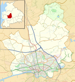
Haighton is a civil parish in the City of Preston, Lancashire, England. It is a rural area north east of the urban city of Preston, beyond Fulwood and Brookfield.

Contents

Geography

Haighton also contains the hamlets of Haighton Green and Haighton Top. It is separated from the city by the M6 motorway, with junction 31A on the boundary with Brookfield.

Community

The area was intended to become a residential suburb as part of the Central Lancashire New Town, with population increasing to 29,100 by 2001 [1] however it never occurred and the area has remained rural. It has a population of 197, [2] increasing to 202 at the 2011 Census. [3]

Economy

The listed building of Haighton Manor [4] [ circular reference ] has operated as a country pub and restaurant since the early 1970s, undergoing substantial renovation in the mid 2010s and now operated by Brunning and Price.

History

The parish was part of Preston Rural District throughout its existence from 1894 to 1974. [5] In 1974 the parish became part of the Borough of Preston, which became a city in 2002.

See also

Related Research Articles

Goosnargh Village and parish in Lancashire, England

Goosnargh is a village and civil parish in the City of Preston district of Lancashire, England.

Cockerham Village in Lancashire, England

Cockerham is a small village and civil parish within the City of Lancaster in Lancashire, England. It is 6 miles (9.7 km) south of Lancaster and 15 miles (24 km) north-northwest of Preston. Located on the River Cocker, at the estuary of the River Lune, it has a total resident population of 558, increasing to 671 at the 2011 Census.

Grimsargh Human settlement in England

Grimsargh is a village and civil parish in the City of Preston, Lancashire, England. located 5.7 miles (9 km) east of Preston.

Barton, Preston Linear village and civil parish in the City of Preston, Lancashire, England

Barton is a linear village and civil parish in the City of Preston, Lancashire, England. The parish had a population of 1,150, of whom 552 were male and 598 were female, according to the 2011 census.

Bashall Eaves Village and civil parish in the Ribble Valley district of Lancashire, England

Bashall Eaves is a village and civil parish in the Ribble Valley district of Lancashire, England, about four miles (6 km) west of Clitheroe. The placename element eaves is Old English and refers to Bashall's location on the borders of the Forest of Bowland. Historically, the village is part of the West Riding of Yorkshire, but was transferred to Lancashire for administrative purposes on 1 April 1974, under the provisions of the Local Government Act 1972.

Woodplumpton Human settlement in England

Woodplumpton is a village and civil parish in the City of Preston, Lancashire, England, located 5 miles (8 km) north of Preston.

Simonswood Human settlement in England

Simonswood is a civil parish in the West Lancashire district of Lancashire, England. At the 2001 census, the population was 130, increasing to 151 by the 2011 census.

Broughton, Lancashire Human settlement in England

Broughton is a village and civil parish in the City of Preston, Lancashire, England, approximately 4 miles (6 km) north of Preston city centre. According to the 2001 census it had a population of 1,735, decreasing to 1,722 at the 2011 Census. The parish is included in Preston Rural East ward of Preston city council, and the Preston Rural division of Lancashire County council.

Whittingham, Lancashire Parish in Lancashire, England

Whittingham is a civil parish in the City of Preston, Lancashire, England. The parish measures 4 miles (6 km) east-to-west, from the outskirts of Longridge to the outskirts of Broughton, but only 1 mile (1½ km) north-to-south. Its population was 2,189 in 2001, reducing to 2,027 at the time of the 2011 Census. The village of Goosnargh is at its centre.

Heath Charnock Human settlement in England

Heath Charnock is a small village and civil parish of the Borough of Chorley in Lancashire, England. According to the United Kingdom Census 2001 it has a population of 2,065, reducing to 2,026 at the 2011 Census.

Wiswell Human settlement in England

Wiswell is a small village and civil parish in the Ribble Valley, Lancashire, England, close to Whalley and Clitheroe at the foot of Wiswell Moor.

Dutton is a civil parish in the Borough of Ribble Valley in the English county of Lancashire, its principal settlement being the hamlet of Lower Dutton. The population of the civil parish at the 2011 census was 238.

Cabus Human settlement in England

Cabus is a village and civil parish in Lancashire, England. It lies 12 miles north of Preston, 9 miles south of Lancaster and 16 miles north east of Blackpool.

Ribbleton Human settlement in England

Ribbleton is a suburb and ward of the city of Preston, Lancashire, England. It is located to the east of the city centre, between the A59 New Hall Lane and the B6243 Longridge Road. The M6 motorway also runs through the area. The ward had a population of 7,351 recorded in the 2001 census increasing to 8,548 at the 2011 Census.

Hutton is a village and civil parish in Lancashire, England. It is located 3 miles (4.8 km) south west of Preston, in the South Ribble borough and parliamentary constituency. The population of the civil parish at the 2011 census was 2,277.

Preston Rural East Human settlement in England

Preston Rural East is an electoral ward in the City of Preston, Lancashire, England. The ward is in the eastern and northeastern part of the city near the M55 motorway moving out towards Sherwood and Grimsargh. The population of the ward at the 2011 census was 4,577.

Hothersall Human settlement in England

Hothersall is a civil parish in the Ribble Valley district, in Lancashire, England. The parish, which is on the north bank of the River Ribble, is rural and contains no major villages, and in the 2001 census had a population of 136, increasing to 145 at the 2011 Census. It is approximately 8 miles (13 km) north-east of Preston, and has boundaries with Longridge to the north and west, and Ribchester to the east.

City of Preston, Lancashire City & Non-metropolitan district in England

The City of Preston is a city and non-metropolitan district in Lancashire, England. On the north bank of the River Ribble, it was granted city status in 2002, becoming England's 50th city in the 50th year of Queen Elizabeth II's reign. The City of Preston district has a population of 143,135 (mid-2019 est.), and lies at the centre of the Central Lancashire sub-region, with a population of 335,000.

Nether Wyresdale Human settlement in England

Nether Wyresdale is a civil parish in Lancashire, England. In the 2001 United Kingdom census, it had a population of 613, rising to 655 at the 2011 Census.

Little Hoole Human settlement in England

Little Hoole is a civil parish in Lancashire, England, It contains the village of Walmer Bridge, and the remaining part is predominantly a farming community. Other nearby villages include Much Hoole and Longton. The parish had a population of 1,815 people in 2001, increasing to 2,070 at the 2011 Census.

References

  1. Central Lancashire Development Corporation outline plan, 1974. ISBN   0-904335-00-3
  2. UK Census (2001). "Local Area Report – Haighton Parish (30UK005)". Nomis. Office for National Statistics . Retrieved 27 May 2019.
  3. UK Census (2011). "Local Area Report – Haighton Parish (E04005238)". Nomis. Office for National Statistics. Retrieved 27 May 2019.
  4. Listed buildings in Haighton
  5. Preston RD, Vision of Britain, accessed 9 June 2014