| Weets Hill | |
|---|---|
 Summit of Weets Hill | |
| Highest point | |
| Elevation | 397 m (1,302 ft) |
| Parent peak | Pendle Hill |
| Coordinates | 53°54′00″N2°13′08″W / 53.900°N 2.219°W Coordinates: 53°54′00″N2°13′08″W / 53.900°N 2.219°W |
| Geography | |
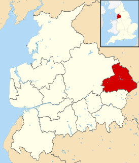
 Weets Hill Location in Lancashire  Weets Hill Location in Pendle Borough | |
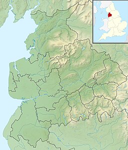
| Location | Lancashire, England |
| OS grid | SD857449 |
| Topo map | OS Landranger 103 |
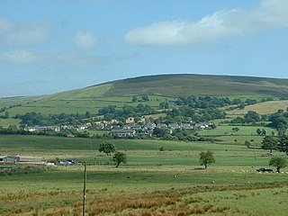
Weets Hill is a hill in the West Craven area of Pendle, Lancashire, England.
West Craven is an area in the east of Lancashire, England in the far northern part of the borough of Pendle. Historically the area was within the ancient county boundaries of Yorkshire and was administered as part of the Skipton Rural District of the West Riding of Yorkshire until 1974.
Pendle is a local government district and borough of Lancashire, England. It adjoins the Lancashire boroughs of Burnley and Ribble Valley, the North Yorkshire district of Craven and the West Yorkshire districts of Calderdale and the City of Bradford. It has a total population of 91,405 (mid-2018 est.).

Lancashire is a ceremonial county in North West England. The administrative centre is Preston. The county has a population of 1,449,300 and an area of 1,189 square miles (3,080 km2). People from Lancashire are known as Lancastrians.
It is 2 1⁄2 miles (4.0 km) south-west of the town of Barnoldswick and is 4 miles (6.4 km) north-east of Pendle Hill.

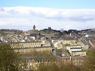
Barnoldswick is a town and civil parish in Lancashire, England, just outside the Yorkshire Dales National Park and the Forest of Bowland Area of Outstanding Natural Beauty. Stock Beck, a tributary of the River Ribble, runs through the town. It has a population of 10,752.

Pendle Hill is in the east of Lancashire, England, near the towns of Burnley, Nelson, Colne, Clitheroe and Padiham. Its summit is 557 metres (1,827 ft) above mean sea level. It gives its name to the Borough of Pendle. It is an isolated hill, separated from the Pennines to the east, the Bowland Fells to the northwest, and the West Pennine Moors to the south. It is included in detached part of the Forest of Bowland Area of Outstanding Natural Beauty.
The hill is in the traditional county of Yorkshire, but following local government reorganisation in 1974 it falls within Lancashire for administrative purposes.

Yorkshire, formally known as the County of York, is a historic county of Northern England and the largest in the United Kingdom. Due to its great size in comparison to other English counties, functions have been undertaken over time by its subdivisions, which have also been subject to periodic reform. Throughout these changes, Yorkshire has continued to be recognised as a geographical territory and cultural region. The name is familiar and well understood across the United Kingdom and is in common use in the media and the military, and also features in the titles of current areas of civil administration such as North Yorkshire, South Yorkshire, West Yorkshire and East Riding of Yorkshire.
The summit has a Triangulation Pillar and commands views over much of east Lancashire, the north Ribble Valley, north Aire Valley and the Yorkshire Dales.

The retriangulation of Great Britain was a triangulation project carried out between 1935 and 1962 that sought to improve the accuracy of maps made of Great Britain. Data gathered from the retriangulation replaced data gathered during the Principal Triangulation of Great Britain, which had been performed between 1783 and 1851. The retriangulation involved erecting around 6,500 concrete pillars on British hilltops, which were used as reference points for the triangulation. Today, use of the trig points and the results of the retriangulation have been replaced by a network of global navigation satellite system stations known as OS Net, which is able to achieve an accuracy of 3 millimetres (0.12 in) over the length of the country compared to 20 metres (66 ft) achievable by use of the trig points.

Ribble Valley is a local government district with borough status within the non-metropolitan county of Lancashire, England. The total population of the non-metropolitan district at the 2011 Census was 57,132. Its council is based in Clitheroe. Other places include Whalley, Longridge and Ribchester. The area is so called due to the River Ribble which flows in its final stages towards its estuary near Preston. The area is popular with tourists who enjoy the area's natural unspoilt beauty, much of which lies within the Forest of Bowland.

The River Aire is a major river in Yorkshire, England, 148 kilometres (92 mi) in length. The Handbook for Leeds and Airedale (1890) notes that the distance from Malham to Howden is 58 miles (93 km) direct, but the river's meanderings extend that to 90 miles (140 km). Between Malham Tarn and Airmyn, the river drops 400 metres (1,300 ft). Part of the river below Leeds is canalised, and is known as the Aire and Calder Navigation.
The summit is approximately 250 metres (820 ft) above the towns of Barnoldswick, Salterforth, Earby, Kelbrook and Gisburn.

Salterforth is a village and civil parish within the Borough of Pendle in Lancashire, England. The population of the Civil Parish at the 2011 census was 637. It lies on the B6383 road that connects Barnoldswick to the A56 road at Kelbrook. The Leeds and Liverpool Canal cuts through the village and there are several narrowboat moorings at Salterforth. The canal footpath provides a picturesque walk to Barnoldswick or to Foulridge in the opposite direction. The village also has a canal side pub, The Anchor Inn along with a lovely children's play area.

Earby is a small town and civil parish within the Borough of Pendle in Lancashire, England. It is 5 miles (8 km) north of Colne, 7 miles (11.3 km) south-west of Skipton, and 11 miles (17.7 km) north-east of Burnley. The parish had a population of 4,538 recorded in the 2011 census,
Kelbrook is a village in the civil parish of Kelbrook and Sough, Borough of Pendle, in Lancashire, England. It lies on the A56 road between Colne and Earby.
Stock Beck originates from the north face of the summit. To the west of the summit lies Gisburn Old Road which is surfaced until it reaches Weets House, from there onwards it is a track over the shoulder of Weets. This road originally ran from Colne to Gisburn but was replaced by the road from Blacko to Gisburn (turnpike) in the 19th century. Weets House was called “Stoops House” on maps until the later part of the 20th century (Stoops were guide posts at junctions on roads crossing open moorland).

Stock Beck is a minor river in the West Craven area of Pendle, Lancashire. It is 8.25 miles (13.27 km) long and has a catchment area of 14.41 square miles (3,731.89 ha).
| Wikimedia Commons has media related to Weets Hill . |
| This Lancashire location article is a stub. You can help Wikipedia by expanding it. |