Brierfield is a town and civil parish in the Borough of Pendle, in Lancashire, England. It is 3 miles (4.8 km) north east of Burnley, 1 mile (1.6 km) south west of Nelson, and 1 mile (1.6 km) north east of Reedley. The parish had a population of 8,193, at the census of 2011.

Higham is a village in the Borough of Pendle in Lancashire, England, south of Pendle Hill. The civil parish is named Higham with West Close Booth. The village is 2 miles (3 km) north-east of Padiham and about 4 miles (6 km) south-west of Nelson along the A6068 road.
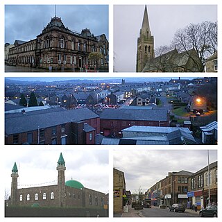
Nelson is a town and civil parish in the Borough of Pendle in Lancashire, England, it had a population of 29,135 in the 2011 Census. Nelson is 3 miles (5 km) north of Burnley and 2 miles (3 km) south-west of Colne. Nelson developed as a mill town during the Industrial Revolution.
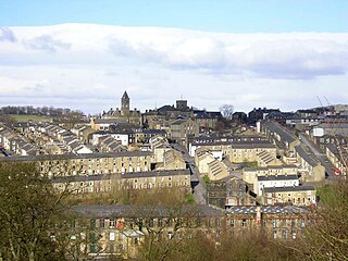
Colne is a market town and civil parish in the Borough of Pendle in Lancashire, England. The town is 3 miles (5 km) northeast of Nelson, 6 miles (10 km) northeast of Burnley and 25 mi (40 km) east of Preston.
Wycoller is a hamlet in the civil parish of Trawden Forest in Pendle, Lancashire, England. It is 3 miles (4.8 km) east of Colne, near to the junction of the Lancashire, West Yorkshire and North Yorkshire borders.

Foulridge is a village and civil parish in Pendle, Lancashire, close to the border with North Yorkshire in England. It is situated just beyond Colne, on the route from the M65 to Skipton, and is an important stopping point on summit pound of the Leeds and Liverpool Canal, just before it enters the Foulridge Tunnel. Noyna Hill, a well known local landmark, sits 1 mile (1.6 km) east of the village.

Earby is a town and civil parish within the Borough of Pendle, Lancashire, England. Although within the boundaries of the historic West Riding of Yorkshire, Earby has been administered by Lancashire County Council since 1974 and regularly celebrates its Yorkshire roots. It is 5 miles (8 km) north of Colne, 7 miles (11.3 km) south-west of Skipton, and 11 miles (17.7 km) north-east of Burnley. The parish had a population of 4,538 recorded in the 2011 census,

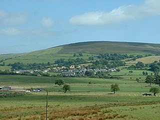
Blacko is a village and civil parish in the Pendle district of Lancashire, England. Before local government reorganisation in 1974 the village lay on the border with the West Riding of Yorkshire. The parish has a population of 672. The village is on the old turnpike road from Nelson to Gisburn (A682). The village enjoys views towards Boulsworth Hill to its southeast, the former cotton town of Nelson, about two miles to its south and Pendle Hill to its west across the valley of Pendle Water.

Barrowford is a village and civil parish in the Pendle district of Lancashire, England, north of Nelson, near the Forest of Bowland Area of Outstanding Natural Beauty.
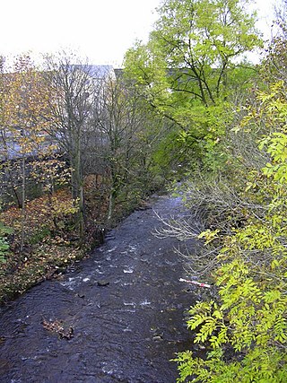
Colne Water is a river in eastern Lancashire. It is approximately 5.0 miles (7.987 km) long and has a catchment area excluding its major tributaries of 4.47 square miles (11.584 km2).

Wycoller Beck is a stream in Lancashire, running through Wycoller Country Park and the village of Wycoller in Pendle. It is 3.76 miles (6.05 km) long and has a catchment area of 4.04 square miles (10.46 km2).
Kelbrook is a village in the civil parish of Kelbrook and Sough, Borough of Pendle, in Lancashire, England. It lies on the A56 road between Colne and Earby.

Salterforth is a village and civil parish within the Borough of Pendle in Lancashire, England. The population of the Civil Parish at the 2011 census was 637. It lies on the B6383 road that connects Barnoldswick to the A56 road at Kelbrook. The Leeds and Liverpool Canal cuts through the village and there are several narrowboat moorings at Salterforth. The canal footpath provides a picturesque walk to Barnoldswick or to Foulridge in the opposite direction. The village also has a canal side pub, The Anchor Inn along with a lovely children's play area.
Trawden Forest is a civil parish in the Pendle district of Lancashire, England. It has a population of 2,765, and contains the village of Trawden and the hamlets of Cottontree, Winewall and Wycoller. Boulsworth Hill is a well known local landmark situated within the parish. It takes its name from a medieval royal forest or "chase" which was in the same area.
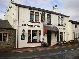
Cottontree and Winewall are two hamlets situated in the civil parish of Trawden Forest in Pendle, Lancashire. They are adjacent to one other and located between the towns of Colne and Trawden. Cottontree is generally situated in the valley along the road that connects the two towns. Winewall is generally on the hillside overlooking Cottontree. The road that runs between Cottontree and Winewall connects to Laneshaw Bridge, Wycoller and is an alternative route to Trawden.
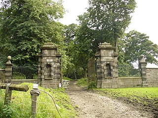
Emmott Hall was a country house in the village of Laneshawbridge, Colne, Lancashire, England.

Kelbrook and Sough is a civil parish in the Pendle district of Lancashire, England. It has a population of 1,008, and contains the village of Kelbrook and neighbouring hamlet of Sough.

The Pendle Way is a recreational path in the South Pennines of England, which encircles the borough of Pendle; it was officially opened in 1987. The circuit is 45 miles (72 km) in length and, according to the Long Distance Walkers Association, involves 1839 m (6033 ft) ascent reaching 557 m (1,827 ft) maximum height. Its attractions include historical associations with the seventeenth century Pendle Witches, connections with the Brontës, stonebuilt villages in the traditional style of East Lancashire and the South Pennines, relics of the weaving and lead mining industry, and limestone meadows and millstone grit moorland culminating in the ascent of Pendle Hill.

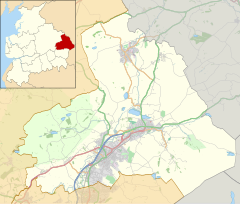
Pendle is a local government district with borough status in Lancashire, England. The council is based in Nelson, the borough's largest town. The borough also includes the towns of Barnoldswick, Brierfield, Colne and Earby along with the surrounding villages and rural areas. Part of the borough lies within the Forest of Bowland Area of Outstanding Natural Beauty.
Laneshaw Bridge is a civil parish in Pendle, Lancashire, England. It contains ten listed buildings that are recorded in the National Heritage List for England. All of the listed buildings are designated at Grade II, the lowest of the three grades, which is applied to "buildings of national importance and special interest". The parish contains the village of Laneshaw Bridge and the surrounding countryside. Most of the listed buildings are houses, farmhouses and farm buildings. The other listed buildings consist of a boundary stone, a public house, and a bridge.