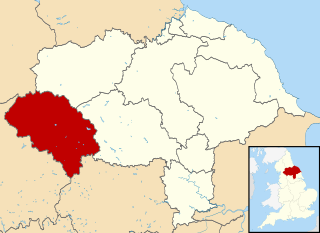
Craven was a non-metropolitan district in the west of North Yorkshire, centred on the market town of Skipton. The name Craven is much older than the modern district and encompassed a larger area. This history is also reflected in the way the term is still commonly used, such as by the Church of England.

Cross Hills is a village in the former Craven District of North Yorkshire, England, situated halfway between Skipton and Keighley. The village is at the centre of a built-up area that includes the adjoining settlements of Glusburn, Kildwick, Eastburn and Sutton-in-Craven. Cross Hills is the newer part of the civil parish now called Glusburn and Cross Hills, historically known as Glusburn.

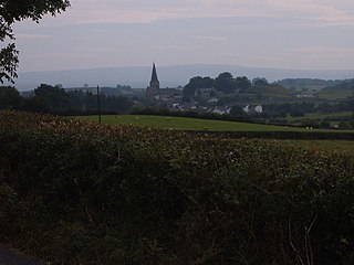
Barnoldswick is a market town and civil parish in the Borough of Pendle, Lancashire, England. It lies within the boundaries of the historic West Riding of Yorkshire. It is situated 30 miles (48 km) from Leeds; nearby towns include Skipton to the east, Clitheroe to the west, Burnley to the south and Keighley to the east-south-east. The civil parish has a population of 10,752.

Foulridge is a village and civil parish in Pendle, Lancashire, close to the border with North Yorkshire in England. It is situated just beyond Colne, on the route from the M65 to Skipton, and is an important stopping point on summit pound of the Leeds and Liverpool Canal, just before it enters the Foulridge Tunnel. Noyna Hill, a well known local landmark, sits 1 mile (1.6 km) east of the village.

Earby is a town and civil parish within the Borough of Pendle, Lancashire, England. Although within the boundaries of the historic West Riding of Yorkshire, Earby has been administered by Lancashire County Council since 1974 and regularly celebrates its Yorkshire roots. It is 5 miles (8 km) north of Colne, 7 miles (11.3 km) south-west of Skipton, and 11 miles (17.7 km) north-east of Burnley. The parish had a population of 4,538 recorded in the 2011 census,
The A56 is a road in England which extends between the city of Chester in Cheshire and the village of Broughton in North Yorkshire. The road contains a mixture of single and dual carriageway sections, and traverses environments as diverse as the dense urban sprawl of inner city Manchester and the lightly populated region of rural east Lancashire. The road includes a short section of trunk road between the end of the M66 motorway near Ramsbottom and the M65 motorway west of Burnley.
Burton in Lonsdale is a village and civil parish in North Yorkshire, England, close to the border with Lancashire and Cumbria. It is in Lonsdale. The parish is approximately 1,500 acres (6 km2) in area and has many farms – dairy, beef and sheep. Little is grown, except grass to feed the animals.

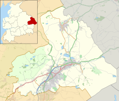
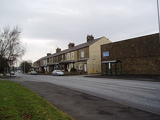
Elslack is a village and civil parish in the former Craven District of North Yorkshire, England, close to the border with Lancashire and 4 miles west of Skipton. Thornton in Craven is nearby. The Tempest Arms is a large pub in the village, sited by the A56, which is popular with locals from the surrounding area. Elslack Moor, above the village, is crossed by the Pennine Way, though this does not visit the village itself.

Thornton-in-Craven is a village and civil parish in the Craven district of North Yorkshire, England. It is approx 1,740 feet (530 m) from the border with Lancashire and 1 mile (1.6 km) north of Earby. Barnoldswick is nearby. The Pennine Way passes through the village, as does the A56 road. The village has a church, a primary school and a retirement home, but no shops or pubs.

Barnoldswick railway station was the only railway station on the Midland Railway's 1-mile-64-chain (2.9 km) long Barnoldswick Branch in the West Riding of Yorkshire in England. It served the market town of Barnoldswick, which was in West Riding of Yorkshire at the time. The line left the Leeds and Bradford Extension Railway at Barnoldswick Junction 55 chains from Earby railway station. The line through the junction was on a 20-chain radius after which it converged to a single track and ran in a straight but undulating line to Barnoldswick. The passenger train that ran back and forth between Barnoldswick and Earby was known locally as the 'Barlick Spud' or 'Spudroaster'. The real reason for the name is lost in time, but the two versions that were commonly recited are that the original branch locomotive was so small it looked like a portable potato roaster used by a local vendor or that the journey time was the same as that taken to roast a potato in the locomotive's firebox.
The Barnoldswick Railway was an English railway company, that constructed a short branch line to Barnoldswick from a junction on the Midland Railway line from Skipton to Colne. It was opened in 1871, and was worked from the outset by the Midland Railway. It was moderately successful in financial terms, and the company was acquired by the Midland Railway in 1899.
The Skipton East Lancashire Rail Action Partnership (SELRAP) is a campaign that is looking to reopen the Skipton to Colne railway line, as part of connecting the Lancashire town of Colne to the North Yorkshire town of Skipton. The line between them had been closed in 1970.

Salterforth is a village and civil parish within the Borough of Pendle in Lancashire, England. The population of the Civil Parish at the 2011 census was 637. It lies on the B6383 road that connects Barnoldswick to the A56 road at Kelbrook. The Leeds and Liverpool Canal cuts through the village and there are several narrowboat moorings at Salterforth. The canal footpath provides a picturesque walk to Barnoldswick or to Foulridge in the opposite direction. The village also has a canal side pub, The Anchor Inn along with a lovely children's play area.
West Craven is an area in the east of Lancashire, England in the far northern part of the borough of Pendle. Historically the area was within the ancient county boundaries of Yorkshire and was administered as part of the Skipton Rural District of the West Riding of Yorkshire until 1974.
Sough is a hamlet, in Lancashire, England.

Weets Hill is a hill in the West Craven area of Pendle, Lancashire, England.

Thornton-in-Craven railway station served the small village of Thornton-in-Craven in North Yorkshire, England. It was a stop on the Leeds and Bradford Extension Railway between Colne, Skipton and Bradford.

Skipton bus station serves the town of Skipton, North Yorkshire, England. It is situated in the town centre, just off Keighley Road, and has eight stands. The main bus operators are Transdev Blazefield, Burnley Bus Company, Stagecoach Merseyside & South Lancashire and Kirkby Lonsdale Coach Hire. Services that are not sustainable on a commercial level are provided by North Yorkshire County Council (NYCC) minibuses.

Kelbrook and Sough is a civil parish in the Pendle district of Lancashire, England. It has a population of 1,008, and contains the village of Kelbrook and neighbouring hamlet of Sough.

Pendle is a local government district with borough status in Lancashire, England. The council is based in Nelson, the borough's largest town. The borough also includes the towns of Barnoldswick, Brierfield, Colne and Earby along with the surrounding villages and rural areas. Part of the borough lies within the Forest of Bowland Area of Outstanding Natural Beauty.