Reedley Hallows

Last updated

Reedley
Location map United Kingdom Borough of Pendle.svg
Red pog.svg
Reedley
Location in Pendle Borough
Lancashire UK location map.svg
Red pog.svg
Reedley
Location within Lancashire
Population1,960 (2011) [1]
OS grid reference SD845355
Civil parish
  • Reedley Hallows
District
Shire county
Region
Country England
Sovereign state United Kingdom
Post town BURNLEY
Postcode district BB10
Dialling code 01282
Police Lancashire
Fire Lancashire
Ambulance North West
UK Parliament
List of places
UK
England
Lancashire
53°48′58″N2°14′06″W / 53.816°N 2.235°W / 53.816; -2.235

Reedley Hallows or Reedley is a civil parish in the Borough of Pendle in Lancashire, England. It forms part of Burnley and Brierfield. It had a population of 1,994, [2] reducing to 1,960 at the 2011 Census. [1]

Contents

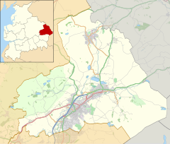
It is on the Leeds and Liverpool Canal, and the construction of a marina started in January 2008 and is expected to be completed in September. [3] The local railway station, Reedley Hallows Halt on the East Lancashire Line, closed in 1956. The marina, and the site of the railway station, are both outside the current boundary of the parish, and are in an unparished area, which is part of the town of Burnley.

History

The civil parish was created in 1894 from the majority of Reedley Hallows, Filly Close and New Laund Booth civil parish. That civil parish had been created in 1866 from the township in the ancient parish of Whalley. [4]

The original boundary with Burnley was Barden Clough, [lower-alpha 1] but as town expanded it was moved to the north-west. [6]

Although administratively inside the parish of Whalley, as parts of the former royal hunting Forest of Pendle, the area was extra-parochial until 1887. [4] As part of the Honour of Clitheroe, this meant the parish church for the area was the chapel at Clitheroe Castle. [7]

Reedley Hallows is the eastern side of Pendle Water, while New Laund Booth is to the north-west and Filly Close to the south-west. [7] All 3 are originally documented as enclosures in the forest. In 1324 Filly Close was leased in connection with Royle, [8] across Pendle Water in Burnley. In 1341, Reedley Hallows was a stock-farm for the vaccaries (mediaeval cattle farms) in the rest of Pendle Forest. [7] By 1459 the New Laund (probably originally a deer park) had also been leased to farm. [8]

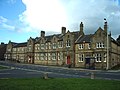
From 1894 to 1974, Reedley was the administrative centre of the Burnley Rural District. The council offices where located in what is now the Oaks Hotel on Colne Road. There is also a Magistrates' court.

Notable people

See also

Related Research Articles

<span class="mw-page-title-main">Brierfield, Lancashire</span> Town in Lancashire, England

Brierfield is a town and civil parish in the Borough of Pendle, in Lancashire, England. It is 3 miles (4.8 km) north east of Burnley, 1 mile (1.6 km) south west of Nelson, and 1 mile (1.6 km) north east of Reedley. The parish had a population of 8,193, at the census of 2011.

<span class="mw-page-title-main">Blackburn Hundred</span> Former sub-division of Lancashire, UK

Blackburn Hundred is a historic sub-division of the county of Lancashire, in northern England. Its chief town was Blackburn, in the southwest of the hundred. It covered an area similar to modern East Lancashire, including the current districts of Ribble Valley, Pendle, Burnley, Rossendale, Hyndburn, Blackburn with Darwen, and South Ribble.

<span class="mw-page-title-main">Higham, Lancashire</span> Human settlement in England

Higham is a village in the Borough of Pendle in Lancashire, England, south of Pendle Hill. The civil parish is named Higham with West Close Booth. The village is 2 miles (3 km) north-east of Padiham and about 4 miles (6 km) south-west of Nelson along the A6068 road.

<span class="mw-page-title-main">Gambleside</span> Abandoned village in Lancashire, England

Gambleside is an abandoned village located in northern Rossendale close to the boundary with Burnley's Dunnockshaw parish.

<span class="mw-page-title-main">Blacko</span> Human settlement in England

Blacko is a village and civil parish in the Pendle district of Lancashire, England. Before local government reorganisation in 1974 the village lay on the border with the West Riding of Yorkshire. The parish has a population of 672. The village is on the old turnpike road from Nelson to Gisburn (A682). The village enjoys views towards Boulsworth Hill to its southeast, the former cotton town of Nelson, about two miles to its south and Pendle Hill to its west across the valley of Pendle Water.

<span class="mw-page-title-main">Bowland Forest Low</span> Human settlement in England

Bowland Forest Low is a civil parish in the Ribble Valley district of Lancashire, England, covering some 5,500 acres (22 km2) of the Forest of Bowland. According to the 2001 census, the parish had a population of 168, falling to 160 at the 2011 Census. The parish includes the hamlets of Whitewell and Cow Ark. From northwards clockwise, it borders the civil parishes of Newton, Bashall Eaves, Aighton, Bailey and Chaigley, Bowland-with-Leagram and Bowland Forest High. Before 1974, it formed part of Bowland Rural District in the West Riding of Yorkshire.

Burnley was a Rural district of Lancashire, England from 1894 to 1974. It was named after but did not include the large town of Burnley, which was a county borough.

<span class="mw-page-title-main">River Calder, Lancashire</span> Tributary of the River Ribble in England

The River Calder is a major tributary of the River Ribble in Lancashire, England, and is around 20 miles (32 km) in length.

<span class="mw-page-title-main">Cliviger</span> Human settlement in England

Cliviger is a civil parish in the Borough of Burnley, in Lancashire, England. It is situated to the southeast of Burnley, and northwest of Todmorden. According to the 2011 census, the parish has a population of 2,238.

<span class="mw-page-title-main">Sabden</span> Human settlement in England

Sabden is a village and civil parish in the Ribble Valley, Lancashire, England. Sabden is located south of Pendle Hill, in a valley about three miles north west of Padiham. The parish covers 2,450.9 acres (991.85 ha), of which 103.2 acres (41.75 ha) is occupied by the village. It lies in the Forest of Pendle section of the Forest of Bowland Area of Outstanding Natural Beauty.

<span class="mw-page-title-main">Ightenhill</span> Parish in Burnley, England

Ightenhill is a civil parish in the Borough of Burnley in Lancashire, England, with a population of 1,975.

<span class="mw-page-title-main">Pendleton, Lancashire</span> Human settlement in England

Pendleton is a small village and civil parish in Ribble Valley, within the county of Lancashire, England. It is close to the towns of Whalley and Clitheroe. The parish lies on the north west side of Pendle Hill below the Nick o' Pendle. The village is just off the A59, Liverpool to York main road, since the construction of the Clitheroe By-Pass. Older roads through the parish include one from Clitheroe to Whalley which passes through the Standen area and another to Burnley which passes Pendleton Hall.

<span class="mw-page-title-main">Goldshaw Booth</span> Human settlement in England

Goldshaw Booth is a civil parish in the Pendle district of Lancashire, England. It has a population of 248, and contains the village of Newchurch in Pendle and the hamlets of Spen Brook and Sabden Fold. Pendle Hill lies to the north.

<span class="mw-page-title-main">Hapton, Lancashire</span> Human settlement in England

Hapton is a village and civil parish in the Borough of Burnley in Lancashire, England, 3 miles (4.8 km) west of Burnley, with a railway station on the East Lancashire Line. At the United Kingdom Census 2011, it had a population of 1,979.

<span class="mw-page-title-main">Habergham Eaves</span> Human settlement in England

Habergham Eaves is a civil parish in the borough of Burnley, in Lancashire, England. The parish consists of a rural area south of Burnley, and suburban areas on the outskirts of the town, including a large industrial estate in the north-west corner of the parish. Habergham is also the name of an area west of Burnley, although it is no longer within the parish. According to the United Kingdom Census 2011, the parish has a population of 1,466.

<span class="mw-page-title-main">Worsthorne-with-Hurstwood</span> Human settlement in England

Worsthorne-with-Hurstwood is a civil parish in the Borough of Burnley, in Lancashire, England. Situated on the eastern outskirts of Burnley, in 2011 it had a population of 2,963.

<span class="mw-page-title-main">Honour of Clitheroe</span>

The Honour of Clitheroe is an ancient grouping of manors and royal forests centred on Clitheroe Castle in Lancashire, England; an honour traditionally being the grant of a large landholding complex, not all of whose parts are contiguous. In the case of Clitheroe, this complex was loosely clustered around the ancient wapentake of Blackburnshire.

<span class="mw-page-title-main">Hameldon Hill</span>

Hameldon Hill is a Carboniferous sandstone hill with a summit elevation of 409 metres (1,342 ft), situated between the towns of Burnley and Accrington in Lancashire, England. It is listed as a "HuMP" or "Hundred Metre Prominence", its parent being Freeholds Top, a Marilyn near Bacup.

<span class="mw-page-title-main">Forest of Pendle</span> Hilly area in eastern Lancashire, England

The Forest of Pendle is a hilly area to the east of Pendle Hill in eastern Lancashire, roughly defining the watershed between the River Ribble and its tributary the River Calder. The area is not a forest in the modern sense of being heavily wooded, and has not been so for many centuries. Historically a somewhat larger area than the modern forest was one of the several royal forests of the area, under the control of Clitheroe Castle, or Honour of Clitheroe. Over its history, the forest has gone from being protected and regulated as a medieval royal forest, to being labelled as an Area of Outstanding Natural Beauty.

<span class="mw-page-title-main">Old Laund Booth</span> Human settlement in England

Old Laund Booth is a civil parish in the Pendle district of Lancashire, England. It has a population of 1,459, and contains the villages of Fence and Wheatley Lane.

References

Notes

  1. Barden Clough is the last tributary to enter the River Calder before it is joined by Pendle Water. Most of its course in no longer visible above ground but it passed under Thomas Whitham Sixth Form and followed a footpath along the north-eastern boundary of Burnley General Hospital. [5]

Citations

  1. 1 2 UK Census (2011). "Local Area Report – Reedley Hallows Parish (1170215074)". Nomis. Office for National Statistics . Retrieved 8 February 2018.
  2. "Parish headcount" (PDF). Lancashire County Council. Archived from the original (PDF) on 10 December 2006. Retrieved 13 April 2008.
  3. Sutcliffe, Camilla (27 May 2008). "Reedley Marina already drawing visitors". Lancashire Telegraph . Newsquest Media Group . Retrieved 27 May 2008.
  4. 1 2 "Reedley Hallows Filly Close and New Laund Booth CP/Tn through time". visionofbritain.org.uk. GB Historical GIS / University of Portsmouth. Retrieved 28 June 2013.
  5. Lancashire and Furness (Map) (1st ed.). 1 : 10,560. County Series. Ordnance Survey. 1848.
  6. Farrer and Brownbill 1911, pp. 489–490
  7. 1 2 3 Farrer and Brownbill 1911, pp. 489
  8. 1 2 3 Farrer and Brownbill 1911, pp. 491
  9. Farrer and Brownbill 1911, p. 490

Bibliography