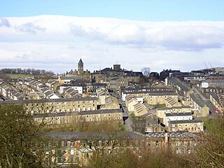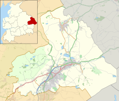
Colne is a market town and civil parish in the Borough of Pendle in Lancashire, England. The town is 3 miles (5 km) northeast of Nelson, 6 miles (10 km) northeast of Burnley and 25 mi (40 km) east of Preston.

Wycoller is a hamlet in the civil parish of Trawden Forest in Pendle, Lancashire, England. It is 3 miles (4.8 km) east of Colne, near to the junction of the Lancashire, West Yorkshire and North Yorkshire borders.

Ashby St Ledgers is a village in the West Northamptonshire district of Northamptonshire, England. The post town is Rugby in Warwickshire. The population of the civil parish at the 2011 census was 173. The Manor House is famous for being a location for the planning of the Gunpowder Plot in 1605. As of 2023, the property had been restored and could be rented for a fee.

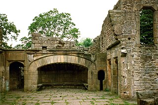
Hollinshead Hall was a manor house close to the village of Tockholes, Lancashire. It is unclear whether the hall was originally the manor house of Tockholes, or if Hollinshead was indeed a manor in its own right alongside Tockholes and Livesey. The ruins of the hall are situated approximately 2 miles (3.2 km) south of the village.
Stourton is a hamlet in South Staffordshire, England 2.5 miles to the northwest of Stourbridge. There is a fair amount of dispute over the pronunciation, being pronounced 'stower-ton', 'stir-ton' or 'store-ton' by different people from the area. The nearest sizeable villages are Wollaston and Kinver, the nearest hamlets are Prestwood and Dunsley. It lies on the River Stour. The Staffordshire and Worcestershire Canal and Stourbridge Canal meet at Stourton Junction, which places Stourton on the Stourport Ring, a navigable waterway popular with narrowboat holidaymakers.

Haden Hill Park is at Haden Hill, between Halesowen and Old Hill in the West Midlands, England, on the southern edge of the Black Country. Within its grounds are the sixteenth and seventeenth century Haden Hall, the Victorian Haden Hill House and Corngreaves Nature Reserve. The park and buildings are owned and managed by Sandwell Metropolitan Borough Council.

Little Hulton is a suburb in the City of Salford, Greater Manchester, England, 3.4 miles (5.5 km) south of Bolton, 7 miles (11.3 km) northwest of Salford, and 9 miles (14.5 km) northwest of Manchester. Within the boundaries of the historic county of Lancashire, Little Hulton is bordered by Farnworth to the north, Walkden to the east and Tyldesley to the south.

Laneshawbridge is a village and civil parish in the Borough of Pendle in England. The population of the civil parish at the 2011 census was 918. It is to the east of Colne in Lancashire and is the easternmost settlement in Lancashire on the main road route, before the North Yorkshire border.

Huntroyde Hall is a grade II listed, 16th-century house in the civil parish of Simonstone in the Borough of Ribble Valley, Lancashire, England. Its estate, Huntroyde Demesne, once extended to over 6,500 acres.

Atherton Hall was a country house and estate in Atherton historically a part of Lancashire, England. The hall was built between 1723 and 1742 and demolished in 1824. Christopher Saxton's map shows there was a medieval deer park here in the time of Elizabeth I.
Emmott is a surname. Notable people with the surname include:

Duxbury Hall was a 19th-century country house in Duxbury Park estate in Duxbury Woods, Duxbury, Lancashire that has been demolished.

Thurnham Hall is a Grade I listed 17th-century country house in the village of Thurnham, Lancashire, England some 10 km south of Lancaster.
Adlington Hall was a Georgian country house, now demolished, in Adlington, Lancashire, England, between Wigan and Chorley.
Aldcliffe Hall was a 19th-century country house, now demolished, which replaced a previous mediaeval building, on the bank of the Lune estuary in Aldcliffe, Lancashire, England.

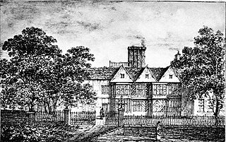
Alkincoats Hall was a country house in Colne, Lancashire, England. Part of the estate in which the hall stood is now the 35-acre Alkincoats public park.

Ancoats Hall in Ancoats, Manchester, England, was a post-medieval country house built in 1609 by Oswald Mosley, a member of the Mosley family, Lords of the Manor of Manchester. The old timber-framed hall, built in the early 17th century, was described by John Aiken in his 1795 book Description of the country from 30 to 40 miles around Manchester. The old hall was demolished in the 1820s and replaced by a brick building in the early neo-Gothic style. The new hall, at the eastern end of Great Ancoats Street, between Every Street and Palmerston Street, was demolished in the 1960s.
Thomas Clifford Emmott (1907–1964) was a British writer and political activist.

This is an event timeline and minor geographical information about Heathrow hamlet.
Walton Hall was a 17th-century historic country house, set in a 300-acre (1.2 km2) estate, which was demolished in the early 20th century. Sometimes referred to as Walton Old Hall, it was situated at the centre of the Walton Hall Park in Walton, Liverpool. Its former residents were Liverpool merchants and the last two families to reside at Walton Hall profited from the Atlantic slave trade. In the 19th century it was the home of Thomas Leyland during his second and third term as Lord Mayor of Liverpool.


