Lancaster Castle is a medieval castle and former prison in Lancaster in the English county of Lancashire. Its early history is unclear, but it may have been founded in the 11th century on the site of a Roman fort overlooking a crossing of the River Lune. In 1164 the Honour of Lancaster, including the castle, came under royal control. In 1322 and 1389 the Scots invaded England, progressing as far as Lancaster and damaging the castle. It was not to see military action again until the English Civil War. The castle was first used as a prison in 1196 although this aspect became more important during the English Civil War. The castle buildings are owned by the British sovereign as Duke of Lancaster; part of the structure is used to host sittings of the Crown Court.

Higham is a village in the Borough of Pendle in Lancashire, England, south of Pendle Hill. The civil parish is named Higham with West Close Booth. The village is 2 miles (3 km) north-east of Padiham and about 4 miles (6 km) south-west of Nelson along the A6068 road.
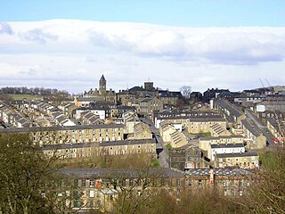
Nelson is a town and civil parish in the Borough of Pendle in Lancashire, England, with a population of 29,135 in 2011. It is 4 miles (6.4 km) north of Burnley and 2.5 miles southwest of Colne.
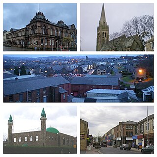
Colne is a market town and civil parish in the Borough of Pendle in Lancashire, England. Located 3 mi (4.8 km) northeast of Nelson, 6 mi (9.7 km) north-east of Burnley, 25 mi (40 km) east of Preston and 30 mi (48 km) west of Leeds.

Blacko is a village and civil parish in the Pendle district of Lancashire, England. Before local government reorganisation in 1974 the village lay on the border with the West Riding of Yorkshire. The parish has a population of 672. The village is on the old turnpike road from Nelson to Gisburn (A682). The village enjoys views towards Boulsworth Hill to its southeast, the former cotton town of Nelson, about two miles to its south and Pendle Hill to its west across the valley of Pendle Water.

Barrowford is a large village and civil parish in the Pendle district of Lancashire, England. It is situated to the north of Nelson on the other side of the M65 motorway, and forms part of the Nelson conurbation. It also comprises the area of Lowerford. The parish has a population of 6,171. The community is located near the Forest of Bowland, an Area of Outstanding Natural Beauty while the Borough of Pendle is at the southern edge of the Yorkshire Dales.

Slaidburn is a village and civil parish within the Ribble Valley district of Lancashire, England. The parish covers just over 5,000 acres of the Forest of Bowland.

Clitheroe Castle is a ruined early medieval castle in Clitheroe in Lancashire, England. It was the caput of the Honour of Clitheroe, a vast estate stretching along the western side of the Pennines.

Fence is a village in the civil parish of Old Laund Booth, Pendle, Lancashire, England, close to the towns of Nelson and Burnley. It lies alongside the A6068 road, known locally as the Padiham bypass. The parish has a population of 1,586.

Wheatley Lane is a village in Pendle, Lancashire, England. It is close to Nelson, Barrowford and Burnley. It lies to the north of the A6068 road, known locally as the Padiham bypass, or "The New Road".

Roughlee is a village in Pendle, Lancashire, England, in the civil parish of Roughlee Booth. It is close to Nelson, Barrowford and Blacko. The village lies at the foot of Pendle Hill, well known for the Pendle Witches, and includes the hamlet of Crowtrees. The parish adjoins the Pendle parishes of Blacko, Barrowford, Old Laund Booth, Goldshaw Booth and Barley-with-Wheatley Booth. It is part of the Forest of Bowland Area of Outstanding Natural Beauty (AONB).
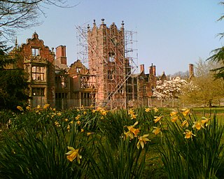
Bank Hall is a Jacobean mansion in Bretherton, Lancashire, England. It is a Grade II* listed building and is at the centre of a private estate, surrounded by parkland. The hall was built on the site of an older house in 1608 by the Banastres who were lords of the manor. The hall was extended during the 18th and 19th centuries. Extensions were built for George Anthony Legh Keck in 1832–1833, to the design of the architect George Webster.

The trials of the Pendle witches in 1612 are among the most famous witch trials in English history, and some of the best recorded of the 17th century. The twelve accused lived in the area surrounding Pendle Hill in Lancashire, and were charged with the murders of ten people by the use of witchcraft. All but two were tried at Lancaster Assizes on 18–19 August 1612, along with the Samlesbury witches and others, in a series of trials that have become known as the Lancashire witch trials. One was tried at York Assizes on 27 July 1612, and another died in prison. Of the eleven who went to trial – nine women and two men – ten were found guilty and executed by hanging; one was found not guilty.
Heritage Trust for the North West / Heritage Trust North West is a registered Building Preservation Trust, established in 1978 as a charity and company.

St Bartholomew's Church is in the town of Colne in Lancashire, England. It is an active Anglican parish church in the Diocese of Blackburn. There has been a church on the site since no later than the 12th century although the present building mostly dates from the 16th century. It is recorded in the National Heritage List for England as a designated Grade I listed building.

The Pendle Way is a Recreational Path in the South Pennines of England which encircles the borough of Pendle. It was officially opened in 1987. The circuit is 45 miles (72 km), and according to the Long Distance Walkers Association involves 1839 m (6033 ft) ascent reaching 557 m (1,827 ft) maximum height. Its attractions include historical associations with the seventeenth century Pendle Witches, connections with the Brontës, stonebuilt villages in the traditional style of East Lancashire and the South Pennines, relics of the weaving and lead mining industry, and limestone meadows and millstone grit moorland culminating in the ascent of Pendle Hill.
The Forest of Pendle is the name given to an area of hilly landscape to the east of Pendle Hill in eastern Lancashire, roughly defining the watershed between the River Ribble and its tributary the River Calder. The forest is not identical to the modern local government district of Pendle, which is larger. And in fact the modern version of the forest has come to contain areas to the north and east of Pendle Hill which are partly in the district of Ribble Valley.

Pendle is a local government district and borough of Lancashire, England. It adjoins the Lancashire boroughs of Burnley and Ribble Valley, the North Yorkshire district of Craven and the West Yorkshire boroughs of Calderdale and Bradford. It has a total population of 95,757 (2021).
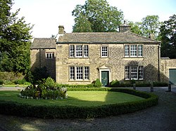
Barrowford is a civil parish in Pendle, Lancashire, England. It contains 34 listed buildings that are recorded in the National Heritage List for England. Of these, two are at Grade II*, the middle grade, and the others are at Grade II, the lowest grade. The parish contains the village of Barrowford and some surrounding countryside. Originally an agricultural community, weaving came to the parish in the late 18th century. This was initially carried out in weavers' cottages, and later in mills. The Leeds and Liverpool Canal arrived in the parish towards the end of the 18th century.
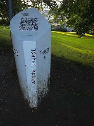
The Lancashire Witches Walk is a 51-mile (82 km) long-distance footpath opened in 2012, between Barrowford and Lancaster, all in Lancashire, England. It starts at Pendle Heritage Centre in Barrowford before passing through the Forest of Pendle, the town of Clitheroe and the Forest of Bowland to finish at Lancaster Castle.