Castercliff

Last updated

Castercliff
Castercliff hillfort 01.jpg
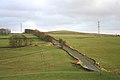
Viewed from Back Lane
Location map United Kingdom Borough of Pendle.svg
Archaeological site icon (red).svg
Shown within the Borough of Pendle
Location Pendle, Lancashire, England
Coordinates Coordinates: 53°50′30″N2°10′56″W / 53.8417°N 2.1823°W / 53.8417; -2.1823
Type Hillfort
Length115 m (377 ft)
Width76 m (249 ft)
Area0.80 ha (2.0 acres)
Height1.5 m (4 ft 11 in)
History
Founded510±70 BC
Site notes
Excavation dates1971
Official nameCastercliff Small Multivallate Hillfort
Reference no. 45247

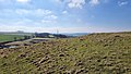
Castercliff is an Iron Age multivallate hillfort situated close to the towns of Nelson and Colne in Lancashire, Northern England.

Contents

It is located on a hilltop overlooking the valley system of the River Calder and its tributaries, on the western edge of the South Pennines. On the upper part of the hill, triple rubble ramparts up to 1.5 metres (4 ft 11 in) high, separated by ditches of similar depth, surround the site on all sides except the north. On this side the defences consist mainly of a single rampart and ditch, but some short lengths of triple rampart and ditch are also found here. The inner rampart may have been timber-laced and revetted with stone and enclosed an oval area measuring approximately 115 by 76 metres (377 by 249 ft). [1]

The summit of the hill is 280 metres (920 ft) above sea level and the surrounding ground falls rapidly on all sides except the south east. Here a neck of land, dropping 18 metres (60 ft) from the summit, connects it to similarly high ground about 370 metres (1,200 ft) away. Streams spring from either side of the ridge and the deep valleys which they have cut, especially on the south, offer additional defence. [2]

Excavations during the 1970s appear to show that the site was not completed, and no evidence of occupation was unearthed. [3] The site is a Scheduled Ancient Monument. [4]

3D view of the digital terrain model Castercliff Digital Terrain Model.jpg
3D view of the digital terrain model

The hillfort has been damaged by coal mining with old bell pits evident both inside and around the site. [1]

See also

Related Research Articles

<span class="mw-page-title-main">Danebury</span> Iron Age hillfort in Hampshire, England

Danebury is an Iron Age hill fort in Hampshire, England, about 19 kilometres (12 mi) north-west of Winchester. The site, covering 5 hectares, was excavated by Barry Cunliffe in the 1970s. Danebury is considered a type-site for hill forts, and was important in developing the understanding of hill forts, as very few others have been so intensively excavated.

<span class="mw-page-title-main">Liddington Castle</span> Hillfort in Wiltshire, England

Liddington Castle, locally called Liddington Camp, is a late Bronze Age and early Iron Age univallate hillfort in the English county of Wiltshire, and a scheduled monument.

<span class="mw-page-title-main">Eggardon Hill</span> Hillfort in Dorset, England

Eggardon Hill is a prehistoric hillfort on a hill in Dorset, England. It is located on chalk uplands approximately four miles to the east of the town of Bridport.

<span class="mw-page-title-main">Yarnbury Castle</span> Site of a multiphase, multivallate Iron Age hillfort in Wiltshire, England

Yarnbury Castle is the site of a multiphase, multivallate Iron Age hillfort near the village of Steeple Langford, Wiltshire, England. The site covers an area of 28.5 acres (11.5 ha), and was extensively surveyed and investigated by the Royal Commission on the Historical Monuments of England in 1991, with finds of Iron Age and Romano-British pottery, Iron Age and Roman coins, and burials of human remains. There is much evidence of prolonged and extensive settlement of the site, including evidence of around 130 structures of various sizes, most probably representing a mix of round houses, pits, and other features. It was designated as a scheduled monument in 1925.

<span class="mw-page-title-main">Maiden Castle, Cheshire</span> Hillfort in Cheshire, England

Maiden Castle is an Iron Age hill fort, one of many fortified hill-top settlements constructed across Britain during the Iron Age, but one of only seven in the county of Cheshire in northern England. The hill fort was probably occupied from its construction in 600 BC until the Roman conquest of Britain in the 1st century AD. At this time the Cornovii tribe are recorded to have occupied parts of the surrounding area but, because they left no distinctive pottery or metalworking, their occupation has not been verified. Since then it has been quarried and used for military exercises. It is protected as a Scheduled Ancient Monument, and is owned by the National Trust. The hill fort is open to visitors, but unrestricted access to the site has resulted in it being classified as "at high risk" from erosion.

<span class="mw-page-title-main">Warton Crag</span> Hill near Warton, Lancaster, Lancashire, UK

Warton Crag is a limestone hill in north west Lancashire, England. It lies to the north west of Warton village, in City of Lancaster district. At 163 metres (535 ft) it is the highest point in the Arnside and Silverdale Area of Outstanding Natural Beauty, and is listed as a "HuMP" or "Hundred Metre Prominence", having a "drop" or "prominence" of 126 metres (413 ft) with its parent being Hutton Roof Crags. Two areas are Local Nature Reserves, called Warton Crag and Warton Crag Quarry. Different sections are owned by Lancashire County Council, the Wildlife Trust for Lancashire, Manchester and North Merseyside, Lancaster City Council and the Royal Society for the Protection of Birds.

<span class="mw-page-title-main">Kelsborrow Castle</span> Iron Age hillfort in Cheshire, England

Kelsborrow Castle is an Iron Age hill fort in Cheshire, northern England. Hill forts were fortified hill-top settlements constructed across Britain during the Iron Age. It is one of only seven hill forts in the county of Cheshire and was probably in use for only a short time. In the 19th century, a bronze palstave was recovered from the site. It is protected as a Scheduled Ancient Monument.

Oakmere hill fort is an Iron Age hill fort, one of many large fortified settlements constructed across Britain during the Iron Age, but one of only seven in the county of Cheshire in northern England. It is protected as a Scheduled Ancient Monument. Despite being a low-lying site, Oakmere is still considered a hill fort.

<span class="mw-page-title-main">Buckland Rings</span> Iron Age hillfort in Hampshire, England

Buckland Rings is the site of an Iron Age hill fort in the town of Lymington, Hampshire. Today, the mounds and dykes around the outside which once constituted its defences are still clearly visible, although the outer bank lies under the road on the west side, and on the south-east it is nearly ploughed-out. Excavations of the inner and middle ramparts in 1935 revealed that they were of wall-and-fill construction, retained at the front by upright timber beams and walls of cut and laid turf. The entrance, which lies on the east side, was also excavated revealing a long entrance passage and the postholes for a pair of stout gateposts. The site was bought by Hampshire County Council in 1989 to ensure its preservation, and it is open to the public from the A337 road onto which part of it faces.

<span class="mw-page-title-main">Bury Camp</span> Iron Age hillfort in Wiltshire, England

Bury Camp is the site of an Iron Age multivallate hillfort in north-west Wiltshire, England. It occupies a triangular promontory of Colerne Down, in the north of Colerne parish, at the southern edge of the Cotswold Hills between two spurs of a river valley. The enclosed area of approximately 9.2ha is surrounded by a ditch 4m wide and up to 1m deep, and an outer rampart up to 1.5m high on the east and northwestern sides and up to 2m high on the southwestern side, across the neck of the promontory.

<span class="mw-page-title-main">Worlebury Camp</span> Iron Age hillfort in Somerset, England

Worlebury Camp is the site of an Iron Age hillfort on Worlebury Hill, north of Weston-super-Mare in Somerset, England. The fort was well defended with numerous walls, embankments and ditches around the site. Several large triangular platforms have been uncovered around the sides of the fort, lower down on the hillside. Nearly one hundred storage pits of various sizes were cut into the bedrock, and many of these contained human remains, coins, and other artefacts. During the 19th and 20th centuries the fort suffered damage and was threatened with complete destruction on multiple occasions. Now, the site is a designated Scheduled monument. It falls within the Weston Woods Local Nature Reserve which was declared to Natural England by the North Somerset Council in 2005.

<span class="mw-page-title-main">Promontory forts of Cornwall</span>

Cornish promontory forts, commonly known in Cornwall as cliff castles, are coastal equivalents of the hill forts and Cornish "rounds" found on Cornish hilltops and slopes. Similar coastal forts are found on the north–west European seaboard, in Normandy, Brittany and around the coastlines of the British Isles, especially in Wales, Scotland and Ireland. Many are known in southwest England, particularly in Cornwall and its neighbouring county, Devon. Two have been identified immediately west of Cornwall, in the Isles of Scilly.

<span class="mw-page-title-main">Caesar's Camp, Rushmoor and Waverley</span> Iron Age hillfort in Hampshire, England

Caesar's Camp is an Iron Age hill fort straddling the border of the counties of Surrey and Hampshire in southern England. The fort straddles the borough of Waverley in Surrey and the borough of Rushmoor and the district of Hart, both in Hampshire. Caesar's Camp is a Scheduled Ancient Monument with a list entry identification number of 1007895. It lies approximately 3 kilometres (1.9 mi) north of the town of Farnham, and a similar distance west of Aldershot. The hillfort lies entirely within the Bourley and Long Valley Site of Special Scientific Interest. Caesar's Camp is a multivallate hillfort, a fort with multiple defensive rings, occupying an irregular promontory, with an entrance on the south side. The site has been much disturbed by military activity, especially at the southeast corner. The remains of the hillfort are considered to be of national importance.

<span class="mw-page-title-main">Beacon Hill, West Sussex</span>

Beacon Hill, also known as Harting Beacon, is a hillfort on the South Downs, in the county of West Sussex in southern England. The hillfort is located in the parish of Elsted and Treyford, in Chichester District. It is a Scheduled Ancient Monument with a list entry identification number of 1015915. The hilltop enclosure is dated to the Late Bronze Age, from the 8th to 6th centuries BC. The hillfort defences were renewed during the Late Iron Age.

<span class="mw-page-title-main">King John's Hill</span>

King John's Hill is the site of an Iron Age hillfort located in Hampshire, in southeast England. The hill is situated in the parish of Worldham, in East Hampshire District. It is a Scheduled Ancient Monument with a list entry identification number of 1020314, and a Monument Number of 243207.

<span class="mw-page-title-main">Bury Walls</span> Iron Age hillfort in Shropshire, England

Bury Walls is an Iron Age hillfort about 1 mile (1.6 km) south-east of Weston-under-Redcastle, in Shropshire, England. It is a scheduled monument.

Berth Hill is an Iron Age hillfort in Staffordshire, England, about 5 miles (8.0 km) south-west of Newcastle-under-Lyme, and near the village of Maer. It is a scheduled monument. Other forms of its name have been Bryth, Bruff and Burgh Hill.

<span class="mw-page-title-main">Portfield Hillfort</span> Hillfort in Lancashire, England

Portfield also known as Planes Wood Camp is a late Bronze Age or Iron Age hillfort situated close to the town of Whalley in Lancashire, Northern England. It is thought to have originally been constructed as a univallate structure and then modified into a small multivallate one sometime after.

<span class="mw-page-title-main">Maiden Bower hillfort</span>

Maiden Bower is an Iron Age hillfort near Dunstable in Bedfordshire, England. The site, which also has traces of a Neolithic causewayed enclosure, is a scheduled monument.

<span class="mw-page-title-main">Castle Knowe, Northumberland</span>

Castle Knowe, also known as Clinch Castle, is the site of an Iron Age hillfort in Northumberland, England, about 1 mile south-east of the village of Ingram. It is a scheduled monument.

References

  1. 1 2 Historic England. "Castercliff small multivallate hillfort (1007404)". National Heritage List for England . Retrieved 1 January 2021.
  2. Farrer, William; Brownbill, John, eds. (1906), The Victoria History of the County of Lancaster Vol 2, Victoria County History - Constable & Co, pp. 514–516, OCLC   59375181 , retrieved 1 January 2021
  3. Excavation of the hillfort of Castercliff, Nelson, Lancashire, 1970-71 Trans. Lancs. & Ches. Antiq. Soc. 81, 111-30
  4. Lancashire County Council Archived 2011-06-13 at the Wayback Machine