
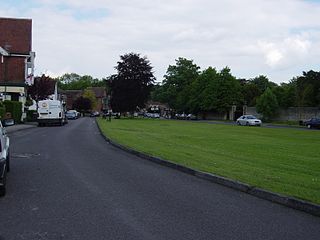
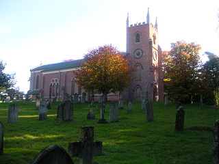
Lyndhurst is a large village and civil parish situated in the New Forest National Park in Hampshire, England. Serving as the administrative capital of the New Forest, it is a popular tourist attraction, with many independent shops, art galleries, cafés, museums, pubs and hotels. The nearest city is Southampton, about nine miles (14 km) to the north-east. As of 2001 Lyndhurst had a population of 2,973, increasing to 3,029 at the 2011 Census. The name derives from an Old English name, comprising the words lind and hyrst.
Rowland's Castle is a village and civil parish in the East Hampshire district of Hampshire, England. It is 2.9 miles (4.7 km) north of Havant, on the Hampshire/West Sussex border.
Woodgreen is a village and civil parish within the New Forest district of Hampshire in England.

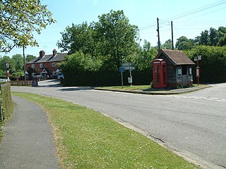
Hordle is a village and civil parish in the county of Hampshire, England. It is situated between the Solent coast and the New Forest, and is bordered by the towns of Lymington and New Milton. Like many New Forest parishes Hordle has no village centre. The civil parish includes the hamlets of Tiptoe and Everton as well as part of Downton. The parish was originally much larger; stretching from the New Forest boundary to Hurst Castle.

Radnor Forest in the county of Radnorshire, Wales is a rock dome composed of Silurian shales, mudstones and limestone in Mid Wales. It is a forest in the medieval sense of the word. It lies within the Welsh Marches region since Offa's Dyke lies nearby to the east.
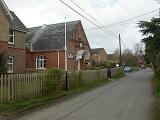
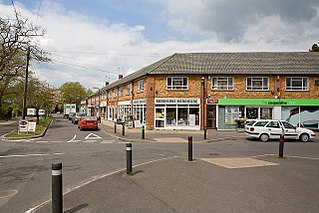
Fair Oak is a large village to the east of Eastleigh in Hampshire, England. Together with the village of Horton Heath, which lies to the south, it is part of the civil parish of Fair Oak and Horton Heath.

Iford is a village and civil parish in the Lewes District of East Sussex, England. The village is located two miles (3.2 km) south of Lewes. The parish lies on slopes of the South Downs in the valley of the River Ouse.
Whitsbury is a village and civil parish in Hampshire, England, close to Fordingbridge. Whitsbury is a part of a group of villages on the edge of the Cranborne Chase and West Wiltshire Downs Area of Outstanding Natural Beauty.

Burley is a village and civil parish in the New Forest, Hampshire, England. It has ancient origins and is now somewhat tourist-orientated.
Copythorne is a village and civil parish in Hampshire, England, within the boundaries of the New Forest National Park.
Bransgore is a village and civil parish within the New Forest District, Hampshire, England. The village developed in the 19th century when a church and a school were built. It is technically classified as an urban area, although in some respects it still has the picturesque character of a rural English village.

Bramshaw is a small village and civil parish in Hampshire, England. It lies just inside the New Forest. The name Bramshaw means Bramble Wood.

Hapton is a village and civil parish in the Borough of Burnley in Lancashire, England, 3 miles (4.8 km) west of Burnley, with a railway station on the East Lancashire Line. At the United Kingdom Census 2011, it had a population of 1,979.
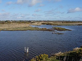
Keyhaven, Pennington, Oxey and Normandy Marshes, also known as the North Solent Marshes, are three areas of saltmarsh in Hampshire, England. The haven outpost of Milford-on-Sea, Keyhaven sits to the west, the village of Pennington to the north, and the town of Lymington to the northeast. The marshes lie behind Hurst Spit and fall within the Hurst Castle And Lymington River Estuary Site of Special Scientific Interest.

Netley Marsh is a village and civil parish in Hampshire, close to the town of Totton. It lies within the New Forest District, and the New Forest National Park. It is the alleged site of the battle between an invading Anglo Saxon army, under Cerdic and a British army under Natanleod in the year 508.
Bisterne is a hamlet in the civil parish of Ringwood in the New Forest National Park in Hampshire, England. Its nearest town is Ringwood, which lies 3 miles (4.8 km) to the north.

Stuckton is a hamlet in the New Forest National Park of Hampshire, England. Its nearest town is Fordingbridge, which lies approximately 1 mile (1.7 km) north-west from the village.

Tiptoe is a small Hamlet in the New Forest National Park in Hampshire. It lies mostly within the civil parish of Hordle and partly within the civil parish of Sway. It is 1+1⁄2 miles (2.4 km) west of the village of Sway, and about 2 miles (3.2 km) northeast of the town of New Milton.

Hameldon Hill is a Carboniferous sandstone hill with a summit elevation of 409 metres (1,342 ft), situated between the towns of Burnley and Accrington in Lancashire, England. It is listed as a "HuMP" or "Hundred Metre Prominence", its parent being Freeholds Top, a Marilyn near Bacup.

West Buckfastleigh is a small civil parish on the eastern border of Dartmoor in Devon, England. Situated within the parish are the village of Scorriton and the hamlets of Michelcombe and Combe.

