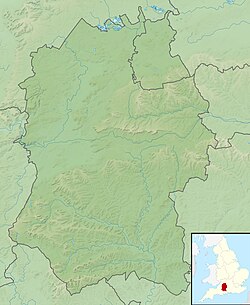
Membury Camp

Last updated

Membury Camp
Membury Camp - geograph.org.uk - 256790.jpg
Wiltshire UK location map.svg
Archaeological site icon (red).svg
Shown within Wiltshire
Alternative nameMembury Fort
Location Wiltshire
Coordinates 51°28′35″N1°33′59″W / 51.4763°N 1.5665°W / 51.4763; -1.5665
Area14 hectares
Height200m
History
PeriodsIron Age
Site notes
Public accessyes

Membury Camp, or Membury Fort, is the site of an Iron Age hill fort located on the borders of Wiltshire and Berkshire, (the county line divides the site in two, although the majority of the site lies within Wiltshire). The site encompasses 14 hectares, and is situated in the south-western corner of a small plateau. The circular earthworks are completely shrouded in trees and inside the walls it is mostly arable farmland. To the northeast, in the Berkshire segment, the camp is totally wooded by a small copse, Walls Copse, which covers a quarter of the site. To the north and east the adjoining ground is flat, but to the south and west it falls away steeply, providing a natural defence. The camp consists of a single ditch with banks on either side and encloses and area measuring 390m by 490m. A gap in the east with inturning flanks is probably an original entrance though it is mutilated and overgrown. Other gaps in the banks appear to be more modern. A possible hut circle is visible as a cropmark situated at the south end of the hill fort. The east side of the earthwork has been partly destroyed by the construction of a wartime airfield, RAF Membury. The site has not been excavated but a number of prehistoric finds have been found in the vicinity. It is a scheduled ancient monument no. 228970 [1] There have been several collections of pottery found, in 1977, 1980 and 1987 [2] Other significant finds have also included for flint artefacts from the mesolithic era, and flint tools from the neolithic era, prior to the Iron Age.

Contents

Location

The site is located at grid reference SU302753 , to the southwest of the village and parish of Lambourn, in the county of Wiltshire and in part Berkshire. The site lies at a height of approximately 200m AOD. There is a public footpath that runs through the site and bridleways to the east and south of the site. The M4 motorway lies to the immediate north and northeast. The motorway services station Membury services, and the wartime airfield, RAF Membury, also lie to the immediate north east. [3]

See also

Related Research Articles

<span class="mw-page-title-main">RAF Membury</span> Former RAF base in Berkshire, England

Royal Air Force Membury or more simply RAF Membury is a former Royal Air Force station built in the civil parish of Lambourn in Berkshire, England, approximately 4.6 miles (7.4 km) north-northwest of Hungerford. The airfield was opened on the site of a civil airfield in August 1942, and closed in October 1946.

<span class="mw-page-title-main">Membury services</span>

Membury services is a motorway service station on the M4 motorway, located on the original site of RAF Membury in the civil parish of Lambourn in the English county of Berkshire, close to the border with Wiltshire, 4 miles (6.4 km) west of Junction 14. It is owned by Welcome Break and is situated adjacent to the Membury Radio Mast.

<span class="mw-page-title-main">Farnsfield</span> Village in Nottinghamshire, England

Farnsfield is a large village and civil parish in Nottinghamshire in Sherwood Forest. It is in the local government district of Newark and Sherwood. The population of the civil parish as at the 2011 Census was 2,731, an increase from 2,681 in the United Kingdom Census 2001.

<span class="mw-page-title-main">Vespasian's Camp</span> Iron Age hillfort in Wiltshire, England

Vespasian's Camp is an Iron Age hillfort just west of the town of Amesbury, Wiltshire, England. The hillfort is less than 3 kilometres (2 mi) from the Neolithic and Bronze Age site of Stonehenge, and was built on a hill next to the Stonehenge Avenue; it has the River Avon on its southern side and the A303 road on its northern edge. The site is a scheduled monument and lies within the boundaries of the Stonehenge World Heritage Site.

Membury may refer to:

<span class="mw-page-title-main">Ashleys Copse</span> Iron Age hillfort in Hampshire, England

Ashley's Copse is the site of an Iron Age hillfort, about 8 miles (13 km) northeast of the city of Salisbury, England, straddling the border between the counties of Wiltshire and Hampshire. The site is a scheduled monument.

<span class="mw-page-title-main">Norsebury Ring</span> Iron Age hillfort in Hampshire, England

Norsebury Ring is the site of an Iron Age univallate hillfort located in Hampshire. Now mostly ploughed out to the South and east, some ditches and ramparts remain within a small copsed area to the North and west, which are surprisingly intact with a small outer ditch, then a bank, then another larger ditch followed by larger bank. However the trees and undergrowth hide the earthworks from immediate view.

<span class="mw-page-title-main">Bussock Camp</span>

Bussock Camp is the site of an Iron Age bivallate hillfort located in Berkshire, England. It has a double bank and ditch to the south and east, with only a single bank remaining the north and western sides. The entrance is to the north of the site and is believed to be original, and the site encloses approximately 11 acres.

<span class="mw-page-title-main">Battlesbury Camp</span> Iron Age hillfort in Wiltshire, England

Battlesbury Camp is the site of an Iron Age bivallate hill fort on Battlesbury Hill near the town of Warminster in Wiltshire, South West England. Excavations and surveys at the site have uncovered various finds and archaeological evidence.

<span class="mw-page-title-main">Scratchbury Camp</span> Iron Age hillfort in Wiltshire, England

Scratchbury Camp is the site of an Iron Age univallate hillfort on Scratchbury Hill, overlooking the Wylye valley about 1 km northeast of the village of Norton Bavant in Wiltshire, England. The fort covers an area of 37 acres (15 ha) and occupies the summit of the hill on the edge of Salisbury Plain, with its four-sided shape largely following the natural contours of the hill.

<span class="mw-page-title-main">Bincknoll Castle</span> Possible Iron Age hillfort in Wiltshire, England

Bincknoll Castle, or Bincknoll Camp, is the site of a possible Iron Age univallate hillfort in Wiltshire, England.

<span class="mw-page-title-main">Bury Camp</span> Iron Age hillfort in Wiltshire, England

Bury Camp is the site of an Iron Age multivallate hillfort in north-west Wiltshire, England. It occupies a triangular promontory of Colerne Down, in the north of Colerne parish, at the southern edge of the Cotswold Hills between two spurs of a river valley. The enclosed area of approximately 9.2ha is surrounded by a ditch 4m wide and up to 1m deep, and an outer rampart up to 1.5m high on the east and northwestern sides and up to 2m high on the southwestern side, across the neck of the promontory.

<span class="mw-page-title-main">Chiselbury</span> Iron Age hillfort in Wiltshire, England

Chiselbury is the site of an Iron Age univallate hillfort in Wiltshire, England. The hillfort is sub-circular in plan, and encloses an area of approximately 10.5 acres (460,000 sq ft). It is defined by an earthen rampart up to 3.6 metres (12 ft) in height and an external ditch, up to a maximum of 1.6 metres (5.2 ft) in depth. A gap in the south-eastern side of the rampart, and a corresponding causeway across the ditch, is thought to be the original entrance and is associated with a small 'D' shaped embanked enclosure, which is apparently visible on aerial photographs. Although the enclosure has subsequently been degraded by ploughing, it is still apparent as a series of low earthworks.

Chisenbury Camp is the site of an Iron Age univallate hillfort in Broad Chalke parish in Wiltshire, England. The site comprises a small circular 5-acre enclosure that was levelled in 1931. The site was partially excavated in the 19th century and there were finds of ceramics, worked stone, worked animal bone and remains of human burial; some are held by the Wiltshire Museum at Devizes. It is a scheduled monument.

<span class="mw-page-title-main">Sidbury Hill</span> Iron Age hillfort in Wiltshire, England

Sidbury Hill, or Sidbury Camp, is the site of an Iron Age bivallate hillfort on the eastern edge of Salisbury Plain in Wiltshire, England. The site is sub-triangular in shape, approximately 17 acres (6.9 ha) in area, and is constructed on the site of a Neolithic settlement.

<span class="mw-page-title-main">Grovely Castle</span> Iron Age hillfort in Wiltshire, England

Grovely Castle is the site of an Iron Age univallate hill fort in the parish of Steeple Langford, in Wiltshire, England. The remaining ramparts stand approximately 3.2 m (10 ft) high, with 1.5 m (4.9 ft) deep ditches, although ploughing has damaged the earthworks in some parts of the site. Excavations have uncovered the remains of five human skeletons within the ramparts. Entrances are in the south-west and north-east corners of the hillfort. A circular enclosure of 35 to 40 m is evident in aerial photographs of the hillfort interior. There is also a later bank and ditch which runs through the hill-fort from south-west to north-east, and is probably part of an extensive surrounding Celtic field system.

<span class="mw-page-title-main">Castle Rings, Wiltshire</span> Iron Age hillfort in Wiltshire, England

Castle Rings is a univallate hill fort in the parish of Donhead St Mary in Wiltshire, England. The site is a Scheduled Ancient Monument. Castle Rings has been dated to the Iron Age and is at an altitude of 228 metres (748 ft) upon Upper Greensand sandstone beds. The bulk of the fort enclosure lies within the boundaries of Donhead St Mary parish but some of the outlying earthworks are in the neighbouring Sedgehill and Semley parish. In the mid-1980s a metal detectorist unearthed a hoard of stater coins of the Durotriges tribe within the hill fort.

<span class="mw-page-title-main">Dudsbury Camp</span>

Dudsbury Camp is one of a series of Iron Age earthworks in Dorset, starting from Hambledon Hill, and including Hod Hill, Spetisbury Rings, Buzbury Rings, Badbury Rings and Dudsbury Camp. The Iron Age port at Hengistbury Head forms a final Iron Age monument in this small chain of sites. The fort is located near the village of West Parley.

<span class="mw-page-title-main">Martin Down Enclosure</span>

The Martin Down Enclosure is an archaeological site on Martin Down, near the village of Martin, in Hampshire, England. It is near the boundaries with Dorset and Wiltshire.

<span class="mw-page-title-main">South Weald Camp</span>

South Weald Camp was a hillfort based in South Weald, Brentwood, Essex, England. Roughly circular in plan, the fort covered 2.8 hectares, with a suggested construction date in the late Iron Age, from the 1st century BC to the 1st century AD. The location is associated in this period with the Catuvellauni and the Trinovantes.

References

  1. Historic England. "Membury Camp (228970)". Research records (formerly PastScape). Retrieved 25 February 2011.
  2. Digital Digging Membury hillfort Archived 2011-10-05 at the Wayback Machine
  3. "Membury Camp" . Retrieved 2 June 2013.