Hardwell Castle

Last updated

Hardwell Castle
Hardwell Camp
Hardwell Camp - panoramio - ian freeman (3).jpg
TypeHillfort
Location Compton Beauchamp, Oxfordshire
Coordinates 51°34′42″N1°35′14″W / 51.57844°N 1.58723°W / 51.57844; -1.58723 Coordinates: 51°34′42″N1°35′14″W / 51.57844°N 1.58723°W / 51.57844; -1.58723
Official nameHardwell Camp promontory fort
Designated18 August 1958
Reference no.1017820 [1]
Oxfordshire UK location map.svg
Red pog.svg
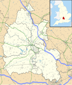
Location of Hardwell Castle in Oxfordshire

Hardwell Castle or Hardwell Camp is an Iron Age valley fort in the civil parish of Compton Beauchamp in Oxfordshire (previously Berkshire). [2]

Contents

Site nature

Like nearby Cherbury Camp, it is not clearly in a strategic or easily defended position. It lies halfway down the scarp slope of the White Horse Hills and is tucked away in a curve, invisible from most angles. This particular positioning suggests its builders had a specialist purpose in mind, although exactly what that may have been remains a mystery. It is also surrounded by a double vallum: its dimensions 140 by 180 ft. [3] It is 'multi-vallate', like Cherbury Camp. It is unexcavated and therefore very little is known about it. The site is described as a promontory fort by Historic England, and has been a Scheduled Monument since 1958. [1]

Location

The site is at grid reference SU287867 in the Vale of White Horse, very close to the small settlements of both Compton Beauchamp and Knighton, 2 miles from Uffington and 1 mile from the hilltop Uffington Castle.

Related Research Articles

<span class="mw-page-title-main">The Ridgeway</span> Ancient trackway described as Britains oldest road

The Ridgeway is a ridgeway or ancient trackway described as Britain's oldest road. The section clearly identified as an ancient trackway extends from Wiltshire along the chalk ridge of the Berkshire Downs to the River Thames at the Goring Gap, part of the Icknield Way which ran, not always on the ridge, from Salisbury Plain to East Anglia. The route was adapted and extended as a National Trail, created in 1972. The Ridgeway National Trail follows the ancient Ridgeway from Overton Hill, near Avebury, to Streatley, then follows footpaths and parts of the ancient Icknield Way through the Chiltern Hills to Ivinghoe Beacon in Buckinghamshire. The National Trail is 87 miles (140 km) long.

<span class="mw-page-title-main">Oxfordshire</span> County in England

Oxfordshire is a ceremonial and non-metropolitan county in South East England. It is locally governed by Oxfordshire County Council and the lower-tier authorities of its five non-metropolitan districts: City of Oxford, Cherwell, South Oxfordshire, Vale of White Horse, and West Oxfordshire. The county is landlocked and bordered by Northamptonshire to the north-east, Warwickshire to the north-west, Buckinghamshire to the east, Berkshire to the south, Wiltshire to the south-west, and Gloucestershire to the west. The area of Oxfordshire south of the River Thames was part of the historic county of Berkshire, including the county's highest point, the 261-metre (856 ft) White Horse Hill. The largest settlement in the county is Oxford, its only city, with an estimated population of 151,584.

<span class="mw-page-title-main">Uffington White Horse</span> Prehistoric carving in Uffington, England

The Uffington White Horse is a prehistoric hill figure, 110 m (360 ft) long, formed from deep trenches filled with crushed white chalk. The figure is situated on the upper slopes of White Horse Hill in the English civil parish of Uffington, some 16 km (10 mi) east of Swindon, 8 km (5.0 mi) south of the town of Faringdon and a similar distance west of the town of Wantage; or 2.5 km (1.6 mi) south of Uffington. The hill forms a part of the scarp of the Berkshire Downs and overlooks the Vale of White Horse to the north. The best views of the figure are obtained from the air, or from directly across the Vale, particularly around the villages of Great Coxwell, Longcot, and Fernham.

<span class="mw-page-title-main">Uffington Castle</span>

Uffington Castle is an early Iron Age univallate hillfort in Oxfordshire, England. It covers about 32,000 square metres and is surrounded by two earth banks separated by a ditch with an entrance in the western end. A second entrance in the eastern end was apparently blocked up a few centuries after it was built. The original defensive ditch was V-shaped with a small box rampart in front and a larger one behind it. Timber posts stood on the ramparts. Later the ditch was deepened and the extra material dumped on top of the ramparts to increase their size. A parapet wall of sarsen stones lined the top of the innermost rampart. It is very close to the Uffington White Horse on White Horse Hill.

<span class="mw-page-title-main">Vale of White Horse</span> Non-metropolitan district in England

The Vale of White Horse is a local government district of Oxfordshire in England. It was historically a north-west projection of Berkshire. The area is commonly referred to as the 'Vale of the White Horse'. It is crossed by the Ridgeway National Trail in its far south, across the North Wessex Downs AONB at the junction of four counties. The northern boundary is defined by the River Thames. The name refers to Uffington White Horse, a prehistoric hill figure.

<span class="mw-page-title-main">Faringdon</span> Market town in Oxfordshire, England

Faringdon is a historic market town in the Vale of White Horse, Oxfordshire, England, 18 miles (29 km) south-west of Oxford, 10 miles (16 km) north-west of Wantage and 12 miles (19 km) east-north-east of Swindon. It extends to the River Thames in the north; the highest ground is on the Ridgeway in the south. Faringdon was Berkshire's westernmost town until the 1974 boundary changes transferred its administration to Oxfordshire. The civil parish is formally known as Great Faringdon, to distinguish it from Little Faringdon in West Oxfordshire. The 2011 Census gave a population of 7,121; it was estimated at 7,992 in 2019. On 1 February 2004, Faringdon became the first place in south-east England to be awarded Fairtrade Town status.

<span class="mw-page-title-main">Dragon Hill, Uffington</span>

Dragon Hill is a small hillock immediately below the Uffington White Horse on the border of the civil parishes of Uffington and Woolstone in the English county of Oxfordshire. In 1974 it was transferred from Berkshire.

<span class="mw-page-title-main">Westbury White Horse</span> Hill figure in England

Westbury or Bratton White Horse is a hill figure on the escarpment of Salisbury Plain, approximately 1.5 mi (2.4 km) east of Westbury in Wiltshire, England. Located on the edge of Bratton Downs and lying just below an Iron Age hill fort, it is the oldest of several white horses carved in Wiltshire. It was restored in 1778, an action which may have obliterated another horse that had occupied the same slope. A contemporary engraving from around 1772 appears to show a horse facing in the opposite direction that was rather smaller than the present figure. There is, however, no documentation or other evidence for the existence of a chalk horse at Westbury before 1772.

<span class="mw-page-title-main">Berkshire Downs</span> Chalk hills in England

The Berkshire Downs are a range of chalk downland hills in South east England split between the counties of Berkshire and Oxfordshire. They are part of the North Wessex Downs Area of Outstanding Natural Beauty. The western parts of the downs are also known as the Lambourn Downs.

<span class="mw-page-title-main">Uffington, Oxfordshire</span> Human settlement in England

Uffington is a village and civil parish in Oxfordshire, about 4 miles (6.4 km) south of Faringdon and 6 miles (10 km) west of Wantage. The 2011 Census recorded the parish's population as 783. It was originally in the county of Berkshire, but under the Local Government Act 1972 it was transferred for local government purposes to Oxfordshire. The Uffington White Horse hill figure is on the Berkshire Downs on the south side of the parish. The village has been twinned with Le Chevain in France since 1991.

<span class="mw-page-title-main">Whitehorse Hill</span> Hill in Oxfordshire, England

Whitehorse Hill is a hill in the Berkshire Downs in Oxfordshire, England, west of Wantage. At 261 metres (856 ft), it is the highest point in Oxfordshire. Uffington Castle lies on the summit of the hill, and the Uffington White Horse is on the hill's northern slope. The hill and an adjacent area below, including Dragon Hill and The Manger, make up a 98.9-hectare (244-acre) biological and geological Site of Special Scientific Interest.

<span class="mw-page-title-main">Longcot</span> Human settlement in England

Longcot is a village and civil parish in the Vale of White Horse District. It was part of Berkshire until the 1974 boundary changes transferred it to Oxfordshire. The village is about 3 miles (5 km) south of Faringdon and about 2.5 miles (4 km) northeast of Shrivenham. The A420 road between Swindon and Oxford passes through the parish 1 mile (1.6 km) northwest of the village. The 2011 Census recorded the parish's population as 617.

<span class="mw-page-title-main">Charney Bassett</span> Human settlement in England

Charney Bassett is a village and civil parish about 4+12 miles (7 km) north of Wantage and 6 miles (10 km) east of Faringdon in the Vale of White Horse. It was part of Berkshire until the 1974 boundary changes transferred it to Oxfordshire. The 2011 Census recorded the parish population as 314. The River Ock flows through it, and divides here for a mile or so. The alternative name of the river, Charn or Cearn, may have originally applied to the northern arm only.

<span class="mw-page-title-main">Cherbury Camp</span> The site of an Iron Age fort in Oxfordshire, England

Cherbury Camp is a multi-vallate hill fort-like earthwork, at grid reference SU374963, 1 mi (1.6 km) north of the village of Charney Bassett in the Vale of White Horse, Oxfordshire, United Kingdom. The site is connected to the village by a footpath.

<span class="mw-page-title-main">Compton Beauchamp</span> Human settlement in England

Compton Beauchamp is a hamlet and civil parish 3 miles (5 km) southeast of Shrivenham in the Vale of White Horse, England. It was part of Berkshire until the 1974 boundary changes transferred it to Oxfordshire. The 2001 Census recorded the parish's population as 50.

Faringdon was a rural district in the administrative county of Berkshire from 1894 to 1974.

<span class="mw-page-title-main">Fernham</span> Human settlement in England

Fernham is a village and civil parish about 2 miles (3 km) south of Faringdon in the Vale of White Horse, Oxfordshire, England. Fernham was historically part of the parish of Shrivenham. It was within Berkshire until the 1974 local authority boundary changes transferred the Vale of White Horse to Oxfordshire.

<span class="mw-page-title-main">Woolstone, Oxfordshire</span> Human settlement in England

Woolstone is a village and civil parish about 4+12 miles (7 km) south of Faringdon in the Vale of White Horse. Woolstone was part of Berkshire until the 1974 boundary changes transferred it to Oxfordshire. The 2011 Census recorded the parish population as 210.

<span class="mw-page-title-main">Devizes White Horse</span>

Devizes White Horse, officially known as the Devizes Millennium White Horse, is a chalk hill figure of a horse located on Bank Field, an escarpment at Roundway Hill, on the outskirts of the town of Devizes above the hamlet of Roundway, Wiltshire, England; it is about ½ mile north of Roundway. It was cut in 1999 to celebrate the forthcoming third millennium, and is based on a design of another white horse hill figure, which was also known as Devizes White Horse, or sometimes The Snobs Horse, which was very close to the present horse as it was also on Roundway Hill beneath the Oliver's Castle hill fort. Traces of the Snobs Horse can still be seen under the right conditions.

References

  1. 1 2 Historic England. "Hardwell Camp promontory fort (1017820)". National Heritage List for England . Retrieved 13 April 2018.
  2. "Hardwell Camp [Hardwell Castle] Hillfort". The Megalithic Portal. 11 March 2011. Retrieved 5 November 2018.
  3. A Handbook for Travellers in Berks, Bucks, and Oxfordshire: Including a Particular Description of the University and City of Oxford and the Descent of the Thames to Maidenhead and Windsor. London: J. Murray. 1872. p. 52.