
A hillfort is a type of fortified refuge or defended settlement located to exploit a rise in elevation for defensive advantage. They are typical of the late European Bronze Age and Iron Age. Some were used in the post-Roman period. The fortification usually follows the contours of a hill and consists of one or more lines of earthworks or stone ramparts, with stockades or defensive walls, and external ditches. If enemies were approaching, the civilians would spot them from a distance.

Danebury is an Iron Age hillfort in Hampshire, England, about 19 kilometres (12 mi) north-west of Winchester. The site, covering 5 hectares, was excavated by Barry Cunliffe in the 1970s. Danebury is considered a type-site for hill forts, and was important in developing the understanding of hillforts, as very few others have been so intensively excavated.

Badbury Rings is an Iron Age hill fort and Scheduled Monument in east Dorset, England. It was in the territory of the Durotriges. In the Roman era a temple was located immediately west of the fort, and there was a Romano-British town known as Vindocladia a short distance to the south-west.

Hod Hill is a large hill fort in the Blackmore Vale, 3 miles (5 km) north-west of Blandford Forum, Dorset, England. The fort sits on a 143 m (469 ft) chalk hill of the same name that lies between the adjacent Dorset Downs and Cranborne Chase. The hill fort at Hambledon Hill is just to the north. The name probably comes from Old English "hod", meaning a shelter, though "hod" could also mean "hood", referring to the shape of the hill.

Chanctonbury Ring is a prehistoric hill fort atop Chanctonbury Hill on the South Downs, on the border of the civil parishes of Washington and Wiston in the English county of West Sussex. A ridgeway, now part of the South Downs Way, runs along the hill. It forms part of an ensemble of associated historical features created over a span of more than 2,000 years, including round barrows dating from the Bronze Age to the Saxon periods and dykes dating from the Iron Age and Roman periods.

Pen Dinas is a large hill in Penparcau, on the coast of Ceredigion, Wales, upon which an extensive Iron Age, Celtic hillfort is situated. The site can easily be reached on foot from Aberystwyth town centre and is accessible via a series of well marked trails. Boasting a commanding position at the confluence of the River Ystwyth and Afon Rheidol, it has been described as "the pre-eminent hillfort on the Cardigan Bay coast".

Buckland Rings is the site of an Iron Age hill fort in the town of Lymington, Hampshire. Today, the mounds and dykes around the outside which once constituted its defences are still clearly visible, although the outer bank lies under the road on the west side, and on the south-east it is nearly ploughed-out. Excavations of the inner and middle ramparts in 1935 revealed that they were of wall-and-fill construction, retained at the front by upright timber beams and walls of cut and laid turf. The entrance, which lies on the east side, was also excavated revealing a long entrance passage and the postholes for a pair of stout gateposts. The site was bought by Hampshire County Council in 1989 to ensure its preservation, and it is open to the public from the A337 road onto which part of it faces.

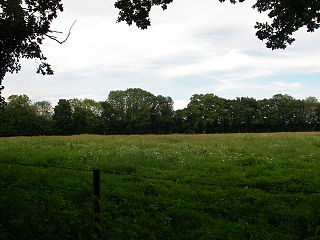
Ladle Hill is a 10.5-hectare (26-acre) biological Site of Special Scientific Interest west of Kingsclere in Hampshire. It is also a Scheduled Monument.
Ashley's Copse is the site of an Iron Age hillfort, about 8 miles (13 km) northeast of the city of Salisbury, England, straddling the border between the counties of Wiltshire and Hampshire. The site is a scheduled monument.

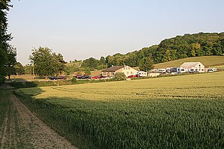
Bury Hill is the site of a former Iron Age hillfort about 1.5 miles (2.4 km) southwest of the centre of Andover, Hampshire. The site encloses about 22 acres (8.9 ha). There are evident two stages to the construction of the fort, the first is a low single rampart and ditch, to the north and west of the second, stronger double rampart and ditch earthworks, part of which overlies the earlier work. The banks and the ditch are apparently in good condition, although fairly heavily wooded. A footpath encircles the hill fort on the inner rampart, accessible from the northeast and southwest. The centre is left to grass and very secluded, but is not accessible to the general public. The site was used well into the Roman era and was used as a camp by King Canute in 1016, when he fought Edmund Ironside in the Battle of Andover.
Frankenbury Camp is the site of an Iron Age univallate hillfort located in Hampshire. The site is on a very slight promontory overlooking the Avon Valley on the north-western edge of the New Forest. The fort encloses approximately 11 acres. It has very steep natural slopes on the west and south sides. The northeast sides are defended by a simple rampart and ditch. The original entrance on the southeast corner has since been widened. It is listed as a scheduled ancient monument no.122. The site is currently pasture, and part of Folds Farm, for the most part, although the earthworks themselves are lined with trees and the south and western parts are now encroached by woodland. Various archaeological relics have been found in the area:

Gorley Hill is the site of a former Iron Age promontory hillfort located in Hampshire in the United Kingdom.
Lockerley Camp is the site of an Iron Age univallate hillfort located in Hampshire. Situated on a low gravel-capped plateau, it covers approximately 5 acres and is now much reduced by ploughing, for the majority of the site falls into farmland, although a small area to the north is within a small coppice and the earthworks are more discernible here.

Norsebury Ring is the site of an Iron Age univallate hillfort located in Hampshire. Now mostly ploughed out to the South and east, some ditches and ramparts remain within a small copsed area to the North and west, which are surprisingly intact with a small outer ditch, then a bank, then another larger ditch followed by larger bank. However the trees and undergrowth hide the earthworks from immediate view.

Whitsbury Castle, or Whitsbury Castle Ditches, is the site of an Iron Age univallate hillfort located near the village of Whitsbury in Hampshire. The fort is roughly pear-shaped, located on a chalk outcrop, and covering approximately sixteen acres. The defenses comprise two large ramparts with outer ditches and an additional counter scarp bank on the northern half. The original entrance was at the southwestern corner but has been destroyed by the construction of a post-medieval manor house. The site has been in use throughout the ages, with excavation revealing mesolithic activity, an association with a Bronze Age ranch boundary, an Iron Age hillfort settlement, followed much later by Anglo-Saxon renovation and reuse of the defences. The site is privately owned but is flanked externally on all sides but east by public bridleways.

Scratchbury Camp is the site of an Iron Age univallate hillfort on Scratchbury Hill, overlooking the Wylye valley about 1 km northeast of the village of Norton Bavant in Wiltshire, England. The fort covers an area of 37 acres (15 ha) and occupies the summit of the hill on the edge of Salisbury Plain, with its four-sided shape largely following the natural contours of the hill.
Worlebury Camp is the site of an Iron Age hillfort on Worlebury Hill, north of Weston-super-Mare in Somerset, England. The fort was well defended with numerous walls, embankments and ditches around the site. Several large triangular platforms have been uncovered around the sides of the fort, lower down on the hillside. Nearly one hundred storage pits of various sizes were cut into the bedrock, and many of these contained human remains, coins, and other artefacts. During the 19th and 20th centuries the fort suffered damage and was threatened with complete destruction on multiple occasions. Now, the site is a designated Scheduled monument. It falls within the Weston Woods Local Nature Reserve which was declared to Natural England by the North Somerset Council in 2005.
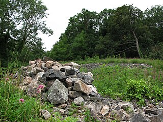
Castle Rings is a univallate hill fort in the parish of Donhead St Mary in Wiltshire, England. The site is a Scheduled Ancient Monument. Castle Rings has been dated to the Iron Age and is at an altitude of 228 metres (748 ft) upon Upper Greensand sandstone beds. The bulk of the fort enclosure lies within the boundaries of Donhead St Mary parish but some of the outlying earthworks are in the neighbouring Sedgehill and Semley parish. In the mid-1980s a metal detectorist unearthed a hoard of stater coins of the Durotriges tribe within the hill fort.

Caesar's Camp is an Iron Age hill fort straddling the border of the counties of Surrey and Hampshire in southern England. The fort straddles the borough of Waverley in Surrey and the borough of Rushmoor and the district of Hart, both in Hampshire. Caesar's Camp is a Scheduled Ancient Monument with a list entry identification number of 1007895. It lies approximately 3 kilometres (1.9 mi) north of the town of Farnham, and a similar distance west of Aldershot. The hillfort lies entirely within the Bourley and Long Valley Site of Special Scientific Interest. Caesar's Camp is a multivallate hillfort, a fort with multiple defensive rings, occupying an irregular promontory, with an entrance on the south side. The site has been much disturbed by military activity, especially at the southeast corner. The remains of the hillfort are considered to be of national importance.

Parciau hill fort is a hill fort on the Welsh island of Anglesey. It stands on the summit of Bryn Ddiôl, whose name means "trackless hill".

