
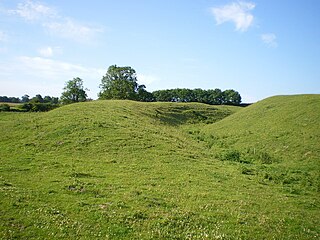
A hillfort is a type of fortified refuge or defended settlement located to exploit a rise in elevation for defensive advantage. They are typical of the late European Bronze Age and Iron Age. Some were used in the post-Roman period. The fortification usually follows the contours of a hill and consists of one or more lines of earthworks or stone ramparts, with stockades or defensive walls, and external ditches. If enemies were approaching, the civilians would spot them from a distance.

Credenhill is a village and civil parish in Herefordshire, England. The population of this civil parish taken at the 2011 Census was 2,271.

Hod Hill is a large hill fort in the Blackmore Vale, 3 miles (5 km) north-west of Blandford Forum, Dorset, England. The fort sits on a 143 m (469 ft) chalk hill of the same name that lies between the adjacent Dorset Downs and Cranborne Chase. The hill fort at Hambledon Hill is just to the north. The name probably comes from Old English "hod", meaning a shelter, though "hod" could also mean "hood", referring to the shape of the hill.

Oldbury Camp is the largest Iron Age hill fort in south-eastern England. It was built in the 1st century BC by Celtic British tribes on a hilltop west of Ightham, Kent, in a strategic location overlooking routes through the Kentish Weald. The fort comprises a bank and ditch enclosing an area of about 50 hectares, with entrances at the north-east and south ends. Wooden gates barred the entrances. Archaeological excavations carried out in the 1930s and 1980s found that the hill fort's interior had probably not been permanently occupied. It had been abandoned around 50 BC and the north-east gate had been burned down, possibly due to a Roman invasion. The wooded southern part of Oldbury Camp is now owned and managed by the National Trust and is open to the public.

The Gog Magog Hills are a range of low chalk hills, extending for several miles to the southeast of Cambridge in England. The highest points are either side of the A1307 Babraham Road, and are marked on Ordnance Survey 1:25000 maps as "Telegraph Clump" at 75 m (246 ft), Little Trees Hill and Wandlebury Hill, both at 74 m (243 ft). The area as a whole is undefined but is roughly the elevated area lying north west of the 41 m (135 ft) col at Worsted Lodge.

Cissbury Ring is an 84.2-hectare (208-acre) biological Site of Special Scientific Interest north of Worthing in West Sussex. It is owned by the National Trust and is designated a Scheduled monument for its Neolithic flint mine and Iron Age hillfort.

South Creake is a village and civil parish in north west Norfolk, England. The village lies 1+1⁄2 miles (2.4 km) south of its twin village of North Creake, and some 5 miles (8 km) north-west of the town of Fakenham.

Stonea Camp is an Iron Age multivallate hill fort located at Stonea near March in the Cambridgeshire Fens. Situated on a gravel bank just 2 metres above sea-level, it is the lowest hill fort in Britain. Around 500 BC, when fortification is thought to have begun at this site, this "hill" would have provided a significant area of habitable land amidst the flooded marshes of the fens. The site exhibits at least two phases of development over several hundred years of settlement, with a D-shaped set of earth banks surrounded by a larger, more formal set of banks and ditches.

Uley Bury is the long, flat-topped hill just outside Uley, Gloucestershire, England. It is an impressive multi-vallate, scarp-edge Iron Age hill fort dating from around 300 B.C. Standing some 750 feet above sea level it has views over the Severn Vale.

Venta Icenorum was the civitas or capital of the Iceni tribe, located at modern-day Caistor St Edmund in the English county of Norfolk. The Iceni inhabited the flatlands and marshes of that county and are famous for having revolted against Roman rule under their queen Boudica in the winter of 61 CE.

Burledge Hill is on the southern edge of the village of Bishop Sutton, Somerset, England. It is the site of a Site of Special Scientific Interest and an univallate Iron Age hillfort.

Cley Hill is a prominent hill to the west of Warminster in Wiltshire, England. Its summit has a commanding view of the Wiltshire / Somerset county boundary, at 244 metres (801 ft) elevation. The land is in Corsley parish and is owned by the National Trust.
Mellor hill fort is a prehistoric site in North West England dating from the British Iron Age – about 800 BC to 100 AD. Situated on a hill in Mellor, Greater Manchester, on the western edge of the Peak District, the hill fort overlooks the Cheshire Plain. Although the settlement was founded during the Iron Age, evidence exists of activity on the site as far back as 8,000 BC; during the Bronze Age the hill may have been an area where funerary practices were performed. Artefacts such as a Bronze Age amber necklace indicate the site was high status and that its residents took part in long-distance trade. The settlement was occupied into the Roman period. After the site was abandoned, probably in the 4th century, it was forgotten until its rediscovery in the 1990s.

Hunsbury Hill is an Iron Age hill fort two miles (3 km) south-west of the centre of the town of Northampton in the county of Northamptonshire.
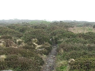
Caer Bran Hill Fort is an archaeological site near Sancreed and Carn Euny Iron Age village, on the Penwith peninsula in Cornwall.
Warham Camp is an Iron Age circular hill fort with a total diameter of 212 metres near Warham, south of Wells-next-the-Sea in Norfolk. It is a scheduled monument dated to between 800BC and 43AD, and a 5.1-hectare (13-acre) biological Site of Special Scientific Interest, located within the Norfolk Coast Area of Outstanding Natural Beauty. The University of East Anglia has described it as the best-preserved hill fort in Norfolk.

The North Norfolk Coast Site of Special Scientific Interest (SSSI) is an area of European importance for wildlife in Norfolk, England. It comprises 7,700 ha (19,027 acres) of the county's north coast from just west of Holme-next-the-Sea to Kelling, and is additionally protected through Natura 2000, Special Protection Area (SPA) listings; it is also part of the Norfolk Coast Area of Outstanding Natural Beauty (AONB). The North Norfolk Coast is also designated as a wetland of international importance on the Ramsar list and most of it is a Biosphere Reserve.

Bigbury Camp is a univallate hill fort in the parish of Harbledown and Rough Common in Kent in England. The fort is a Scheduled Ancient Monument, with a list entry identification number of 1005169. Bigbury Camp is the only confirmed Iron Age hill fort in east Kent. It is managed by Kent Wildlife Trust.

There are over 670 scheduled monuments in the ceremonial county of Somerset in South West England. The county consists of a non-metropolitan county, administered by Somerset County Council, which is divided into five districts, and two unitary authorities. The districts of Somerset are West Somerset, South Somerset, Taunton Deane, Mendip and Sedgemoor. The two administratively independent unitary authorities, which were established on 1 April 1996 following the breakup of the county of Avon, are North Somerset and Bath and North East Somerset. These unitary authorities include areas that were once part of Somerset before the creation of Avon in 1974.
Holkham Camp, or Holkham Fort, is an Iron Age fort in Norfolk, England, about 1 mile (1.6 km) north-west of the village of Holkham. It is a scheduled monument.

