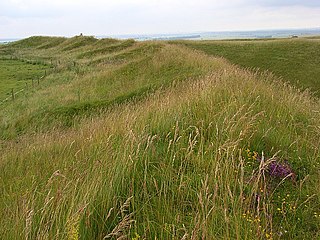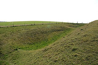
Mount Caburn is a 150-metre prominent landmark in East Sussex, England, about one mile (1.6 km) east of Lewes overlooking the village of Glynde. It is the highest part of an outlier of the South Downs, separated from the main range by Glynde Reach, a tributary of the River Ouse.

Chanctonbury Ring is a prehistoric hill fort atop Chanctonbury Hill on the South Downs, on the border of the civil parishes of Washington and Wiston in the English county of West Sussex. A ridgeway, now part of the South Downs Way, runs along the hill. It forms part of an ensemble of associated historical features created over a span of more than 2,000 years, including round barrows dating from the Bronze Age to the Saxon periods and dykes dating from the Iron Age and Roman periods.

Yarnbury Castle is the site of a multiphase, multivallate Iron Age hillfort near the village of Steeple Langford, Wiltshire, England. The site covers an area of 28.5 acres (11.5 ha), and was extensively surveyed and investigated by the Royal Commission on the Historical Monuments of England in 1991, with finds of Iron Age and Romano-British pottery, Iron Age and Roman coins, and burials of human remains. There is much evidence of prolonged and extensive settlement of the site, including evidence of around 130 structures of various sizes, most probably representing a mix of round houses, pits, and other features. It was designated as a scheduled monument in 1925.

Roundway Down and Covert is an area of sloping chalk grassland close to the hamlet of Roundway, near Devizes in Wiltshire, England. It is part of the North Wessex Downs Area of Outstanding Natural Beauty. At the summit of the slope are ancient earthworks, evidence of a Bronze Age human settlement and Iron Age hillfort.

The Bull Ring is a Class II henge that was built in the late Neolithic period near Dove Holes in Derbyshire, England.

Scratchbury Camp is the site of an Iron Age univallate hillfort on Scratchbury Hill, overlooking the Wylye valley about 1 km northeast of the village of Norton Bavant in Wiltshire, England. The fort covers an area of 37 acres (15 ha) and occupies the summit of the hill on the edge of Salisbury Plain, with its four-sided shape largely following the natural contours of the hill.

Bratton Castle is a bivallate Iron Age built hill fort on Bratton Down, at the western edge of the Salisbury Plain escarpment. The hill fort comprises two circuits of ditch and bank which together enclose a pentagonal area of 9.3 hectares.

Knap Hill lies on the northern rim of the Vale of Pewsey, in northern Wiltshire, England, about a mile north of the village of Alton Priors. At the top of the hill is a causewayed enclosure, a form of Neolithic earthwork that was constructed in England from about 3700 BC onwards, characterized by the full or partial enclosure of an area with ditches that are interrupted by gaps, or causeways. Their purpose is not known: they may have been settlements, or meeting places, or ritual sites of some kind. The site has been scheduled as an ancient monument.

Torberry Hill is an Iron Age hillfort in the county of West Sussex, in southern England. It is a Scheduled Ancient Monument, with a list entry identification number of 1015966. The hill fort is located within the parish of Harting, within the South Downs National Park. The hill includes the remains of an Early Iron Age univallate hill fort, a Middle Iron Age promontory fort and a post-medieval post mill. The hill is a chalk spur projecting northwards from the South Downs.

Beacon Hill, also known as Harting Beacon, is a hillfort on the South Downs, in the county of West Sussex in southern England. The hillfort is located in the parish of Elsted and Treyford, in Chichester District. It is a Scheduled Ancient Monument with a list entry identification number of 1015915. The hilltop enclosure is dated to the Late Bronze Age, from the 8th to 6th centuries BC. The hillfort defences were renewed during the Late Iron Age.

Chalbury Hillfort is an Iron Age hillfort about 1 mile (1.6 km) south-east of the village of Bincombe, in Dorset, England. It is a scheduled monument.

Hollingbury Castle, also known as Hollingbury Camp and Hollingbury Hillfort, is an Iron Age hillfort on the northern edge of Brighton, in East Sussex, England. It is adjacent to Hollingbury Park Golf Course.

The Martin Down Enclosure is an archaeological site on Martin Down, near the village of Martin, in Hampshire, England. It is near the boundaries with Dorset and Wiltshire.

Harrow Hill is an archaeological site in West Sussex, England. It is on the South Downs about 3 miles (5 km) north of the village of Angmering and 5 miles (8 km) north-west of Worthing.
Barkhale Camp is a Neolithic causewayed enclosure, an archaeological site on Bignor Hill, on the South Downs in West Sussex, England. Causewayed enclosures were built in England from shortly before 3700 BC until at least 3500 BC; they are characterized by the full or partial enclosure of an area with ditches that are interrupted by gaps, or causeways. Their purpose is not known; they may have been settlements, meeting places, or ritual sites. The Barkhale Camp enclosure was first identified in 1929, by John Ryle, and was surveyed the following year by E. Cecil Curwen, who listed it as a possible Neolithic site in a 1930 paper which was the first attempt to list all the causewayed enclosures in England.

Wor Barrow is a Neolithic long barrow on Cranborne Chase, about 1 mile (1.6 km) east of Sixpenny Handley in Dorset, England. It is a scheduled monument.

Maiden Bower is an Iron Age hillfort near Dunstable in Bedfordshire, England. The site, which also has traces of a Neolithic causewayed enclosure, is a scheduled monument.
Huckhoe Settlement is an archaeological site in Northumberland, England, near the village of Bolam and about 7 miles (11 km) west of Morpeth. The site shows occupation, in at least four phases, dating from the early Iron Age to the post-Roman period. It is a scheduled monument.
Brandon Camp is an archaeological site, about 1 mile south of Leintwardine, in Herefordshire. England. It is a hillfort of the Iron Age, which later became a Roman fort. The site is a scheduled monument.

Winkelbury Camp is an Iron Age hillfort, a short distance south-east of the village of Berwick St John, in Wiltshire, England. It is a scheduled monument.


