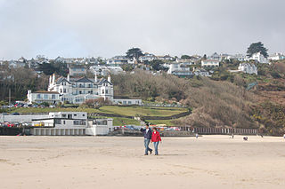
Carbis Bay is a seaside resort and village in Cornwall, England. It lies 1 mile (1.6 km) southeast of St Ives, on the western coast of St Ives Bay, on the Atlantic coast. The South West Coast Path passes above the beach.

Kit Hill, at 334 metres high, dominates the area between Callington and the River Tamar in southeast Cornwall, England, UK. The word 'Kit' comes from Old English for kite, a reference to birds of prey. Buzzards and sparrowhawks can still be seen on the hill. It is one of five Marilyn hills in Cornwall, the four others are Watch Croft, Brown Willy, Carnmenellis and Hensbarrow Beacon.

Towednack is a churchtown and civil parish in Cornwall, England, United Kingdom. The parish is bounded by those of Zennor in the west, Gulval in the south, Ludgvan in the west and south, and St Ives and the Atlantic Ocean in the north and east. The church is about two miles (3 km) from St Ives and six miles (10 km) from Penzance.
Porthtowan is a small village in Cornwall, England which is a popular summer tourist destination. Porthtowan is on Cornwall's north Atlantic coast about 2 km (1.2 mi) west of St Agnes, 4 km (2.5 mi) north of Redruth, 10 km (6.2 mi) west of Truro and 15 km (9.3 mi) southwest of Newquay in the Cornwall and West Devon Mining Landscape, a World Heritage Site.

Mount Wellington Tin mine, two miles east of the village of St Day in Cornwall, in the United Kingdom, opened in 1976 and was the first new mine in the region in many years.

Geevor Tin Mine, formerly North Levant Mine is a tin mine in the far west of Cornwall, England, between the villages of Pendeen and Trewellard. It was operational between 1911 and 1990 during which time it produced about 50,000 tons of black tin. It is now a museum and heritage centre left as a living history of a working tin mine. The museum is an Anchor Point of ERIH, The European Route of Industrial Heritage. Since 2006, the mine has been part of the UNESCO World Heritage Site Cornwall and West Devon Mining Landscape.

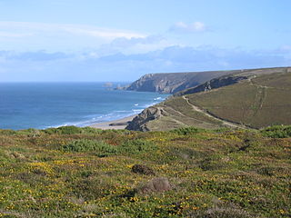
The Botallack Mine is a former mine in Botallack in the west of Cornwall, UK. Since 2006 it has been part of the UNESCO World Heritage Site – Cornwall and West Devon Mining Landscape. The mine is within the Aire Point to Carrick Du Site of Special Scientific Interest (SSSI) and the South West Coast Path passes along the cliff.

Mining in Cornwall and Devon, in the southwest of Britain, is thought to have begun in the early-middle Bronze Age with the exploitation of cassiterite. Tin, and later copper, were the most commonly extracted metals. Some tin mining continued long after the mining of other metals had become unprofitable, but ended in the late 20th century. In 2021, it was announced that a new mine was extracting battery-grade lithium carbonate, more than 20 years after the closure of the last South Crofty tin mine in Cornwall in 1998.

St Agnes is a civil parish and a large village on the north coast of Cornwall, England, United Kingdom. The village is about five miles (8 km) north of Redruth and ten miles (16 km) southwest of Newquay. An electoral ward exists stretching as far south as Blackwater. The population at the 2011 census was 7,565.

Towan is found in many placenames in Cornwall. However, The Towans usually refers to the three-mile (5 km) stretch of coastal dunes which extends north-east from the estuary of the River Hayle to Gwithian beach with a midpoint near Upton. The South West Coast Path crosses the towans.

The Cheesewring is a granite tor in Cornwall, England, situated on the eastern flank of Bodmin Moor on Stowe's Hill in the parish of Linkinhorne approximately one mile northwest of the village of Minions and four miles (6 km) north of Liskeard. It is a natural geological formation, a rock outcrop of granite slabs formed by weathering. The name derives from the resemblance of the piled slabs to a "cheesewring", a press-like device that was once used to make cheese.
Belowda is a village in Cornwall, England, UK. The village is just north of the A30 trunk road, about seven miles west-southwest of Bodmin. The village also gives its name to the nearby Belowda Beacon. It is in the civil parish of Roche.

Wheal Peevor was a metalliferous mine located on North Downs about 1.5 miles north-east of Redruth, Cornwall, England. The first mining sett was granted here in around 1701 on land owned by the St Aubyn family. It was originally mined at shallow depths for copper, but when the price for that metal slumped after 1788, the mine was able to change to mining tin ore, which was found deeper down. In the late 18th century Wheal Peevor had the advantage of being drained by the Great County Adit which was around 100 metres deep here. The mine covered only 12 acres but had rich tin lodes. In addition to tin and copper, pyrite was also mined here between 1872 and 1887.
Wheal Vor was a metalliferous mine about 2 miles (3.2 km) north west of Helston and 1 mile (1.6 km) north of the village of Breage in the west of Cornwall, England, UK. It is considered to be part of the Mount's Bay mining district. Until the mid-19th century the mine was known for its willingness to try out new innovations. Although very rich in copper and tin ores, the mine never lived up to its expectations. During the later part of the 19th century it had several periods of closure, with an attempt to reopen it in the 1960s which was not successful mainly because of bureaucracy. Today the site is part of the Cornwall and West Devon Mining Landscape.

East Pool mine, was a metalliferous mine in the Camborne and Redruth mining area, just east of the village of Pool in Cornwall, England. Worked from the early 18th century until 1945, first for copper and later tin, it was very profitable for much of its life. Today the site has two preserved beam engines and is part of the Cornwall and West Devon Mining Landscape World Heritage Site. It is owned by the National Trust.

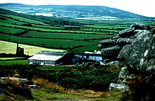
Trink Hill is a 212-metre-high hill that lies between the hamlets of Trink and Cripplesease, near to the village of Nancledra, Cornwall, UK. Trencrom Hill lies one kilometre to the South East.
Wheal Metal is a tin-mining sett in west Cornwall, England, UK. Whilst not as famous as neighbouring Wheal Vor, it was thus described by the Mining Journal in July 1885: " Truly this is a wonderful mine—probably the richest tin mine in the world." It also hosts a very remarkable engine house of the mid-19th century that once stood over Trelawney's shaft on Wheal Vor, and since the Wheal Vor area itself has no visible remains, this is the only large surviving engine house of this group of mines which accounted for over a quarter of Cornish tin production in the mid-19th century.

South Wheal Frances is a former mine accessing the copper and tin of the Great Flat Lode south of Camborne in Cornwall, England.

Basset Mines was a mining company formed in Cornwall, England, by the amalgamation of six copper and tin mining setts. It operated from 1896 until 1918, when it was closed due to a fall in the price of tin.