
Maiden Castle is an Iron Age hillfort 1.6 mi (2.6 km) southwest of Dorchester, in the English county of Dorset. Hill forts were fortified hill-top settlements constructed across Britain during the Iron Age.

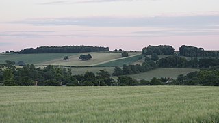
Uffington Castle is an early Iron Age univallate hillfort in Oxfordshire, England. It covers about 3.2 ha and is surrounded by two earth banks separated by a ditch with an entrance in the western end. A second entrance in the eastern end was apparently blocked up a few centuries after it was built. The original defensive ditch was V-shaped with a small box rampart in front and a larger one behind it. Timber posts stood on the ramparts. Later the ditch was deepened and the extra material dumped on top of the ramparts to increase their size. A parapet wall of sarsen stones lined the top of the innermost rampart. It is very close to the Uffington White Horse on White Horse Hill.
The Vale of White Horse is a local government district of Oxfordshire in England. It was historically part of Berkshire. The area is commonly referred to as the 'Vale of the White Horse'. It is crossed by the Ridgeway National Trail in its far south, across the North Wessex Downs AONB at the junction of four counties. The northern boundary is defined by the River Thames. The name refers to Uffington White Horse, a prehistoric hill figure.
Hermitage is a village and civil parish, near Newbury, in the English county of Berkshire. The civil parish is made up of a number of settlements: Hermitage village, Little Hungerford and Wellhouse.

Beech Hill is a small village and civil parish in Berkshire, England. It is in the south east of the West Berkshire unitary authority area and bounds Hampshire and Wokingham district.
Prideaux Castle is a multivallate Iron Age hillfort situated atop a 133 m (435 ft) high conical hill near the southern boundary of the parish of Luxulyan, Cornwall, England, United Kingdom. It is also sometimes referred to as Prideaux Warren, Prideaux War-Ring, or Prideaux Hillfort. The site is a scheduled monument and so protected from unauthorised works by the Ancient Monuments and Archaeological Areas Act 1979.
Bletchingley Castle is a ruined castle and set of earthworks partly occupied by three buildings. The Scheduled Ancient Monument is directly beside the Greensand Way below it to the south in the village of Bletchingley in Surrey. The site's tower standing from c.1170 to 1264 had a panorama from one of the narrower parts of the Greensand Ridge, which runs from mid-Kent to south-west Surrey.
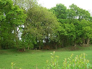
Caesar's Camp is an Iron Age hill fort around 2,400 years old. It is located just in Crowthorne civil parish to the south of Bracknell in the English county of Berkshire. It falls within the Windsor Forest and is well wooded, although parts of the fort have now been cleared of some trees. The area is managed by the Forestry Commission but owned by Crown Estate, and is open and accessible to the public. The hill fort covers an area of about 17.2 acres and is surrounded by a mile-long ditch, making it one of the largest in southern England.

Maiden Castle is an Iron Age hill fort, one of many fortified hill-top settlements constructed across Britain during the Iron Age, but one of only seven in the county of Cheshire in northern England. The hill fort was probably occupied from its construction in 600 BC until the Roman conquest of Britain in the 1st century AD. At this time the Cornovii tribe are recorded to have occupied parts of the surrounding area but, because they left no distinctive pottery or metalworking, their occupation has not been verified. Since then it has been quarried and used for military exercises. It is protected as a Scheduled Ancient Monument, and is owned by the National Trust. The hill fort is open to visitors, but unrestricted access to the site has resulted in it being classified as "at high risk" from erosion.

Kelsborrow Castle is an Iron Age hill fort in Cheshire, northern England. Hill forts were fortified hill-top settlements constructed across Britain during the Iron Age. It is one of only seven hill forts in the county of Cheshire and was probably in use for only a short time. In the 19th century, a bronze palstave was recovered from the site. It is protected as a Scheduled Ancient Monument.

Blewburton Hill is the site of an Iron Age hillfort located in Oxfordshire, in the southeast of England. It was a univallate hillfort. The area is mostly farmland with some small areas of wooded copse to the south and the northeast. The hill fort may have been occupied from the 4th century BC to the 1st century BC, and replaced a small settlement surrounded by a stockade, which is estimated to have been built in the 5th or 6th century BC.

Bussock Camp is the site of an Iron Age bivallate hillfort located in Berkshire, England. It has a double bank and ditch to the south and east, with only a single bank remaining the north and western sides. The entrance is to the north of the site and is believed to be original, and the site encloses approximately 11 acres.

Castle Ditches is the site of an Iron Age trivallate hillfort in the south-east of Tisbury parish in Wiltshire, England.
Hillforts in Britain refers to the various hillforts within the island of Great Britain. Although the earliest such constructs fitting this description come from the Neolithic British Isles, with a few also dating to later Bronze Age Britain, British hillforts were primarily constructed during the British Iron Age. Some of these were apparently abandoned in the southern areas that were a part of Roman Britain, although at the same time, those areas of northern Britain that remained free from Roman occupation saw an increase in their construction. Some hillforts were reused in the Early Middle Ages, and in some rarer cases, into the Later Medieval period as well. By the early modern period, these had essentially all been abandoned, with many being excavated by archaeologists in the nineteenth century onward.
Membury Camp, or Membury Fort, is the site of an Iron Age hill fort located in England on the borders of Wiltshire and Berkshire counties,. The site encompasses 14 hectares, and is situated in the south-western corner of a small plateau. The circular earthworks are completely shrouded in trees and inside the walls it is mostly arable farmland. To the northeast, in the Berkshire segment, the camp is totally wooded by a small copse, Walls Copse, which covers a quarter of the site. To the north and east the adjoining ground is flat, but to the south and west it falls away steeply, providing a natural defence. The camp consists of a single ditch with banks on either side and encloses and area measuring 390m by 490m. A gap in the east with inturning flanks is probably an original entrance though it is mutilated and overgrown. Other gaps in the banks appear to be more modern. A possible hut circle is visible as a cropmark situated at the south end of the hill fort. The east side of the earthwork has been partly destroyed by the construction of a wartime airfield, RAF Membury. The site has not been excavated but a number of prehistoric finds have been found in the vicinity. It is a scheduled ancient monument no. 228970 There have been several collections of pottery found, in 1977, 1980 and 1987. Other significant finds have also included flint artefacts from the mesolithic era, and flint tools from the neolithic era, prior to the Iron Age.

Knook Castle is the site of an Iron Age univallate hillfort on Knook Down, near the village of Knook in Wiltshire, England, but largely within the civil parish of Upton Lovell. It has also been interpreted as a defensive cattle enclosure associated with nearby Romano-British settlements. It is roughly rectangular in plan with a single entrance on the south/south-east side, but with a later break in the wall on the western side. The site is a scheduled monument.

Cornish promontory forts, commonly known in Cornwall as cliff castles, are coastal equivalents of the hill forts and Cornish "rounds" found on Cornish hilltops and slopes. Similar coastal forts are found on the north–west European seaboard, in Normandy, Brittany and around the coastlines of the British Isles, especially in Wales, Scotland and Ireland. Many are known in southwest England, particularly in Cornwall and its neighbouring county, Devon. Two have been identified immediately west of Cornwall, in the Isles of Scilly.
Castle Rings is a univallate hill fort in the parish of Donhead St Mary in Wiltshire, England. The site is a Scheduled Ancient Monument. Castle Rings has been dated to the Iron Age and is at an altitude of 228 metres (748 ft) upon Upper Greensand sandstone beds. The bulk of the fort enclosure lies within the boundaries of Donhead St Mary parish but some of the outlying earthworks are in the neighbouring Sedgehill and Semley parish. In the mid-1980s a metal detectorist unearthed a hoard of stater coins of the Durotriges tribe within the hill fort.

Hollingbury Castle, also known as Hollingbury Camp and Hollingbury Hillfort, is an Iron Age hillfort on the northern edge of Brighton, in East Sussex, England. It is adjacent to Hollingbury Park Golf Course.

Castle Knowe, also known as Clinch Castle, is the site of an Iron Age hillfort in Northumberland, England, about 1 mile south-east of the village of Ingram. It is a scheduled monument.


