| Eldersfield | |
|---|---|
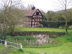 Village pond | |
 Eldersfield Location within Worcestershire | |
| Population | 584 |
| District | |
| Shire county | |
| Region | |
| Country | England |
| Sovereign state | United Kingdom |
| Post town | Gloucester |
| Postcode district | GL19 |
| Police | West Mercia |
| Fire | Hereford and Worcester |
| Ambulance | West Midlands |
| UK Parliament | |

Eldersfield is a village and civil parish in the Malvern Hills district of Worcestershire, England. It had a population of 584 in 2021. [1]
Contents
It stands exactly ten miles east of Ledbury and ten miles north of Gloucester; a fact marked by a milestone on the side of the B4211 road that runs through Corse Lawn.