| Ryall | |
|---|---|
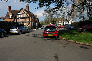
 The Blue Bell, Ryall | |
 Ryall Ryall shown within Worcestershire | |
| OS grid reference | SO870410 |
| Civil parish | |
| District | |
| Shire county | |
| Region | |
| Country | England |
| Sovereign state | United Kingdom |
| Post town | WORCESTER |
| Postcode district | WR8 |
| Police | West Mercia |
| Fire | Hereford and Worcester |
| Ambulance | West Midlands |
| EU Parliament | West Midlands |
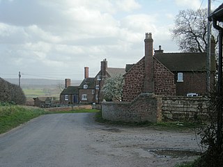
Ryall is a village in the south of Worcestershire, England, on the east bank of the River Severn, near Upton-upon-Severn on the opposite bank.
Worcestershire is a county in the West Midlands of England. Between 1974 and 1998, it was merged with the neighbouring county of Herefordshire as Hereford and Worcester.

The River Severn is the longest river in Great Britain at a length of 220 miles (354 km), and the second longest in the British Isles after the River Shannon in Ireland. It rises at an altitude of 2,001 feet (610 m) on Plynlimon, close to the Ceredigion/Powys border near Llanidloes, in the Cambrian Mountains of mid Wales. It then flows through Shropshire, Worcestershire and Gloucestershire, with the county towns of Shrewsbury, Worcester and Gloucester on its banks. With an average discharge of 107 m3/s (3,800 cu ft/s) at Apperley, Gloucestershire, the Severn is by far the greatest river in terms of water flow in England and Wales.

Upton-upon-Severn is a small town and civil parish in the Malvern Hills District of Worcestershire, England. The 2011 census recorded a population of 2,881 making it the smallest town in the county.
The village is located on the A38 road that runs roughly parallel to the River Severn, on its Tewkesbury to Kempsey stretch, and on the A4104, which crosses the Severn at Upton.

The A38, part of which is also known as the Devon Expressway, is a major A-class trunk road in England.
Tewkesbury is a town and civil parish in Gloucestershire, England. It stands at the confluence of the River Severn and the River Avon, and also minor tributaries the Swilgate and Carrant Brook. It gives its name to the Borough of Tewkesbury, of which the town is the second largest settlement. It lies in the far north of the county, forming part of the border with Worcestershire.

Kempsey is a village and civil parish in the Malvern Hills District in the county of Worcestershire, England. It is bounded by the River Severn on the west, and the A38 main road runs through it and is about 3 miles south of Worcester. The village has a long history. Its name is derived from the Saxon "Kemys' Eye", or the island of Kemys. Kemys was a Saxon chief, whose island lay between marshes and the River Severn. One of the roads in Kempsey, Lyf's Lane, is named after another Saxon chief. The village was recorded in the 11th century Domesday Book as having a value of £7.
The part of the village by the A38 is called The Grove, and includes the Blue Bell public house. The part along the A4104 is called Holly Green.
| Wikimedia Commons has media related to Ryall, Worcestershire . |
| This Worcestershire location article is a stub. You can help Wikipedia by expanding it. |