| Martley | |
|---|---|
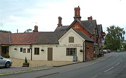 The Crown | |
 Martley Location within Worcestershire | |
| OS grid reference | SO754597 |
| Civil parish |
|
| District | |
| Shire county | |
| Region | |
| Country | England |
| Sovereign state | United Kingdom |
| Post town | WORCESTER |
| Postcode district | WR6 |
| Dialling code | 01886 |
| Police | West Mercia |
| Fire | Hereford and Worcester |
| Ambulance | West Midlands |
| UK Parliament | |
Martley is a village and civil parish in the Malvern Hills district of the English county of Worcestershire. It is approximately nine miles north-west of Worcester. The population of the village is approximately 1,200 people. The mixed farming of the area includes arable, formerly cherry, apple, damson orchards and hopyards.
Contents
It is a popular village for retired people and professionals working in the city and surrounding towns, and has a large secondary school to which around 700 pupils are bussed daily from the surrounding area. It has a sports hall with rock climbing wall and a gym within the grounds of the school can be used by the public out of school times.